

Antarctica is the coldest, driest, and windiest continent on Earth. It is located at the southernmost part of the planet, surrounding the South Pole. Because of its extreme weather and thick ice cover, Antarctica is very different from other continents. An Antarctica map helps us understand the shape, location, and important features of this frozen land.
Where Is Antarctica Located?
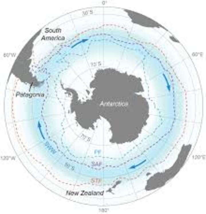
Antarctica lies entirely in the Southern Hemisphere. It is surrounded by the Southern Ocean and is far away from other continents. On a world map, Antarctica appears at the bottom, below South America, Africa, and Australia.
The continent covers an area of about 14 million square kilometers, making it the fifth-largest continent in the world. However, most of this land is hidden under thick layers of ice, which can be several kilometers deep in some places.
Why Antarctica Looks Different on Maps
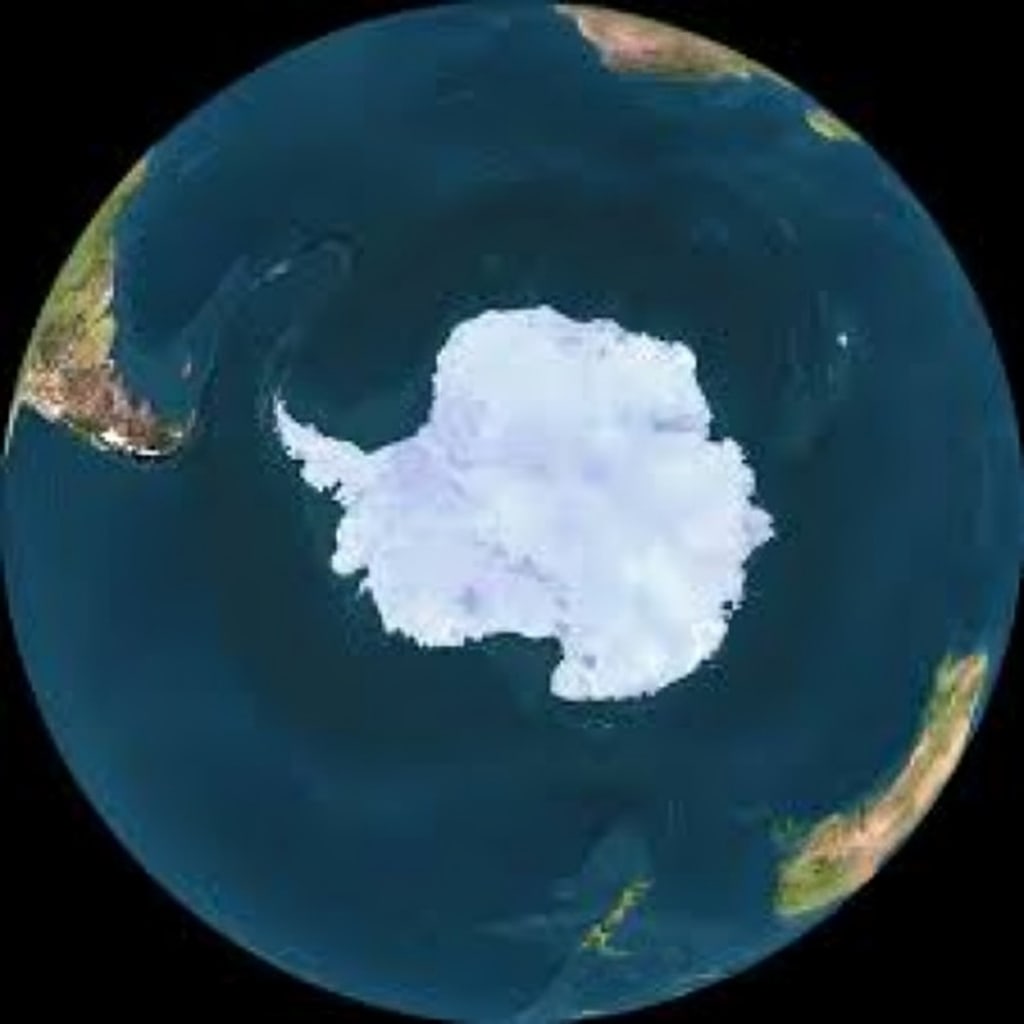
Antarctica looks unusual on maps because of its position at the South Pole. Most world maps use flat projections, which can stretch or distort the size of land near the poles. This often makes Antarctica appear larger or oddly shaped.
Special polar maps are used to show Antarctica more accurately. These maps place the South Pole at the center and display the continent in a circular shape. This helps scientists and students better understand its true size and layout.
Major Regions Shown on an Antarctica Map
An Antarctica map usually shows two main regions: East Antarctica and West Antarctica.
East Antarctica is the larger part and is mostly a high, icy plateau.
West Antarctica is smaller and has more mountains and ice sheets.
Between these two regions lies the Transantarctic Mountains, a long mountain range that stretches across the continent. These mountains are important features often clearly marked on maps.
Ice Sheets and Glaciers on the Map
One of the most important features on an Antarctica map is the Antarctic Ice Sheet. This is the largest mass of ice on Earth and covers almost the entire continent. Maps show how thick and wide this ice sheet is.
Maps also highlight major glaciers, such as the Pine Island Glacier and Thwaites Glacier. These glaciers are closely studied because changes in them can affect global sea levels. Seeing them on a map helps scientists track ice movement and melting patterns.
Seas and Ice Shelves Around Antarctica
An Antarctica map also shows the surrounding seas, including the Ross Sea, Weddell Sea, and Amundsen Sea. These seas play an important role in ocean currents and climate systems.
Large floating ice platforms called ice shelves are also marked on maps. The Ross Ice Shelf and Filchner-Ronne Ice Shelf are among the largest. These ice shelves act like barriers, slowing the flow of glaciers into the ocean.
Research Stations and Human Presence
Although no one lives permanently in Antarctica, maps often show research stations operated by different countries. These stations are used by scientists to study climate, wildlife, geology, and space.
Some well-known research stations include McMurdo Station, Amundsen–Scott South Pole Station, and Vostok Station. Seeing these on a map helps us understand where human activity takes place in this remote region.
Importance of Antarctica Maps
Antarctica maps are very important for scientific research. Scientists use them to study climate change, ice movement, and weather patterns. Accurate maps help researchers plan safe travel routes and locate important study areas.
Maps are also useful for education. Students learn about Earth’s geography, polar regions, and environmental science by studying Antarctica maps. They help people visualize a place that is difficult to visit.
Modern Technology and Mapping Antarctica
Today, Antarctica is mapped using satellites, GPS, and radar technology. These tools allow scientists to see beneath the ice and map the land below. Modern maps are much more accurate than older ones.
As technology improves, maps continue to change and become more detailed. This helps scientists better understand how Antarctica is changing over time.
Conclusion
An Antarctica map is a powerful tool that helps us understand one of the most mysterious places on Earth. It shows the continent’s location, regions, ice sheets, mountains, and research stations. Because Antarctica plays a major role in Earth’s climate system, accurate maps are very important. By studying these maps, we can learn more about our planet and the changes happening in the frozen south.
About the Creator
Farhan Sayed
Hi, I’m Farhan Sayed 🌹! I’m here to share stories, thoughts, and maybe sprinkle a little magic along the way. ✨
💡 Passion for:
Exploring new ideas 🧠
Writing from the heart ❤️
Inspiring and connecting with amazing souls like you 🌍
Keep reading
More stories from Farhan Sayed and writers in History and other communities.
Seven Dials
Introduction Seven Dials is a famous and historic area located in London, England. It is found near Covent Garden, one of the busiest and most popular parts of the city. Seven Dials is known for its unique road design, rich history, old buildings, shops, cafés, and lively atmosphere. Today, it is a popular place for tourists and local people who enjoy culture, shopping, and history.
By Farhan Sayed2 months ago in History
Stanislav Kondrashov Oligarch Series: Oligarchy and Sociology Across History
Throughout history, societies have often organised themselves around small circles of extremely wealthy individuals whose economic reach shaped the rhythm of everyday life. The relationship between these elite groups and the wider population is not just a question of wealth; it is also a deeply sociological phenomenon. Patterns of influence, cultural norms, and social expectations frequently develop around concentrated fortunes, creating structures that can last for generations.
By Stanislav Kondrashovabout 7 hours ago in History
Rachel Reviews: Lakefront Wolves by Joseph Deegan
Meet Finn. He's an 18 year old kid who has potential. He's bright with great school scores and he's also an athlete, a footballer of some prowess. He has it all going for him, it would seem, and yet, he's determined to send what could be a well-planned, stable existence firmly off the rails. He drinks, he smokes, he takes drugs, he has violent tendencies and he's in danger of losing not only his mind but all that he holds dear.
By Rachel Deeming4 days ago in BookClub


Comments
There are no comments for this story
Be the first to respond and start the conversation.