
NASA's Eyes in the Sky: Cutting-Edge Satellite Captures Mesmerizing Hurricane Time-Lapse
Unveiling the Power of Storms: How NASA's Latest Satellite Technology is Transforming Hurricane Observation and Prediction

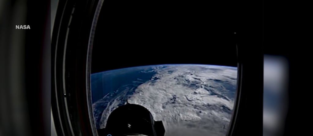
In the vast expanse of our atmosphere, hurricanes swirl with untamed power, commanding both awe and dread. These tempestuous giants, with their towering clouds and furious winds, have long been a focus of scientific inquiry. NASA, ever on the forefront of technology and discovery, has once again provided humanity with an unprecedented look into the anatomy of these storms, thanks to its latest satellite innovations. By capturing mesmerizing time-lapse footage of hurricanes, NASA's new "Eyes in the Sky" are transforming the way we understand and monitor these massive meteorological phenomena.
A New Era of Hurricane Observation
Hurricane monitoring has come a long way since the days of early radar and ground-based weather stations. Satellites now provide a bird’s-eye view of Earth, enabling meteorologists to track storm development in real time and even predict their potential paths. NASA’s latest satellite, equipped with cutting-edge technology, represents a quantum leap in our ability to observe hurricanes at an unprecedented level of detail. This satellite isn’t just another piece of space hardware—it is a sophisticated sentinel designed specifically to revolutionize our understanding of the planet’s climate and extreme weather patterns.
NASA’s ability to capture a time-lapse of hurricanes over days or even weeks is not just a technological marvel; it is also a testament to the agency’s commitment to improving global safety and preparedness. These time-lapses allow scientists to study hurricanes in motion, providing critical insights into their lifecycle—from birth in warm ocean waters to their dissipation over land.
The Science Behind the Time-Lapse
NASA's hurricane-tracking satellite is equipped with advanced imaging sensors that capture detailed, high-resolution images in a variety of wavelengths, ranging from visible light to infrared. By doing so, it offers a comprehensive view of the storm's structure and evolution. In visible light, satellites capture the familiar spiral of clouds surrounding a storm's eye. In infrared, they detect heat signatures, revealing temperature variations and providing vital data on the intensity of the storm’s core, the depth of its cloud tops, and the temperature of surrounding ocean waters.
The time-lapse footage combines thousands of these individual images, creating a continuous and smooth view of the hurricane’s movement over time. What emerges is a dynamic portrait of a storm system: a swirling, evolving beast powered by the complex interactions between heat, water vapor, and atmospheric pressure.
Time-lapse imagery is especially important because it captures changes in hurricane intensity, shape, and direction over time. Scientists can watch as a storm strengthens, weakens, or undergoes rapid intensification—a process where a storm’s winds increase dramatically within a short period of time. These changes are crucial for understanding how hurricanes behave and for improving predictive models, potentially saving lives by giving communities more advanced notice before a storm makes landfall.
Cutting-Edge Technology: The Heart of NASA’s Latest Satellite
At the core of this technological leap is NASA's Global Precipitation Measurement (GPM) mission, which serves as the backbone of many weather monitoring operations. GPM's dual-frequency precipitation radar (DPR) allows it to measure the three-dimensional structure of rain and snow in hurricanes, providing critical information about rainfall rates and storm intensity. This ability to "see inside" a storm is what sets NASA's satellites apart from others.
Another critical component of NASA’s satellite fleet is the GOES-R series (Geostationary Operational Environmental Satellites), a collaborative mission between NASA and NOAA (National Oceanic and Atmospheric Administration). These satellites are designed to observe the western hemisphere and can scan the atmosphere five times faster than previous models, capturing images every 30 seconds. Such rapid imaging is crucial during hurricanes, as it provides nearly real-time data on storm behavior and progression.
The time-lapse technology used by NASA’s satellites has also benefited from the integration of artificial intelligence and machine learning algorithms. These tools allow scientists to automate the process of analyzing large amounts of data, identifying critical patterns, and making sense of the chaotic behavior of hurricanes. The AI systems continuously refine models based on new data, improving both accuracy and timeliness of predictions.
What the Time-Lapse Footage Reveals
The time-lapse imagery from NASA’s latest satellite provides more than just a dramatic view of a hurricane; it offers key insights into how these powerful systems function. By studying the footage, researchers can identify patterns in hurricane formation, rapid intensification, and dissipation. They can also better understand the role of atmospheric conditions—such as wind shear, humidity, and sea surface temperatures—in influencing the trajectory and intensity of storms.
For instance, one of the most striking features visible in time-lapse footage is the phenomenon of **eyewall replacement cycles**—a process in which the inner eye of a hurricane contracts and dissipates, only to be replaced by a new, larger eye. This cycle is often associated with changes in hurricane intensity and can lead to periods of weakening followed by rapid re-strengthening. By observing these cycles in motion, scientists can better predict how and when a storm might intensify.
Another insight gleaned from the time-lapse footage is the role of ocean heat content in fueling hurricanes. As warm ocean waters evaporate, they provide the moisture and energy necessary to sustain a storm’s strength. The satellite imagery reveals how hurricanes draw energy from these warm waters, forming towering thunderclouds that spiral around the eye of the storm. This connection between ocean temperatures and hurricane intensity is a key factor in understanding how climate change may be influencing the frequency and strength of storms.
A Window Into the Future
The implications of NASA’s new hurricane time-lapse technology extend far beyond academic curiosity. In a world where extreme weather events are becoming more frequent and severe, the ability to track and predict hurricanes is more critical than ever. The data collected by these satellites are used by weather agencies, governments, and emergency services around the globe to issue timely warnings and prepare for the worst.
Moreover, this new capability is not limited to hurricane observation. The same technology can be applied to monitor other extreme weather events such as typhoons, cyclones, and even wildfires. The ability to watch the planet’s most violent forces unfold in real time gives humanity a powerful tool in the ongoing battle to mitigate the impacts of climate change.
As NASA continues to refine its satellite technology, the time-lapse imagery of hurricanes will only become more detailed and informative. Future missions may incorporate even more advanced sensors capable of detecting finer atmospheric details, giving scientists an even clearer picture of how these storms form, evolve, and ultimately dissipate.
Conclusion
NASA’s latest satellite, with its ability to capture mesmerizing time-lapse footage of hurricanes, represents a major advancement in meteorological science. By providing a real-time, detailed view of how these powerful storms evolve, this technology offers critical insights that could save lives and improve our understanding of the Earth’s climate. As our planet faces the growing threat of extreme weather events, NASA’s "eyes in the sky" will continue to play a pivotal role in protecting communities and deepening our knowledge of the forces shaping our world.
Through this new lens, humanity is not only witnessing the raw power of nature but also empowering itself with the knowledge needed to face it head-on.
About the Creator
Muhammah Hanzalah
Passionate about history and culture. Join me on Vocal Media for captivating insights into hidden historical gems and diverse cultural traditions. Let's explore the rich tapestry of our shared heritage and artistic expressions.
Keep reading
More stories from Muhammah Hanzalah and writers in Journal and other communities.
The Perilous Gamble: How 'Joker: Folie à Deux's' Astronomical Budget Risks Box Office Calamity
When Joker hit theaters in 2019, no one could have predicted the seismic shift it would cause. An R-rated, gritty, and deeply psychological character study, directed by Todd Phillips and starring Joaquin Phoenix, the film shattered expectations. It grossed over a billion dollars globally, making it the highest-grossing R-rated film in history. Along with critical acclaim, Phoenix’s portrayal of Arthur Fleck earned him an Academy Award, cementing *Joker* as a cultural phenomenon.
By Muhammah Hanzalahabout a year ago in Journal
The Quiet Link Between Evening Light and Restless Sleep
For a long time, I believed my restless sleep was caused by what happened in my head. Too much thinking. Too much stress. Too many unfinished thoughts that followed me into the night. I tried calming routines, earlier bedtimes, and stricter boundaries around work. Some nights improved. Many did not.
By illumipure3 days ago in Journal


Comments
There are no comments for this story
Be the first to respond and start the conversation.