

Discovery and Ancient Geography Around 70,000 years ago, during the last Ice Age, a vast landmass known as Sahul existed in the southwestern Pacific Ocean. This supercontinent connected modern-day Australia, New Guinea, Tasmania, and the Aru Islands, creating a single, enormous landmass. Picture lush tropical rainforests surrounded by majestic mountains, with peaks in the New Guinea Highlands reaching over 13,000 feet. Sahul was a haven for unique wildlife, predominantly marsupials. Unlike today's koalas and kangaroos, Sahul hosted a diverse array of creatures, including the massive Diprotodon, the formidable Thylacoleo, and the giant Megalania, a lizard far larger than any in existence today. The rest of the world was dominated by placental mammals like wolves, elephants, and humans, while Sahul’s mammals were mainly bats and rodents. Different regions, such as the Torres Strait, Arafura, and Carpentaria, featured hot savannahs, dry forests, and temperate coastal forests, resembling modern Australia's varied landscapes.
Human Migration and Settlement As people migrated globally, they embarked on an incredible journey from Southeast Asia to Sahul, arriving between 60,000 and 45,000 years ago. They traveled primarily on foot and used bamboo rafts and simple boats to cross the seas. These early settlers hailed from the ancient landmass of Sunda, which includes parts of Southeast Asia, and navigated a series of islands known as Wallacea to reach Sahul. Covering an area of about 4.1 million square miles, larger than the USA or Canada, Sahul stretched from the equator to southern New Zealand. The first Australians arrived and became the continent's inaugural inhabitants. Scientists estimate that Sahul supported a population of half a million people. Cave paintings dating back 40,000 years depict hunting scenes with miniature buffaloes and human figures. Researchers are studying how these early settlers traversed Sahul and where archaeological evidence of their journey might be found. Landscape evolution models simulate Sahul's changes between 75,000 and 35,000 years ago, revealing potential migration routes and archaeological sites along coastlines and rivers.
Submersion and Modern Exploration The submersion of Sahul resembles the mythical Atlantis. During the last Ice Age, much of Earth's water was trapped in massive ice sheets and glaciers, resulting in lower sea levels. As global temperatures rose and ice melted, sea levels increased, submerging land bridges that once connected parts of Sahul. About 8,000 years ago, New Guinea separated from mainland Australia, and Tasmania followed suit around 6,000 years ago. Modern technology allows us to explore the underwater remnants of Sahul. Divers collect samples from the ocean floor, and underwater drones explore depths too dangerous for humans. Sonar mapping uses sound waves to create detailed maps of the ocean floor, revealing ancient rivers, lakes, and coastlines. Archaeologists have found stone tools, fossils of animals like Diprotodon, and Thylacoleo, offering insights into Sahul's ancient landscapes.
Other Underwater Worlds: Sundaland and Zealandia Sahul isn't the only hidden continent in Southeast Asia. Sundaland, comprising Sumatra, Java, Borneo, and other islands, was a massive landmass during the Ice Age but is now mostly underwater. The remaining parts are rich in biodiversity, home to a fifth of the world's bird species and a fourth of Earth's fish species. Sundaland’s lush forests and waters are teeming with life, from the colorful Java hawk-eagle to the exotic Asian arowanas. Zealandia, another underwater continent, is about half the size of Australia. It broke away from Antarctica around 100 million years ago. Today, 7% of Zealandia remains above sea level, forming New Zealand, Stewart Island, and smaller islands. These regions boast volcanoes, mountain ranges, natural geysers, and hot springs, which local Māori people use for cooking.
Other Hidden Continents The discovery of Sahul and other underwater continents highlights the dynamic nature of Earth's geology. For example, Aroland was once part of Australia but broke away around 155 million years ago. As it drifted north, it sank into the Sunda Trench, leaving its remnants buried under Indonesia and Myanmar. Greater Adria, a colossal landmass the size of Greenland, broke away from Gondwana 240 million years ago. After drifting north, it collided with Europe, forming part of the Alps. The idyllic Seychelles islands, sitting atop ancient continental crust, and Mauritia, a fragmented landmass under the Indian Ocean, reveal Earth's ever-changing landscape. The discovery of ancient zircons, tiny crystals dating back 660 million to 2 billion years, hints at hidden continents yet to be found.
Continued exploration and technological advancements promise to unveil more of Earth's hidden continents in the future. These discoveries not only enrich our understanding of geological history but also inspire curiosity about the ancient world lying beneath our oceans.
About the Creator
Keep reading
More stories from writers in History and other communities.
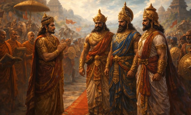
Ashoka and the Three Kings of South India: Power, Diplomacy, and Moral Conquest
Unlike his northern campaigns, Ashoka did not wage a full-scale war against these southern powers. Instead, his interaction with them reveals a unique blend of political realism, military restraint, and ideological influence.
By Say the truth a day ago in History
The Blue Ridge Stalker
Tom had left the Ford down the way, its spark plugs finally exhausted and no mechanics for a dozen miles back through the foothills to Strossburg. No matter, he had worn his boots—almost as if he planned for this to happen. The puzzle he sought to solve emanated from the woods clinging to the slopes above; the valley behind held no mysteries.
By Stephen A. Roddewig6 days ago in Fiction


Comments
There are no comments for this story
Be the first to respond and start the conversation.