
10 Mysterious Places on Google Maps
Satellite mapping technologies, such as Google Maps, have become incredibly useful tools for global researchers and explorers. Although certain locations, like military bases and private homes, remain hidden from view, much of the planet is now easily accessible to anyone with internet access and a few free hours. However, this increased access has only led to more questions than answers. While we can view the Earth from a bird's eye perspective and in high definition, thanks to services like Google Maps and Google Earth, we have only uncovered more mysterious and unexplained locations around the world.
10. Surtsy Island Cersei
A volcanic island is situated off the southern coast of Iceland. It was created by a volcanic eruption that took place in 1963, making it one of the youngest islands globally. The eruption lasted for approximately three and a half years, and the island expanded to around 2.7 square kilometers or 1.04 square miles. Certsey Island, because of its youth and seclusion, grants scientists a rare opportunity to observe the creation of an entirely new ecosystem in real-time. As a result, access to the island is strictly controlled, and at present, only scientists are allowed to explore it. Despite this, there is still much to learn about Certsey Island's geography and ecology. It may even be one of the most extensive unexplored areas on the planet, with many of the island's species believed to be exclusive to it.
9. the Kazakh
In 2007, researchers discovered the Kazakh geoglyphs, which are massive symbols located in the Northern Kazakhstan steps. These designs, which are visible only from high above, include images of animals, geometric shapes, and other enigmatic symbols that remain undeciphered. The glyphs are mostly made of Earth and mounds, and their exact purpose and meaning are still unknown. Some people believe they might have been used for religious or ceremonial purposes, while others think they may have served as navigational markers. The age of the glyphs is also uncertain, with estimates ranging from a few hundred years to over 8,000. It is unclear whether these glyphs were built by a lost civilization or a group of dedicated hunter-gatherers, challenging our understanding of the capabilities of ancient people.
8. Rak Oasis
In 1927, British R Air flight Lieutenant Percy Maitland described the wheel-like series of stone structures in Azraq Oasis, Jordan, as Rak Oasis. These structures remain a mystery to this day, and while not all of them are known, two of the patterns have been found to be at least 8,500 years old. The nomadic Bedouin tribes in the region call them "works of old men," which includes other similar works scattered across Syria, Jordan, Saudi Arabia, and Yemen. Little is known about these structures, except that the stone material used to build them was brought from many miles away, which required a coordinated effort on a large scale. One study suggests that they were used in astronomy, as the spokes of some of the wheels are aligned in a Southeast-Northwest direction, but this is still only a guess, as the alignment is not common to all the wheels in the set.
7. Coronado Navy base
In 2007, while using Google Earth, internet users noticed that the Coronado Navy base in Southern California was shaped like a Nazi swastika when viewed from the air, despite appearing to be a normal building with multiple L-shaped sections from the ground. The military acknowledged that the shape looked bad and promised to fix it, but there is no report suggesting that it was actually fixed. The discovery led to various conspiracy theories, including one that German prisoners of war secretly built it as a tribute to Adolf Hitler, and another that the base resembled a set of Cavalry crosses pointing to Jerusalem. Although unlikely, some records suggest that the Navy was aware of the swastika shape before the building was completed. However, it was ultimately an oversight by individual building planners rather than a grand Nazi conspiracy within the United States.
6. the Phantom
On September 15, 1774, Captain James Cook and his crew, a British navigator, spotted an island off the coast of Australia. They named it Sandy Island and added it to their maps. For centuries, this small land mass, located between Australia and New Caledonia, was included on all other maps. However, in November 2012, during a research expedition, Australian scientists tried to visit Sandy Island, only to realize that it doesn't exist. Even though it was marked on Google Maps until that point, they removed it later that year. No visible rise in the seabed can be seen where the island should be, sparking all kinds of controversy. While it's possible that the island doesn't exist and there's really nothing at that location, Sandy Island has been at the center of conspiracy theories and other alternative theories ever since the story first came to light.
5. Mount Liko
is a mountain located in Northern Mozambique that was known only to locals until 2012 when Dr. Julian Bayless, a scientist, discovered a rainforest on top of it using Google Earth. He assembled a team of 28 experts in various fields, including engineers, biologists, and rock climbers, to explore the area. What they found was one of the last unexplored places on the planet. The summit of Mount Liko is home to a new tropical jungle that has not been disturbed by outside interference. The team discovered a new butterfly species, small mammals and reptiles, and an amphibian species unknown to them. Furthermore, the team found upturned pots near a stream that may indicate human presence in the area prior to their expedition.
4. Jeanette
In 2018, internet users discovered that Jeanette Island, a remote island in the East Siberian Sea, had turned into a black blob on Google Maps. The island was named after the USS Jeanette, an American ship that got stuck there in 1881 while trying to find the fabled polar route to open waters of the Arctic. The crew claimed the territory in the name of the American government but left as soon as they could because it was still a remote, icy island in the middle of nowhere. Since then, it's unclear whether the island belongs to the USA or Russia as both countries claim it. Some people believe that the reason for the disappearance on Google Maps is due to the conflicting claims, while others have theories involving aliens and secret military bases.
3. Maureroa Island
Maureroa is a small island in French Polynesia situated in the South Pacific Ocean. From 1966 to 1996, France conducted 193 nuclear tests on the island, resulting in environmental contamination and controversy. The extent of the damage caused by the tests is still unknown. In 1996, international and local pressure led to the cessation of the nuclear program. Since then, Maureroa has been mostly uninhabited and inaccessible to the public. Google Maps has blurred out a portion of the island, likely to conceal the bombed-out landscape and other details about the tests. The French military also protects the island, adding to its overall mystery.
2. China's Gobi Desert
The story of the mysterious mega structures in China's Gobi Desert was first reported by Gizmodo in 2011. Since then, readers and internet users have discovered more of these structures, often shaped in geometric patterns like squares and circles. Despite their apparent purposelessness and remote location, these structures must have required significant effort to construct. Some speculate that they are ancient ruins used for navigation during the Silk Road era, while others suggest they are part of a secret Chinese military facility or classified research base. According to one theory, they are simply industrial airstrips or roads built for remote desert purposes, even though one of the structures is curiously painted bright blue.
1. Nazca Lines
The Nazca Lines are a collection of prehistoric geoglyphs situated in the Nazca desert in Southern Peru. They came to light in the 1920s when commercial airlines started flying over the area, and pilots reported seeing peculiar marks on the ground for the first time. The lines, which feature images of various geometric shapes, animals, and humans, are so vast that they can only be fully appreciated from the air. As evidenced by the general theme of this video, we still do not know who created them and why. According to theories, they might have been utilized for astronomical observations, religious rituals, or some kind of ancient communication. However, there is no proof or disproof to confirm either of these theories. The lines remain one of the most enigmatic ancient structures we have ever discovered, with over 800 straight lines, 300 distinct geometric patterns, and 70 animal and plant motifs. This includes 168 geoglyphs that were discovered only in December 2022.
About the Creator
Keep reading
More stories from DOING Well and writers in Earth and other communities.
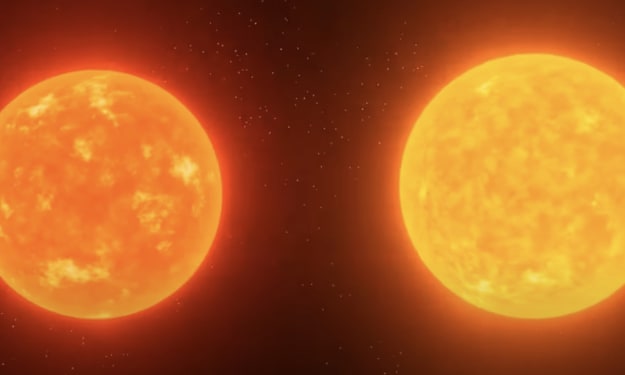
Sun’s evil twin that spoils our life
The sun is the only star we have in the universe, but it was once thought to have a twin, possibly an evil one. This is now known as a giant molecular cloud, also known as dark nebula. These clouds contain gas dust and piles of stars, and can be seen with the naked eye in the clear sky at night. The sun originated from one of these molecular clouds billions of years ago, when waves of energy were passing by and collected all this material. This is where our son was born four and a half billion years ago.
By DOING Well3 years ago in Earth
Archaeologists Are Lifting 70- to 80-Ton Stones from the Legendary Lighthouse of Alexandria, and the Most Intriguing Part Is That Some Pieces Appear to Be Part of a Long-Lost Monumental Doorway
Introduction: A Wonder Rising from the Sea More than 2,000 years after it collapsed into the Mediterranean Sea, the legendary Lighthouse of Alexandria—also known as the Pharos of Alexandria—is revealing new secrets. Archaeologists working off the coast of Egypt have begun lifting enormous stone blocks weighing between 70 and 80 tons from the seabed. These stones once formed part of one of the most famous structures in human history.
By Sajida Sikandarabout 6 hours ago in Earth


Comments
There are no comments for this story
Be the first to respond and start the conversation.