
Hiking Long Distance in Europe
Best long hiking trails


Cinque Terre is a rugged portion of coast on the Italian Riviera, Liguria, and sets hikers on a route through picturesque Italian seaside villages along the coastline of the eponymous national park and UNESCO World Heritage Site. You’ll enjoy the lovely towns of Monterosso al Mare, Vernazza, Corniglia, Manarola, and Riomaggiore. It is best to hike between the towns on foot. The Blue Trail connects Riomaggiore in the east with Monterosso al Mare in the west. There is some breathtaking scenery along the way.
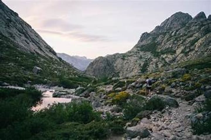
GR20 is considered to be among the most beautiful and toughest treks. It stretches across the French island of Corsica. It takes around 15 days to complete. It includes steep climbs, especially in the northern section. The trail connects Calenzana in the north to Conca in the south. Hikers pass through diverse landscapes that include granite peaks, forests, and glacial lakes.

The Juliana Trail stretches across Slovenia through the Julian Alps and Triglav National Park. It is a multi-day trek and leads hikers to towns such as Bled and Bohini. However, the highlights of this trek are the small villages located in the Soca River Valley. You can discover adventure as well, like whitewater rafting, paragliding, and horseback riding.
The Kungsleden, or King’s Trail, takes hikers across northern Sweden. (pictured above) Starting at the town of Abisko in the far north, heading south to Hemavan. The trail stretches through Videlfjalien Nature Reserve, which is the largest natural protected space in Sweden and one of the largest in Europe. It is best hiked in the summer to early autumn with huts along the way. The route is divided into four sections, each representing about one week of hiking. You’ll cross high streams and rivers, which are passable by bridges or rowboats.
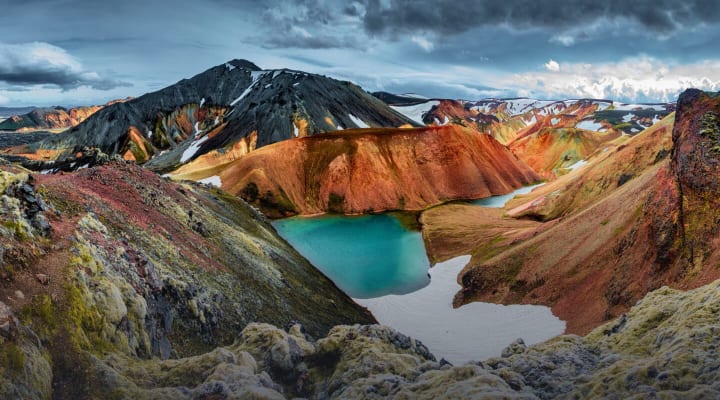
The Laugavegur Trail is the most famous in Iceland. It is usually hiked south and takes hikers from the geothermal Landmannalaugar to the glacial valley of Porsmork. The trail takes 3 to 5 days to traverse. Along the way hikers pass the multi-colored rhyolite mountains, steaming volcanic vents, black obsidian deserts, ice caves, and lush green valleys. Hikers can rest in huts or campsites.
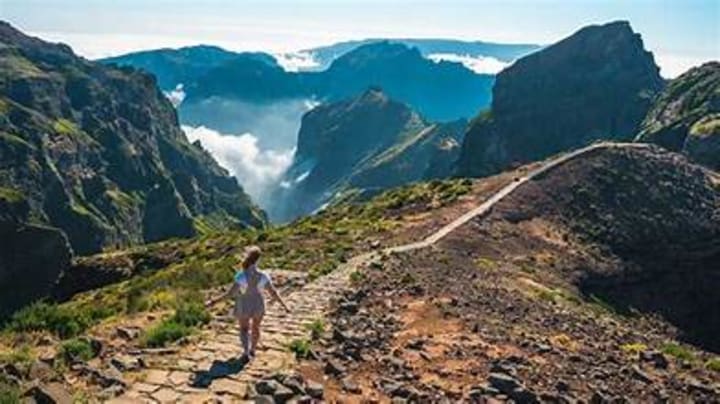
Madeira Coast to Coast crosses the Portuguese island of Madeira. The official FKT route stretches 32 km north to south. It connects the villages of Ribeira Brava and Sao Vincente. The Madeira Island Ultra Trail/MIUT is three times as long stretching west to east from Porto Moniz to Machico. This route takes hikers to several of the highest peaks on the island. Madeira is known as the “Hawaii of Europe” and has lush subtropical forests.

Peaks of the Balkans takes hikers through Albania, Kosovo, and Montenegro. This is a circular trail that takes 10 to 13 days to complete. The route traverses the Prokletije Mountains, often called the “Accursed Mountains.” There are limestone peaks, deep glacial valleys, and shepherd villages.

Tour de Monte Rosa/TMR takes hikers from Italy to Switzerland. This route takes hikers around both the Monte Rosa and Mischabel massifs. Part of the Monte Rosa massif is the Dufourspitze, which is the highest mountain in Switzerland. This route also takes hikers on treks below the Matterhorn. Hikers can take a break and rest in lodges and mountain huts along the way. The most popular places to start the route are Zermatt or Saas-Fee in Switzerland or Alagna Valsesia in Italy.

Tour du Mont Blanc will take you through France, Italy, and Switzerland. This is best known as the TMB and is a 165 km trek. Many hikers start off at the mountain town of Chamonix in France. There are great elevations along this trail, and hikers can expect to climb a height of 8,917 m. The route passes through seven valleys around the Mont Blanc massif. To help hikers along, there are many lodges, refuges, and mountain huts along the route.

Via Transilvanica is a trail stretching across Romania from Putna in the north to Drobeta-Turnu Severin on the Danube. The trail is 1,400 km long and divided into seven cultural-historical regions. Hikers cross mountains and hills and walk through forests and villages. Along the way are guest houses.

The West Highland Way in Scotland stretches for 154 km from Milngavie, outside of Glasgow, to Fort William at the foot of Ben Nevis, which is the highest peak in the UK. The hike will take you through the Scottish Highlands to the banks of Loch Lomond to Rannoch Moor and the towering peaks surrounding Glen Coe. Along the way are villages, B&Bs, and campsites.
About the Creator
Rasma Raisters
My passions are writing and creating poetry. I write for several sites online and have four themed blogs on Wordpress. Please follow me on Twitter.
Keep reading
More stories from Rasma Raisters and writers in Wander and other communities.
Away from the Crowds in New Jersey
New Jersey is the Garden State surrounded by lush countryside and is among the most popular states in the US. Tour the Batsto Mansion in Batsto. Visitors can tour the rooms on guided tours that tell you about the arc of industry, family, and wilderness. It sits by a quiet lake.
By Rasma Raisters2 months ago in Wander
How To Find the Most Scenic Places to Photograph Around Dambulla
Sri Lanka is a great country to visit, filled with history, scenery as well as a plethora of fun activities. Among the cities of interest is Dambulla, a place where scenery, historic landmarks and travel come together for photographers. The area is known for its cave temples, rock formations as well as nature-filled surroundings, giving travellers many places to capture. This guide breaksdown practical and straightforward ways to plan your photography journey in Dambulla.
By Daphne Olga4 days ago in Wander
They Read My Future in a Coffee Cup in Istanbul
See Pictures from the trip here. That's the honest starting point. I sat down, drank the coffee - which is strong in a way that makes you question every cup you've had before it, the kind of strong you'd rather smell than commit to - flipped the cup upside down on the saucer, and waited.
By Destiny S. Harrisabout 19 hours ago in Wander


Comments
There are no comments for this story
Be the first to respond and start the conversation.