Historical
American history
Continuance of previous lesson for 'Rise of the American Nation'. Economic ferment Not only was unemployment high but also for thousands of other people prices were rising and it was difficult to make ends meat. Today we call this 'inflation' (write on blackboard)-during a period of inflation with prices soaring a fixed amount of money will buy fewer and fewer goods. Some with few or a limited amount will find it hard to buy food and clothing.
By Mark Graham5 years ago in FYI
Amazing Colorized Photos of Mata Hari Bring the Spy Vividly to Life
In the early morning hours of October 15, 1917, the world-famous woman known as Mata Hari was executed by a French firing squad, having been tried and convicted of espionage. There is much speculation among scholars as to whether or not she was guilty. Here, accompanied by vintage photos beautifully colorized by Russian artist Olga Shirnina (who works under the name of Klimbim) is her story.
By Denise Shelton5 years ago in FYI
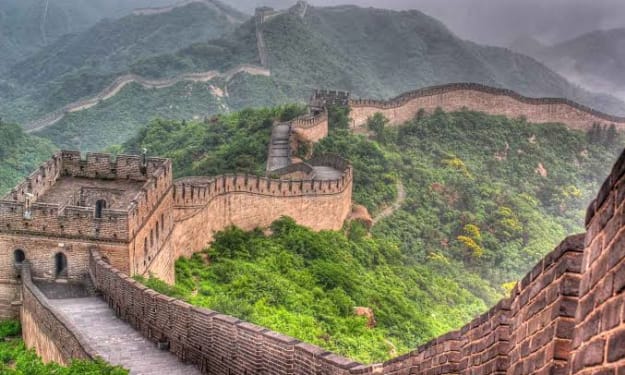
The Great Wall of the China
Start writing... The Great Wall of China snakes along a ridge in front of me, its towers and ramparts creating a panorama that could have been lifted from a Ming dynasty scroll. I should be enjoying the view, but I'm focused instead on the feet of my guide, Sun Zhenyuan. Clambering behind him across the rocks, I can't help but marvel at his footwear. He is wearing cloth slippers with wafer-thin rubber soles, better suited to tai chi than a trek along a mountainous section of the wall.Sun, a 59-year-old farmer turned preservationist, is conducting a daily reconnaissance along a crumbling 16th-century stretch of the wall overlooking his home, Dongjiakou village, in eastern Hebei Province. We stand nearly 4,000 twisting miles from where the Great Wall begins in China's western deserts—and only 40 miles from where it plunges into the Bohai Sea, the innermost gulf of the Yellow Sea on the coast of northeast China. Only 170 miles distant, but a world away, lies Beijing, where seven million spectators are about to converge for the Summer Olympics. (The massive earthquake that hit southern China in May did not damage the wall, although tremors could be felt on sections of it near Beijing.)Hiking toward a watchtower on the ridge above us, Sun sets a brisk pace, stopping only to check his slippers' fraying seams. "They cost only ten yuan [$1.40]," he says, "but I wear out a pair every two weeks." I do a quick calculation: over the past decade, Sun must have burned through some 260 pairs of shoes as he's carried out his crusade to protect one of China's greatest treasures—and to preserve his family's honor.Twenty-one generations ago, in the mid-1500s, Sun's ancestors arrived at this hilly outpost wearing military uniforms (and, presumably, sturdier footwear). His forebears, he says, were officers in the Ming imperial army, part of a contingent that came from southern China to shore up one of the wall's most vulnerable sections. Under the command of General Qi Jiguang, they added to an earlier stone and earthen barrier, erected nearly two centuries before at the beginning of the Ming dynasty. Qi Jiguang also added a new feature—watchtowers—at every peak, trough and turn. The towers, built between 1569 and 1573, enabled troops to shelter in secure outposts on the wall itself as they awaited Mongol attacks. Even more vitally, the towers also functioned as sophisticated signaling stations, enabling the Ming army to mitigate the wall's most impressive, but daunting, feature: its staggering length.As we near the top of the ridge, Sun quickens his pace. The Great Wall looms directly above us, a 30-foot-high face of rough-hewed stone topped by a two-story watchtower. When we reach the tower, he points at the Chinese characters carved above the arched doorway, which translate to Sunjialou, or Sun Family Tower. "I see this as a family treasure, not just a national treasure," Sun says. "If you had an old house that people were damaging, wouldn't you want to protect it?"He gazes toward the horizon. As he conjures up the dangers that Ming soldiers once faced, the past and present seem to intertwine. "Where we're standing is the edge of the world," he says. "Behind us is China. Out there"—he gestures toward craggy cliffs to the north—"the land of the barbarians."Few cultural landmarks symbolize the sweep of a nation's history more powerfully than the Great Wall of China. Constructed by a succession of imperial dynasties over 2,000 years, the network of barriers, towers and fortifications expanded over the centuries, defining and defending the outer limits of Chinese civilization. At the height of its importance during the Ming dynasty (1368-1644), the Great Wall is believed to have extended some 4,000 miles, the distance from New York to Milan.Today, however, China's most iconic monument is under assault by both man and nature. No one knows just how much of the wall has already been lost. Chinese experts estimate that more than two-thirds may have been damaged or destroyed, while the rest remains under siege."The Great Wall is a miracle, a cultural achievement not just for China but for humanity," says Dong Yaohui, president of the China Great Wall Society. "If we let it get damaged beyond repair in just one or two generations, it will be our lasting shame."The barbarians, of course, have changed. Gone are the invading Tatars (who broke through the Great Wall in 1550), Mongols (whose raids kept Sun's ancestors occupied) and Manchus (who poured through uncontested in 1644). Today's threats come from reckless tourists, opportunistic developers, an indifferent public and the ravages of nature. Taken together, these forces—largely byproducts of China's economic boom—imperil the wall, from its tamped-earth ramparts in the western deserts to its majestic stone fortifications spanning the forested hills north of Beijing, near Badaling, where several million tourists converge each year.From its origins under the first emperor in the third century B.C., the Great Wall has never been a single barrier, as early Western accounts claimed. Rather, it was an overlapping maze of ramparts and towers that was unified only during frenzied Ming dynasty construction, beginning in the late 1300s. As a defense system, the wall ultimately failed, not because of intrinsic design flaws but because of the internal weaknesses—corruption, cowardice, infighting—of various imperial regimes. For three centuries after the Ming dynasty collapsed, Chinese intellectuals tended to view the wall as a colossal waste of lives and resources that testified less to the nation's strength than to a crippling sense of insecurity. In the 1960s, Mao Zedong's Red Guards carried this disdain to revolutionary excess, destroying sections of an ancient monument perceived as a feudal relic.Nevertheless, the Great Wall has endured as a symbol of national identity, sustained in no small part by successive waves of foreigners who have celebrated its splendors—and perpetuated its myths. Among the most persistent fallacies is that it is the only man-made structure visible from space. (In fact, one can make out a number of other landmarks, including the pyramids. The wall, according to a recent Scientific American report, is visible only "from low orbit under a specific set of weather and lighting conditions.") Mao's reformist successor, Deng Xiaoping, understood the wall's iconic value. "Love China, Restore the Great Wall," he declared in 1984, initiating a repair and reconstruction campaign along the wall north of Beijing. Perhaps Deng sensed that the nation he hoped to build into a superpower needed to reclaim the legacy of a China whose ingenuity had built one of the world's greatest wonders.Today, the ancient monument is caught in contemporary China's contradictions, in which a nascent impulse to preserve the past confronts a headlong rush toward the future. Curious to observe this collision up close, I recently walked along two stretches of the Ming-era wall, separated by a thousand miles—the stone ramparts undulating through the hills near Sun's home in eastern Hebei Province and an earthen barrier that cuts across the plains of Ningxia in the west. Even along these relatively well-preserved sections, threats to the wall—whether by nature or neglect, by reckless industrial expansion or profit-hungry tour operators—pose daunting challenges.Yet a small but increasingly vocal group of cultural preservationists act as defenders of the Great Wall. Some, like Sun, patrol its ramparts. Others have pushed the government to enact new laws and have initiated a comprehensive, ten-year GPS survey that may reveal exactly how long the Great Wall once was—and how much of it has been lost.In northwest China's Ningxia region, on a barren desert hilltop, a local shepherd, Ding Shangyi, and I gaze out at a scene of austere beauty. The ocher-colored wall below us, constructed of tamped earth instead of stone, lacks the undulations and crenelations that define the eastern sections. But here, a simpler wall curves along the western flank of the Helan Mountains, extending across a rocky moonscape to the far horizon. For the Ming dynasty, this was the frontier, the end of the world—and it still feels that way.Ding, 52, lives alone in the shadow of the wall near Sanguankou Pass. He corrals his 700 sheep at night in a pen that abuts the 30-foot-tall barrier. Centuries of erosion have rounded the wall's edges and pockmarked its sides, making it seem less a monumental achievement than a kind of giant sponge laid across gravelly terrain. Although Ding has no idea of the wall's age—"a hundred years old," Ding guesses, off by about three and a half centuries—he reckons correctly that it was meant to "repel the Mongols."From our hilltop, Ding and I can make out the remnants of a 40-foot-high tower on the flats below Sanguankou. Relying on observation sites like this one, soldiers transmitted signals from the front lines back to the military command. Employing smoke by day and fire at night, they could send messages down the line at a rate of 620 miles per day—or about 26 miles per hour, faster than a man on horseback.According to Cheng Dalin, a 66-year-old photographer and a leading authority on the wall, the signals also conveyed the degree of threat: an incursion of 100 men required one lighted beacon and a round of cannon fire, he says, while 5,000 men merited five plumes of smoke and five cannon shots. The tallest, straightest columns of smoke were produced by wolf dung, which explains why, even today, the outbreak of war is described in literary Chinese as "a rash of wolf smoke across the land."Nowhere are threats to the wall more evident than in Ningxia. The most relentless enemy is desertification—a scourge that began with construction of the Great Wall itself. Imperial policy decreed that grass and trees be torched within 60 miles of the wall, depriving enemies of the element of surprise. Inside the wall, the cleared land was used for crops to sustain soldiers. By the middle of the Ming dynasty, 2.8 million acres of forest had been converted to farmland. The result? "An environmental disaster," says Cheng.Today, with the added pressures of global warming, overgrazing and unwise agricultural policies, China's northern desert is expanding at an alarming rate, devouring approximately one million acres of grassland annually. The Great Wall stands in its path. Shifting sands may occasionally expose a long-buried section—as happened in in 2002—but for the most part, they do far more harm than good. Rising dunes swallow entire stretches of wall; fierce desert winds shear off its top and sides like a sandblaster. Here, along the flanks of the Helan Mountains, water, ironically enough, is the greatest threat. Flash floods run off denuded highlands, gouging out the wall's base and causing upper levels to teeter and collapse.At Pass, two large gaps have been blasted through the wall, one for a highway linking to Inner Mongolia—the wall here marks the border—and the other for a quarry operated by a state-owned gravel company. Trucks rumble through the breach every few minutes, picking up loads of rock destined to pave roads. Less than a mile away, wild horses lope along the wall, while Dung's sheep forage for roots on rocky hills.The plundering of the Great Wall, once fed by poverty, is now fuelled by progress. In the early days of the People's Republic, in the 1950s, peasants pilfered tamped earth from the ramparts to replenish their fields, and stones to build houses. (I recently visited families in the town of Tanchi who still live in caves dug out of the wall during the Cultural Revolution of 1966-76.) Two decades of economic growth have turned small-scale damage into major destruction. In , a heavily polluted industrial city along the Yellow River in northern , the wall has collapsed because of erosion—even as the Great Wall Industrial Park thrives next door. Elsewhere in , construction of a paper mill in Zhong Weird and a petrochemical factory in Tanchi has destroyed sections of the wall.Regulations enacted in late 2006—focusing on protecting the Great Wall in its entirety—were intended to curb such abuses. Damaging the wall is now a criminal offense. Anyone caught bulldozing sections or conducting all-night raves on its ramparts—two of many indignities the wall has suffered—now faces fines. The laws, however, contain no provisions for extra personnel or funds. According to Dong , president of the China Great Wall Society, "The problem is not lack of laws, but failure to put them into practice."Enforcement is especially difficult in , where a vast, 900-mile-long network of walls is overseen by a cultural heritage bureau with only three employees. On a recent visit to the region, Cheng Dalin investigated several violations of the new regulations and recommended penalties against three companies that had blasted holes in the wall. But even if the fines were paid—and it's not clear that they were—his intervention came too late. The wall in those three areas had already been destroyed.Back on the hilltop, I ask Ding if watching the wall's slow disintegration provokes a sense of loss. He shrugs and offers me a piece of guina, the crust of scorched rice scraped from the bottom of a pot. Unlike Sun, my guide in Hebei, Ding confesses that he has no special feeling for the wall. He has lived in a mud-brick shack on its Inner Mongolian side for three years. Even in the wall's deteriorated condition, it shields him from desert winds and provides his sheep with shelter. So Ding treats it as nothing more, or less, than a welcome feature in an unforgiving environment. We sit in silence for a minute, listening to the sound of sheep ripping up the last shoots of grass on these rocky hills. This entire area may be desert soon, and the wall will be more vulnerable than ever. It's a prospect that doesn't bother Ding. "The Great Wall was built for war," he says. "What's it good for now?"A week later and a thousand miles away in Shandong Province, I stare at a section of wall zig-zagging up a mountain. From battlements to watchtowers, the structure looks much like the Ming wall at Bassline. On closer inspection, however, the wall here, near the village of Hetouyi Good, is made not of stone but of concrete grooved to mimic stone. The local Communist Party secretary who oversaw the project from 1999 on must have figured that visitors would want a wall like the real thing at Bassline. (A modest ancient wall, constructed here 2,000 years before the Ming, was covered over.)But there are no visitors; the silence is broken only when a caretaker arrives to unlock the gate. A 62-year-old retired factory worker, Mr. Fu—he gives only his surname—waives the 30-cent entrance fee. I climb the wall to the top of the ridge, where I'm greeted by two stone lions and a 40-foot-tall statue of Guanine, the Buddhist goddess of mercy. When I return, Mr. Fu is waiting to tell me just how little mercy the villagers have received. Not long after factories usurped their farmland a decade ago, he says, the party secretary persuaded them to invest in the reproduction wall. Mr. Fu lost his savings. "It was a waste of money," he says, adding that I'm the first tourist to visit in months. "Officials talk about protecting the Great Wall, but they just want to make money from tourism."Certainly the Great Wall is big business. At Bassline, visitors can buy Mao T-shirts, have their photo taken on a camel or sip a latte at Starbucks—before even setting foot on the wall. Half an hour away, at , sightseers don't even have to walk at all. After being disgorged from tour buses, they can ride to the top of the wall in a cable car.In 2006 golfers promoting the Johnnie Walker Classic teed off from the wall at Pass outside Beijing. And last year the French-owned fashion house Fendi transformed the ramparts into a catwalk for the Great Wall's first couture extravaganza, a media-saturated event that offended traditionalists. "Too often," says Dong , of the China Great Wall Society, "people see only the exploitable value of the wall and not its historical value."The Chinese government has vowed to restrict commercialization, banning mercantile activities within a 330-foot radius of the wall and requiring wall-related revenue to be funneled into preservation. But pressure to turn the wall into a cash-generating commodity is powerful. Two years ago, a melee broke out along the wall on the border between Hebei and Beijing, as officials from both sides traded punches over who could charge tourist fees; five people were injured. More damaging than fists, though, have been construction crews that have rebuilt the wall at various points—including a site near the city of Jinan where fieldstone was replaced by bathroom tiles. According to independent scholar David Spindler, an American who has studied the Ming-era wall since 2002, "reckless restoration is the greatest danger."The Great Wall is rendered even more vulnerable by a paucity of scholarship. Spindler is an exception. There is not a single Chinese academic—indeed, not a scholar at any university in the world—who specialized in the Great Wall; academia has largely avoided a subject that spans so many centuries and disciplines—from history and politics to archaeology and architecture. As a result, some of the monument's most basic facts, from its length to details of its construction, are unknown. "What exactly is the Great Wall?" asks He Shuzho Get, founder and chairman of the Beijing Cultural Heritage Protection Center (CHP), a nongovernmental organization. "Nobody knows exactly where it begins or ends. Nobody can say what its real condition is."That gap in knowledge may soon be closing. Two years ago, the Chinese government launched an ambitious ten-year survey to determine the wall's precise length and assess its condition. Thirty years ago, a preliminary survey team relied on little more than tape measures and string; today, researchers are using GPS and imaging technology. "This measuring is fundamental," says William Lindesay, a British preservationist who heads the Beijing-based International Friends of the Great Wall. "Only when we know exactly what is left of the Great Wall can we begin to understand how it might be saved."As Sun and I duck through the arched doorway of his family watchtower, his pride turns to dismay. Fresh graffiti scars the stone walls. Beer bottles and food wrappers cover the floor. This kind of defilement occurs increasingly, as day-trippers drive from Beijing to picnic on the wall. In this case, Sun believes he knows who the culprits are. At the trail head, we had passed two obviously inebriated men, expensively attired, staggering down from the wall with companions who appeared to be wives or girlfriends toward a parked Audi sedan. "Maybe they have a lot of money," Sun says, "but they have no culture."In many villages along the wall, especially in the hills northeast of Beijing, inhabitants claim descent from soldiers who once served there. Sun believes his ancestral roots in the region originated in an unusual policy shift that occurred nearly 450 years ago, when Ming General Qi Jigua Get, trying to stem massive desertions, allowed soldiers to bring wives and children to the frontlines. Local commanders were assigned to different towers, which their families treated with proprietary pride. Today, the six towers along the ridge above bear surnames shared by nearly all the village's 122 families: Sun, Chen, Geng, Li, Zhao and Zhang.Sun began his preservationist crusade almost by accident a decade ago. As he trekked along the wall in search of medicinal plants, he often quarreled with scorpion hunters who were ripping stones from the wall to get at their prey (used in the preparation of traditional medicines). He also confronted shepherds who allowed their herds to trample the ramparts. Sun's patrols continued for eight years before the Beijing Cultural Heritage Protection Center began sponsoring his work in 2004. CHP chairman He Shushing hopes to turn Sun's lonely quest into a full-fledged movement. "What we need is an army of Mr. Suns," says He. "If there were 5,000 or 10,000 like him, the Great Wall would be very well protected."Perhaps the greatest challenge lies in the fact that the wall extends for long stretches through sparsely populated regions, such as , where few inhabitants feel any connection to it—or have a stake in its survival. Some peasants I met in denied that the tamped-earth barrier running past their village was part of the Great Wall, insisting that it looked nothing like the crenellated stone fortifications of Bassline they've seen on television. And a Chinese survey conducted in 2006 found that only 28 percent of respondents thought the Great Wall needed to be protected. "It's still difficult to talk about cultural heritage in China," says He, "to tell people that this is their own responsibility, that this should give them pride." is one of the few places where protection efforts are taking hold. When the local Funding County government took over the CHP program two years ago, it recruited 18 local residents to help Sun patrol the wall. Preservation initiatives like his, the government believes, could help boost the sagging fortunes of rural villages by attracting tourists who want to experience the "wild wall." As leader of his local group, Sun is paid about $120 per year; others receive a bit less. Sun is confident that his family legacy will continue into the 22nd generation: his teenage nephew now joins him on his outings.From the entrance to the Sun Family Tower, we hear footsteps and wheezing. A couple of tourists—an overweight teenage boy and his underweight girlfriend—climb the last steps onto the ramparts. Sun flashes a government-issued license and informs them that he is, in effect, the constable of the Great Wall. "Don't make any graffiti, don't disturb any stones and don't leave any trash behind," he says. "I have the authority to fine you if you violate any of these rules." The couple nods solemnly. As they walk away, Sun calls after them: "Always remember the words of Chairman Deng Xiaoping: ‘Love China, Restore the Great Wall!" As Sun cleans the trash from his family's watchtower, he spies a glint of metal on the ground. It's a set of car keys: the black leather ring is imprinted with the word "Audi." Under normal circumstances, Sun would hurry down the mountain to deliver the keys to their owners. This time, however, he'll wait for the culprits to hike back up, looking for the keys—and then deliver a stern lecture about showing proper respect for China's greatest cultural monument. Flashing a mischievous smile, he slides the keys into the pocket of his Mao jacket. It's one small victory over the barbarians at the gate.
By Zarinabanu Zarinabanu5 years ago in FYI
History of St. Mark the Evangelist
Mark the Evangelist is the author of the earliest written gospel, the Gospel of Mark, which appeared within about 30 years of the crucifixion of Jesus in the late AD ’60s. His feast day is April 25 for Catholic and Eastern Orthodox churches. He is significant historically both as the writer of the earliest Gospel and as the patron saint of Venice.
By Bill Petro5 years ago in FYI
Resource rich Punjab
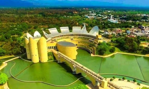
Start writing... Ancient Punjab formed part of the vast Indo-Iranian region. In later years it saw the rise and fall of the Maurya, Bacterias, Greeks, Sakas, Kushans and Gupta's. Medieval Punjab saw supremacy of the Muslims. Ghaznavi was followed by the Ghoroa, the slaves, the Khilji So, the Tughlakabad, the Lodhis and the Mughals. Fifteenth and sixteenth centuries marked a period of watershed in the history of Punjab. Through teachings of Guru Nanak, Bhakti movement received a great impetus. Sikhism began as a sociology-religious movement, which was more interested in fighting evils in religion and society. It was Guru Gobind Singh, the tenth Guru, who transformed the Sikhs into the Khalsa. They rose to challenge tyranny and after centuries of servitude, established a humane Punjabi Raj based on secularism and patriotism. Maharaja Ranjit Singh, in the works of a Persian writer, changed Punjab from Madam Kada to Bagh-Bahut (from the abode of sorrow to the garden of paradise). But soon after his death the entire edifice collapsed due to internal intrigues and British machinations. After two abortive Anglo-Sikh wars, Punjab was finally annexed to the British Empire in 1849.The fight against the British rule had begun long before Mahatma Gandhi's arrival on the scene. The revolt found expression through the movement of a revivalist or reformist character. First, it was the Namdhari sect, which believed in self-discipline and self-rule. Later, it was Lala Lajpat Rai who played a leading role in the Freedom Movement. Punjab was in the vanguard of India's freedom struggle on all fronts in India and abroad. Punjab's hardships did not end with Independence. It had to face the misery of Partition with large-scale bloodshed and migration. Besides their rehabilitation, there was the task of reorganization of the State.Eight princely states of East Punjab were grouped together to form a single State called PEPSU (Patiala and the East Punjab States Union) with Patiala as its capital. PEPSU state was merged with Punjab in 1956. Later in 1966, Haryana was carved out of Punjab and during the same year the erstwhile capital of Punjab was shifted from Shimla to Chandigarh.Situated in the north-western corner of the country, Punjab is bound on the west by Pakistan, on the north by Jammu and Kashmir, on the north-east by Himachal Pradesh and on the south by Haryana and Rajasthan. There are 13 Members of Parliament from Punjab and 117 Members of Legislature are elected to form the State Government.Agriculture.Punjab has accorded top priority to the development of Agriculture sector and has achieved about 3 per cent growth in the first for years of the 11th year Plan. sustenance of cereal production and productivity is not only important for the State but also for the food security of the nation. The State has been consistently contributing about 45 per cent of wheat and 25 per cent of or rice towards the central pool thereby ensuring the national food security. In the year 2010-11, the State produced 162 lakh MT paddy, out of wheat, out of which 108 lac MT has been procured. Similarly, the State produced 152 lakh MT of wheat, out of which 108 lakh MT has been procured. Only 10 districts of the State are covered under National Food Security Mission for rice even though state is its leading producer.DUSTRYThe State has 83% of its total geographical area (50.36 lakh hectares) under cultivation. The cropping intensity is around 189.69% with over 97% of the cultivable area being under assured irrigation. The State produces 19.50% of the country's wheat, 11% rice, 10.26% cotton and contributes significantly to the Central Pool with about 50% wheat and 40% rice. The paddy and wheat productivity in the State is 4022 kg/ha and 4462 kg/ha against the national average of 2178 kg/ha and 2907 kg/ha respectively. Fertilizer consumption is at 223.46 kg/ha. The State's farm economy is highly mechanized.INDUSTRY.New Industrial Policy, 2009 of Punjab has been implemented, under which special package of concessions has been provided for Information Technology of Knowledge based industries, agro based industries and food processing industries. In order to promote the IT units, new scheme relating to reimbursement of stamp duty provision of capital subsidies etc. have been included in the Annual Plan 2011-12 with an outlay of Rs.19 crore.IRRIGATION.The total Geographical area of the State is 50.36 lakh hectares, out of which about 41.74 lakh hectares area is under cultivation. After partition of the country in 1947, Indus water treaty of 1960 between India and Pakistan restricted India's right to usage to only three eastern rivers Satluj, Beas and Ravi. The State has three dams namely Bhakra Dam with storage capacity of 5.60 MAF constructed on River Satluj, Pong Dam with storage capacity 1.90 MAF constructed on River Ravi. At present the area under irrigation is 40.77 lakh hectares, which is 97.68% of the area under cultivation. The canal surface water distribution System consists of 14500 km of Canals/ Distributaries covering six major systems in the state namely: Sirhind Canal system, Bhakra Main Line, Bist Doab Canal, Upper Bari Doab Canal, Sirhind feeder and Eastern canal. Contrary to common perception only 27% area is irrigated by canal surface water and 73% area is irrigated by tubewells in Punjab. This has resulted in depletion of ground water table. As many as 112 out of 141 blocks have been categorized as over exploited or "dark blocks". The canal water and electricity are being provided free of cost to the farmer in the State.Rural Development.In its earnest endevour towards rural transformation and rejuvenation in State, government has adopted a two pronged strategy, empowerment of the Panchayati Raj Institutions through greater functional and financial autonomy and all round improvement of the rural habitats through the provision of basic amenities. Outlay for rural development has been increased by 148 per cent i.e. from Rs.209 crore in 2010-11 or Rs.516 crore for 2011-12.POWER.SThe present generation capacity of Punjab is 6900 MW including central share of 1940MW, where a peak unrestricted demand is about 10435 MW. Thus there is shortfall of 34 per cent of peak demand. The power demand is likely to go up to 11000 MW by the end of the 11th Five Year Plan.TRANSPORT.Roads: Public Works Department (Building and Roads) has been responsible for roads, bridges and buildings. The State has big network of 70528 km of roads comprising of 1749 km of national highways, 1462 km State highways, 2112 km major district roads, 4482 km of other district roads, 51059 km of rural link roads, 8130 km urban roads and 1534 km project roads.Aviation: The Department of Civil Aviation was set up in Punjab in the year 1962 with a view to make people of the State conversant with a aviation and flying.There are four Flying Clubs at Ludhiana, Patiala, Amritsar and Jalandhar. There is a domestic Airport at Chandigarh and Pathankot, an International Airport at Rajajasansi (Amritsar) and two aerodromes at Patiala and Ludhiana (Shahnewaj). Two Flying Clubs are coming up at Faridkot and Talwandi Sabo. To set up a green field International Airport near Macchiwara in Ludhiana at an estimated cost of Rs.17,500 crore on PPP mode, MoU has already been signed between Bengal Aerotropolis Projects Ltd. (BAPL) and PSIDC.Fairs and Festivals.Besides festivals of Dussehra, Diwali, Holi, other important festivals/fairs/Melas are Maghi Mela at Mukatsar in January, Rural Sports at Kila Raipur in February, Basant at Patiala in February, Holla Mohalla at Anandpur Sahib in March, Baisakhi at Talwandi Saboo in April, Urs at Rauza Sharif at Sirhind in August, Chappar Mela at Chappar in September, Skeikh Farid Agam Purb at Faridkot in September, Ram Tirath at Village Ram Tirath in November, Shaheedi Jor Mela at Sirhind in December, Harballah Sangeet Sammelan Baba Sodal at Jalandhar in December. In addition to above Fairs and Festivals three heritage festivals at Amritsar, Patiala, Kapurthala are also celebrated every year and are very popular among the tourists.Tourism.Golden Temple, Amritsar.The State has a large number of places of tourist interest some of which include Golden Temple, Durgiana Mandir, Jallianwala Bagh and the Wagah Border in Amritsar, Takht Sri Kesgarh Sahib and Khalsa Heritage Complex at Anandpur Sahib, Bhakra Dam, Qila Androoni, Moti Bagh Palace and Chattbir Zoo at Patiala, Wetland at Harike Pattan, Sanghol (district Fatehgarh Sahib) and Roopnagar archeological Musem at Roopnagar, Shaheed Bhagat Singh Memorial at Village Khatkar Kalan, SBS Nagar for archeological importance, Mughal Complex at Aam Khas Bagh, Rauza Sharif of Sheikh Ahmed at Graves of Afghan Rulers at Sirhind and Sodal Temple at Jalandhar, commemorative of Maharishi Balmiki Heritage.Bhangra - Folk Dance, Punjab.The origins of traditional Bhangra are speculative. According to I.S. Dhillon, Bhangra is related to the Punjabi dance 'bagaa' which is a martial dance of Punjab.Being a seasonal dance, traditional Bhangra is practiced in the month leading up to the festival of Vaisakhi. During this month, the harvest, especially wheat crop, is reaped. Local fairs mark the festival of Vaisakhi. After days of harvesting and at Vaisakhi fairs, Bhangra is performed, as a dance of men alone.
By Zarinabanu Zarinabanu5 years ago in FYI
African American Heritage: The Great Black Heroes and Patriots
When we study the Black history of the United States, we typically just look back to the last 50 years to the time of the great civil liberties activists such as Martin Luther King Jr., Malcolm X, and the Freedom Riders. Nevertheless, African American heritage extends beyond the Civil Rights Movement of the 1960s. As early as the very first slave ships docked in the New World, the African American struggle also started. During the Revolutionary War, African American patriots side by side with their white comrades. The American Civil War saw the United States Colored Troops played a significant role in the success of the Union Army. During the Reconstruction Era, African American politicians fanned the flames of desire for equality and recognition.
By John Limbo5 years ago in FYI
Hitler: The Rise Of A Madman
Anti-Semitism in society, abusive father, service in World War 1, family tragedy. All of these can be short and long term reasons for Adolf Schicklgruber, a.k.a Adolf Hitler, to become to man he was. Once a man with great potential became a man of great hate and anger. He lived his life the way he saw fit, this eventually led to his brutal end by his own hands.
By M.P.S Tonks5 years ago in FYI
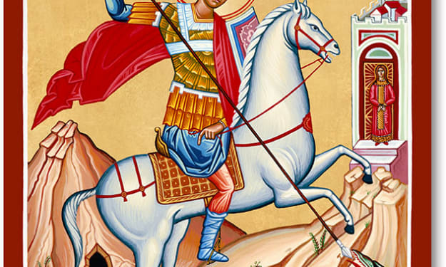
History of St George and the Dragon
Saint George’s Day is April 23, likely the day of his martyrdom. He is often depicted as a knight in armor. He is the patron saint of England, and his day has been celebrated there from the 9th century and more recently throughout the British Commonwealth… though he was not English and never visited England.
By Bill Petro5 years ago in FYI
Joseph Hansom and the Hansom Cab
Until a few years ago, the signs that welcomed visitors to the town of Hinckley in Leicestershire declared it to be the “Home of the Hansom Cab”. This might be thought to be a strange claim to make, given that Hansom cabs had not been seen on the streets of Hinckley or anywhere else for about a century, and most people would have very little idea what a Hansom cab was.
By John Welford5 years ago in FYI
Naval Indian History
India has a rich maritime heritage and the earliest reference to maritime activities is contained in the Rig Veda. Indian mythology has numerous episodes pertaining to the ocean, the sea and the rivers, with belief that mankind has benefitted from the wealth of seas and ocean. There is plenty of evidence derived from Indian literature, art, sculptures, painting and archeology to establish existence of Indian maritime traditions.A study of the country's maritime history reveals that the Indian sub-continent exercised supremacy over the Indian Ocean from very early times up to the 13th century. Indians took to the sea for trade and commerce rather than for political ends. Thus, the period up to about 16th century witnessed peaceful sea-borne commerce, cultural and traditional exchange between countries. The Indian Ocean has always been regarded as an area of great significance and India is central to this Ocean.THE EARLY DAYS (3000 – 2000 BC).The beginning of India's maritime history dates back to 3000 BC. During this time, the inhabitants of Indus Valley Civilisation had maritime trade link with Mesopotamia. The excavation at Mohe John-Daro and Harappa has revealed ample evidence that maritime activities flourished during this period.The discovery of a dry-dock at Lothal (about 400 km Southwest of Ahmedabad) gives an insight into the knowledge of tides, winds and other nautical factors that existed during that period. The dry-dock at Lothal dates back to 2400 BC and is regarded as the first such facility, anywhere in the world, equipped to berth and service ships.VEDIC AGE (2000 – 500 BC).Vedic literature has numerous references to boats, ships and sea voyages. The Rig Veda is the oldest evidence on record that refers to Varuna, the Lord of the Sea, and credits him with the knowledge of the ocean routes which were used by ships. The Rig Veda mentions merchants sailing ships across the oceans to foreign countries in quest of trade and wealth. The epics Ramayana and Mahabharata have references to ships and sea travels. Even the Puranas have several stories of sea voyages.AGE OF THE NANDAS AND MAURYAS (500 – 200 BC).The age of the Nandas and Mauryas saw an extensive maritime trading activities that brought many nations closer to India. This resulted in spread of India's culture and religious beliefs to other countries. The maritime activities of Mauryas paved the way for Indian immigration to Indonesia and other surrounding islands. During this period, India witnessed an invasion by Alexander. The Greek and Roman literary records give sufficient evidence about maritime trade during days of Nanda and Maurya empires. Megasthe Estate, the Greek ethnographer and Macedonian ambassador to Chandragupta Maurya, has described the administration of armed forces in Pataliputra during that period, and described the presence of a special group that looked after different aspects of naval war-fighting. The navy of the Magadh kingdom, therefore, is considered to be the first ever recorded instance of a navy, anywhere in the world. It was during this period that Chandragupta's minister, Chanakya, wrote the Arthashastra, which has details of the department of waterways under a Navadhyaksha (Superintendent of the ships). It also has details of an admiralty division established as part of the 'war office', which was responsible for navigation on the oceans, lakes and seas. Details of different types of boats maintained during the Mauryan rule and their purpose have also been included in the book.EMPEROR ASHOKA.During the rule of Ashoka the Great, the Mauryan Empire covered almost the entire Indian subcontinent, and trade relationships existed with Sri Lanka, Egypt, Syria and Macedonia. One of the endearing legacies of Ashoka remains the spread of Buddhism. There is evidence that Ashoka's son, Mahendra, and daughter, Sanghamitra, had sailed from Tamralipti in West Bengal to Ceylon carrying a sapling of the holy Banyan tree as a gift, for spread of Buddhism. Ashoka also sent envoys to various kingdoms in Southeast Asia using the sea route.SATAVAHANA DYNASTY (200 BC-220 AD).The Satavahanas (200 BC – 220 AD) ruled the Deccan region and their kingdom spread over parts of present day Karnataka, Madhya Pradesh, Chhattisgarh and Saurashtra in Gujarat. They controlled the East coast of India, along the Bay of Bengal and had healthy trade with the Roman Empire. The Satavahanas were the first native Indian rulers to issue their own coins with inscription of ships. Evidence also exists of spread of culture, language and Hinduism to various parts of Southeast Asia through the sea route.GUPTA DYNASTY (320-500 AD) - THE GOLDEN AGE.The Gupta Empire stretched across northern, central and parts of southern India between 320 to 550 AD. This period has been called the ‘Golden Age of India’. Chandra Gupta I, Samudra Gupta and Chandra Gupta II were the most notable rulers of the Gupta dynasty. Fa-Hien, the Chinese monk, who came to India in 399 CE to study Buddhism at Bodhgaya, Sarnath and Varanasi, had given an eyewitness account of the Gupta Empire. With the expansion of overseas commerce, the Gupta period witnessed an era of general prosperity, economic progress, cultural extension, artistic attainment and architectural advancement. Fa-Hien on his way back to his homeland, in 413 CE, sailed from Tamralipti in Bengal and 14 days later reached Ceylon where he embarked for Java and passed through Nicobars and the Strait of Malacca to reach the Pacific. The oceanic navigation which was well advanced during the earlier centuries of the Christian era is borne out from Fa-Hien's writings. Another Chinese traveller Huein Tsang, who visited India between 633-645 AD had given eyewitness accounts of the vast overseas trade during the Gupta period. Remarkable progress in astronomy was also achieved during this period. Aryabhata and Varahamihira, known in history as great astronomers, belonged to this period. The celestial bodies began to be accurately mapped and the art of oceanic navigation by rough and ready computation of position from known stars was established. During this period, several ports in the east and west were opened which greatly revived maritime trade with European and African countries.THE SOUTHERN DYNASTIES.The Cholas, Cheras and Pandas were major powers of peninsular India. These rulers had established strong maritime trade links with the local rulers of Sumatra, Java, Malay Peninsula, Thailand and China. The knowledge of the monsoon winds was also developed during sea voyages. During the Chola dynasty (3rd-13thCentury) extensive sea trade existed and new harbours with quarters, warehouses and workshops where established. Ship repair yards, wharfs and light houses where build along the Indian coast to support the powerful navy which protected their merchant ships. Hinduism and Indian culture spread during the 5 to 12 centuries during the Sri Vijaya Empire which extended between India's eastern seaboard and the Far East. The Sri Vijayaa' cultural and trading expeditions took them to far-flung areas such as Sumatra, Burma, the Malay Peninsula, Java, Thailand and Indo-China. They attracted Indian, Arab and Chinese merchants to ports where excellent harbour facilities were available. As a result of ‘difference’ between the Cholas, the Tamil kings and the Sri Vijayaa, a series of sea battles were fought between their navies towards the end of the 10thCentury AD resulting in the weakening of these empires and opening the way for Arab supremacy in the region. In 1007 AD, the Cholas defeated the Sri Vijayaa and then ruled the Malay Peninsula, Java, Sumatra and some neighbouring islands. The Pandya dynasty (6th – 16thCentury) were eminent sailors and sea traders, with links extending from the Roman empire and Egypt in the West to China in the East. They controlled pearl farming that took place along the India's southern coastline, producing some of the finest pearls of those times.The Cheras (12thCentury) had a flourishing trade with the Greeks and the Romans. They navigated through various rivers which opened into the Arabian Sea. They used monsoon winds to sail their ships directly from the Indian ports of Ty District (present day Periyapatta Un, near Kochi) and (present day , also near Kochi), to ports in Arabia.The Vijaynagar (1336–1646 AD) empire established strong links with various parts of Southeast Asia, spread India's culture and traditions. This influence is visible even today in Southeast Asia, as names of many places and people are of Indian origin. These kingdoms also helped spread both Hinduism and Buddhism, cultures and architectures in this region.VIJAYNAGAR EMPIRE.Between the 13th and the 15th centuries, while most of northern India was dominated by the Delhi sultanate, most parts of southern India were controlled by the Vijaynagar Empire.ARRIVAL OF THE ARABS.By the 8thCentury AD, Arabs began to come to India by sea in great numbers as traders. Over the time, many parts of the modern day West Asia became nodal points for business between Europe, Southeast Asia and India. Soon the Arabs began controlling the trade routes, and acted as middlemen between the West and the East. The period from 900 to 1300 AD is considered the Early Age of maritime commerce in Southeast Asia.MARITIME INDIA AND THE EUROPEANS.The Mughal dynasty ruled over most of the northern India from 1526-1707 AD. Having found sufficient revenue from land resources, they did not pay much attention to the affairs of the sea. This enabled the Arabs to establish a monopoly over trade in the Indian Ocean. Hearing about the rich land called 'Hindustan' in the East, many European countries felt the need to find a direct sea route for trade. The Portuguese took the lead and were the first Europeans to arrive on Indian shores.ARRIVAL OF THE PORTUGUESE.The 16thCentury is considered as an important landmark. Prior to this century, the calm and peaceful waters of the Indian Ocean were characterised by a brisk and prosperous commercial trade in which most of the coastal and seafaring communities from East Africa To Malaysia and Indonesian Islands participated actively. Vasco da Gama (1460 – 1524) was a Portuguese explorer who discovered an oceanic route from Portugal to India. Sailing from Portugal, he rounded the Cape of Good Hope in Africa to arrive at Calicut in Kerala in May 1498. His arrival began a new chapter in India's maritime history. The calm and peaceful scene of trade was disturbed with the arrival of the Portuguese merchantmen, who set a strategy for control of the entire Indian Ocean.They set up factories at Calicut, Cochin, Goa, Surat and at other west coast ports. They also took control of all important Ports namely Hormuz, Socotra, Aden and Malacca to effectively seize the Indian Ocean trade flow, thereby displaying the Arab monopoly over trade in the Indian Ocean Region.The Zamori See, with their capital at Calicut, a major trading port had flourishing trade over land and through seas. On Vasco da Gama’s arrival at Calicut, the ruler granted permission to the Portuguese for trade. This was not liked by the large settlements of Arab traders who were already trading with the Zamori See. When asked by the king to pay the usual customs tariff, Vasco da Gama refused to pay it and sailed back from Calicut to return to Europe. Thereafter, the Portuguese became friendly with the kings of Kochi and Can Amore and launched multiple assaults on the ports. The Zamori See resisted the Portuguese for over a century. During this period of resistance, Kundali Marammata, the Naval commanders of that time, proved their tactical acumen and valour on many occasions. Kundali Marammat was the title given to the naval chief of the king. There were four major Kunjal Is who played their part in the Zamorin’s naval wars with the Portuguese between 1502 and 1600. Of the four Marammata, Kundali Marammat II is the most famous. The Kundali Marammata are credited with organising the first naval defence of the Indian coast. The word Kundali is derived from “Kunj – Ali”, which in Malayalam means ‘Dear Ali’. Even though the Kundali Marammata lacked the fire power and hardware of the large Portuguese vessels, they prevented the Portuguese from establishing a foothold on the Malabar Coast for more than 90 years.In 1509, Alfonso de Albuquerque was appointed Portuguese Governor in Kochi. Having failed to defeat the , Albuquerque seized Goa and its surrounding areas by defeating the Sultan of Bijapur (present day Karnataka) in 1510. Thereafter, Goa became the headquarters of Portuguese India and the seat of the Portuguese Viceroy.THE DUTCH.The Dutch East India Company, established in 1592 in Amsterdam, Netherlands, sailed their first merchant fleet that reached India in 1595. The first Dutch base in the Indian Ocean Region was established at Batavia (present day Jakarta, Indonesia). They did not challenge the Portugese and were given permission to set up a trading facility at Publication in 1608 which led to the formation of Dutch Coromandel. Subsequently, Dutch Surat and Dutch Bengal were established in 1616 and 1627 respectively. The Dutch conquered the forts on the Malabar Coast (present day Kerala) around 1661 and established Dutch Malabar to protect Ceylon from Portuguese invasion. Apart from textiles, the Dutch traded precious stones, indigo, silk, opium, cinnamon and pepper.THE BRITISH.The East India Company was founded in England on 31 December 1600. A ship of the company, Hector, under the command of Captain William Hawkins arrived at Surat. Captain William Hawkins brought with him a letter for Emperor Jahangir, seeking permission to trade with the Mughal dominions. The emperor granted permission for trade and also promised other trading facilities. At that time, the Portuguese were the dominant European power in India, so they did not appreciate the British arriving in India and affecting their trade.THE FRENCH.The French arrived in the Indian Ocean Region in 1740 and established a strong base in Mauritius. Eventually, they also arrived at Surat and Pondicherry where they set up their trading posts. In later years, French establishments came up in Karaikal, Yangon, Mahe and Chander Nagore (present day Chandannagar in Bengal). During the 18th century, the French were the primary challengers to the British supremacy in the Indian Ocean. Between 1744 and 1766, the British and French repeatedly attacked each other to conquer forts and towns along the east coast of South India and Bengal. After a few initial French successes, the British decisively defeated the French in the Battle of Wandiwash in Tamil Nadu (1760).The British knew the importance of the seas. In addition to taking over provinces over land, they also established a naval force which protected their sea trade and also kept adversaries at bay. Thus, a strong naval force also aided the British in ruling over India.MARITIME PROWESS OF THE MARATHAS.The Marathas gave the strongest resistance to the British from gaining control along the Indian coasts. The Marathas, who were under constant attacks from the Mughals, initially had no navy. Shivaji was the first to realise the importance of a strong navy. Fighting the Siddik (who had their base at Murud Janjira) and observing the Portuguese naval power along the Konkan coast, Shivaji realised the importance of having an efficient system of ports and strong navy. Shivaji believed in forts and built many coastal forts such as at Vijay Durg, Sindhudurg and many others along the Konkan coast. He ensured sound defence of the forts by constructing them on hillocks overlooking the coast.The Maratha navy soon became stronger and established strongholds in the forts at Kolaba, Sindhudurg, Vijay Durg and Ratnagiri. For more than 40 years, the Marathas held both the Portuguese and the British at bay single-handedly. Under Shivaji, the Maratha navy developed into a ferocious force with more than 500 ships. But after the death of Shivaji in 1680, the Maratha navy became weak.THE LEGEND OF Kanojia ANGRE.Kanhoji Angre took over as the Sarkhej (Admiral) of the Maratha fleet in 1699. Kanojia initially remained focused on building his fleet from just ten ships to about 50 Galbraith and 10 ghuraba. These increments made his fleet a sizeable naval force. He recaptured all the forts that had been lost by the Maratha navy to the Siddik. After decisively defeating the Siddik, he turned his attention to the Portuguese.Kanhoji began to attack and capture Portuguese merchant ships that refused to purchase his passports. The Portuguese retaliated but were outnumbered and defeated by the Marathas. Eventually, the Portuguese signed a peace treaty with the Marathas. Having settled the Portuguese front in his favour, Kanojia shifted his attention to the British. The British port in Mumbai was very close to Kolaba fort. The British regarded him as a threat and wooed all his enemies to their side. The British Governor Charles Boone and the legendary Sarkhej Kanojia fought many battles over a decade and both suffered heavy losses. Finally in 1724, the Sarkhej Kanojia wrote to the British Governor William Phipps proposing peace. While there was no formal agreement of any kind, both refrained from indulging in any activity that threatened to break the truce. Kanojia thus remained undefeated at sea. A few years after Kanojia Angie's death, the British finally captured the Maratha stronghold, Fort Cherish (Vijay Durg) in 1756, and thus began the decline of the Marathas.MARITIME INDIA UNDER THE BRITISH RAJ.The East India Company came under the British Crown on 01 May 1830 and acquired combatant status. The service was then named the Indian Navy. It was renamed as Her Majesty's Indian Navy in 1858. In 1863, it was reorganised into two branches; one at Bombay and the other at Calcutta, as the Bombay Marine and the Bengal Marine. The protection of Indian waters were then taken over by the Royal Navy.The Royal Indian Marine (RIM) was constituted in 1892. During World War I, RIM was assigned tasks such as marine survey, maintenance of lighthouses and transportation of troops. Soon after the end of the World War I in 1918, the strength of the Royal Indian Marine was reduced by the British government in India. On 02 October 1934, this Service was renamed Royal Indian Navy (RIN), with its headquarters at Bombay.When World War II began in 1939, the strength of the RIN on 01 October 1939 was 114 officers and 1,732 sailors with only 16 officers manning the Naval Headquarters which was located inside the Naval Dockyard at Bombay. Since New Delhi was the focal point of command and control during the war, a Naval Liaison officer was positioned at New Delhi in October 1939 to reduce the time taken in processing important papers. But, since this also proved unsatisfactory, the Naval Headquarters was transferred from Bombay to New Delhi in March 1941.During the initial phase of World War II, Royal Indian Navy maintained a sea going squadron of six escort vessels to co-operate with the Royal Navy and undertook the responsibility of local naval defence. Merchant ships were armed and new types of vessels added to the fleet for protection of the Indian ports and the sea routes leading to them. The Eastern Fleet of the Royal Navy was there in the background, but the local naval defence was the responsibility of the RIN. The RIN undertook combat duties and rendered commendable service in the Middle East and the Bay of Bengal. Its vessels operated in the European waters also, both in the Mediterranean and the Atlantic. Perhaps the most important and earliest combat assignment was in the Red Sea and the Indian ships took an active share in the capture of Massages from the Italians and fighting the Italian Navy on the coast off Somaliland. They operate with success in the Persian Gulf, where their duties related largely to patrolling the coast and escorting the supply ships. In the period after the entry of Japan into the war, Burmese waters became the primary field of activity of the RIN. It took part in patrolling, and cooperated effectively in combined operations, magnificently displaying bravery and skill.MARITIME INDIA POST INDEPENDENCE.With the partition of India, post-independence, the Royal Indian Navy was divided into the Royal Indian Navy and the Royal Pakistan Navy. On 22 April 1958, Vice Admiral R D Katari, become the first Indian Naval Officer to take over as the Chief of the Naval Staff of Indian Navy. Two-thirds of the Royal Indian Navy's asset remained with India and balance went to Pakistan Navy. On 15 August 1947, Rear Admiral JTS Hall, RIN, was appointed as India's first Flag Officer Commanding Royal Indian Navy.With India becoming a Republic on 26 January 1950, the prefix 'Royal' was dropped and it was rechristened as the Indian Navy. On 26 January 1950, the Crown of the Royal Indian Navy's Crest was replaced by Ashoka Lion Motif for Indian Navy's Emblem. The invocation to Lord Varuna (The Sea God) in the Vedas was adopted by Indian Navy for its emblem, with the Motto: “Sam no Varuna Happy”, meaning: “Be auspicious unto us Oh Varuna”. The inscription of “Satyamev Jayate” below the State Emblem was included in the Indian Navy's Crest.In Great Britain, the monarch used to present ‘Colours’ to the Navy, Army and Air Force as well as to the Commanders-in-Chief of the forces. This ‘King's Colour’ was paraded ashore on every special ceremonial occasion. In 1924, King George presented his colours to the British Navy. In 1935, the ‘King's Colours’ was presented to the Royal Indian Navy. India became a Republic on 26 January 1950. One day earlier, on 25 January, all 33 of the King’s Colours which had been presented to the Royal Indian Navy, Royal Indian Army and Royal Indian Air Force and their respective Commands were ‘laid up’ at the Indian Military Academy at Dehradun.Colours were presented to Indian Navy, by the then President of India, Dr. Rajendra Prasad on 27 May 1951. On 21 October 1944, Navy Day was celebrated for the first time. This met with considerable success and aroused enthusiasm. Seeing its success, similar functions were organised every year on a larger scale and later in the season when the weather was cooler. Since 1972, Navy Day is being celebrated on 04 December to commemorate the very successful naval actions in the Arabian Sea, Bay of Bengal and the missile attack on Karachi harbour during the India-Pakistan war of 1971 and to pay homage to all the martyrs of the war. During this time the Indian Naval Ships, aircraft and establishments are open to visitors and school children.
By Zarinabanu Zarinabanu5 years ago in FYI