
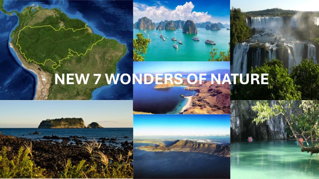
NEW 7 WONDERS OF NATURE
As you know, nature is incredibly magnificent. Around the world, each country has its own unique natural beauty. Below are the seven most beautiful natural wonders of the world, as selected by the private company New Open World (NOW) Corporation.

1. Amazon Rainforest (many countries)
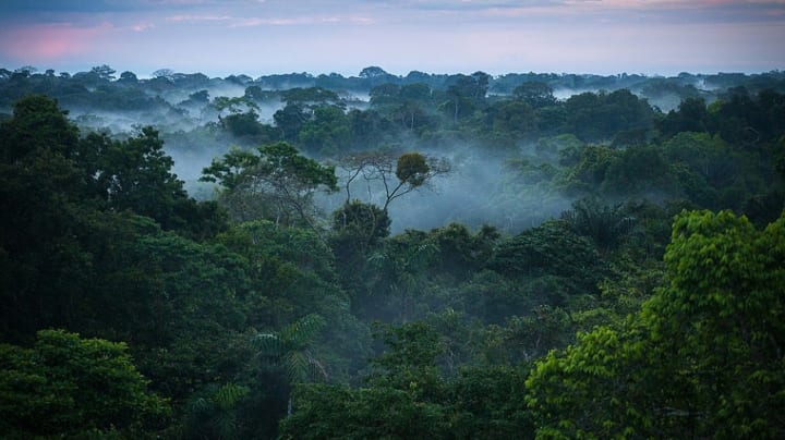
The Amazon Forest, also known as the Amazon Rainforest, is the world’s largest forest. It covers an area of 6.7 million square kilometres. It’s importance to the planet’s ecosystem is recognised in its other name, when it is referred to as the “lungs of the world”. For each of the countries that share the Amazon Forest, it represents over a third of the surface area of the nation itself – making it for all their most important bio-reserve.
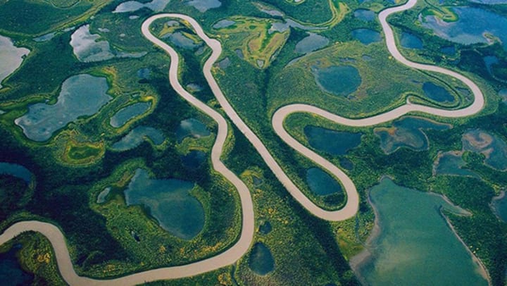
The forest also contains in it, from beginning to end, the famous Amazon River, the largest river by discharge of water in the world, and according to some experts, the longest in length.
The Amazon is home to an incredibly diverse range of flora and fauna. It is estimated to contain around 390 billion individual trees belonging to 16,000 species, and it provides habitat for approximately 10% of the world's known species, including jaguars, sloths, piranhas, and anacondas.
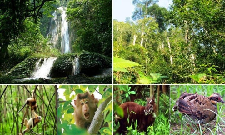
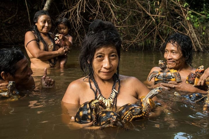
And of course, it is home to numerous indigenous tribes, many of whom have lived in the rainforest for thousands of years. These communities rely on the forest for their livelihoods and have developed unique cultures and knowledge systems deeply connected to the natural environment.
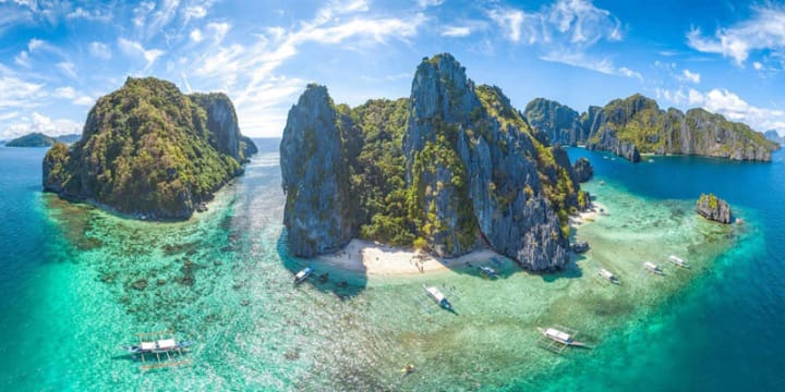
2. Hạ Long Bay (Việt Nam)
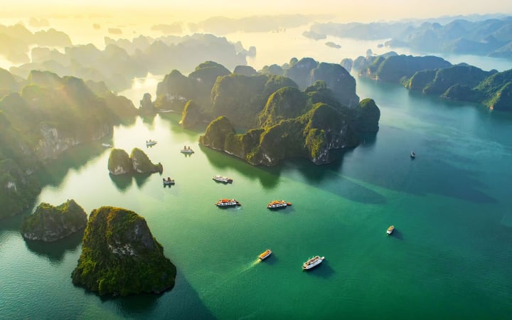
Hạ Long Bay is a UNESCO World Heritage Site and popular travel destination in Quảng Ninh Province, Vietnam. Administratively, the bay belongs to Hạ Long City, Cẩm Phả town, and is a part of Vân Đồn District. The bay features thousands of limestone karsts and isles in various shapes and sizes. Hạ Long Bay is a center of a larger zone which includes Bái Tử Long Bay to the northeast, and Cát Bà Island to the southwest. These larger zones share a similar geological, geographical, geomorphological, climate and cultural characters.
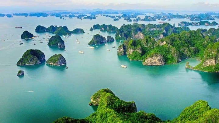
Hạ Long Bay has an area of around 1,553 km2, including 1,960–2,000 islets, most of which are limestone. The core of the bay has an area of 334 km2 with a high density of 775 islets. The limestone in this bay has gone through 500 million years of formation in different conditions and environments. The evolution of the karst in this bay has taken 20 million years under the impact of the tropical wet climate. The geo-diversity of the environment in the area has created biodiversity, including a tropical evergreen biosystem, oceanic and sea shore biosystem. Hạ Long Bay is home to 14 endemic floral species and 60 endemic faunal species.
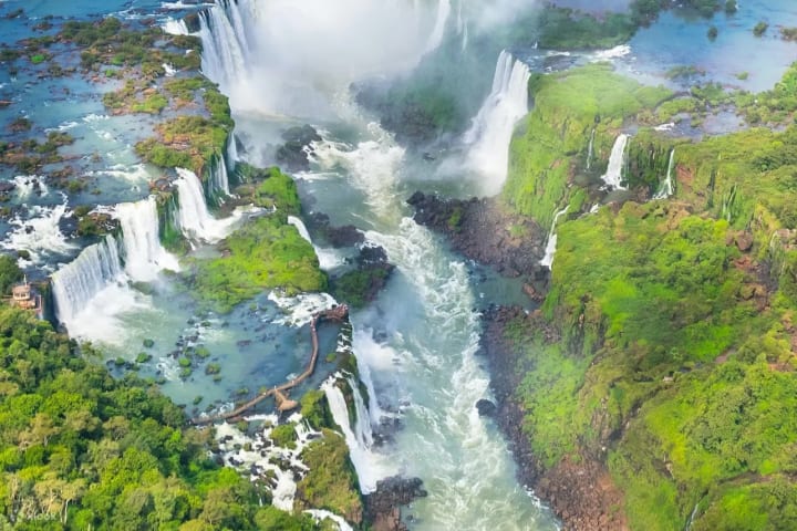
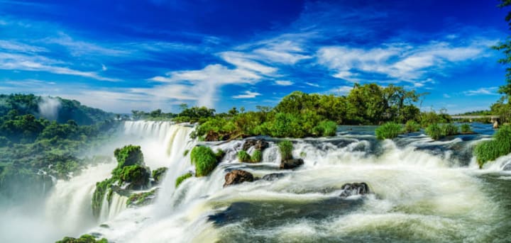
3. Iguazu Falls (Argentina & Brazil)
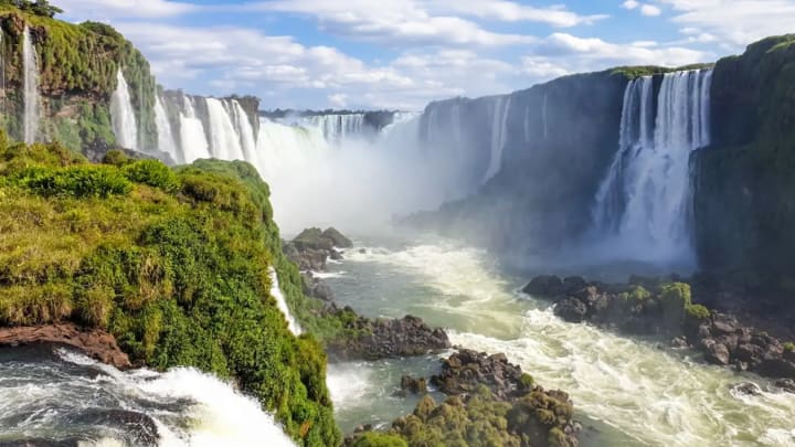
Iguazu Falls are waterfalls of the Iguazu River on the border of the Argentine province of Misiones and the Brazilian state of Paraná. They are the largest waterfalls system in the world. The falls divide the river into the upper and lower Iguazu. The Iguazu River rises near the city of Curitiba. For most of its course, the river flows through Brazil, however, most of the falls are on the Argentine side. Below its confluence with the San Antonio River, the Iguazu River forms the boundary between Argentina and Brazil.
The name “Iguazu” comes from the Guarani or Tupi words “y” [ɨ], meaning “water”, and “ûasú “[waˈsu], meaning “big”. Legend has it that a deity planned to marry a beautiful woman named Naipí, who fled with her mortal lover Tarobá in a canoe. In a rage, the deity sliced the river, creating the waterfalls and condemning the lovers to an eternal fall. The first European to record the existence of the falls was the Spanish conquistador Álvar Núñez Cabeza de Vaca in 1541.
The Iguazu Falls system stretches to a length of 2700 meters, comprising 275 individual waterfalls. The falls have an average height of over 60 meters. This place is dubbed the 'Devil's Throat' due to its ferocity, with the cascading water always ready to engulf anything that might accidentally fall into it.
4. Jeju island (Jeju Province, South Korea)
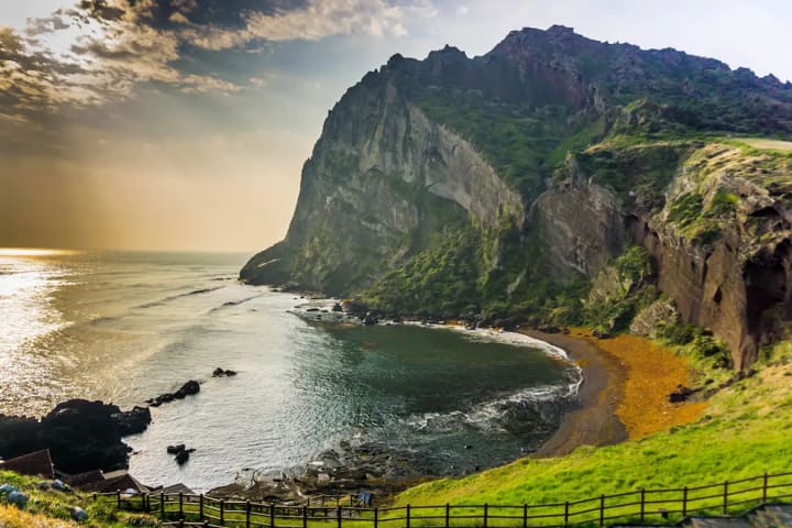
Jejudo (also known as Jeju Island) is a volcanic island. With a surface area of 1,846 sqkm it is the largest island 130 km off the coast of the Korean Peninsula, and the main island of Jeju Province of South Korea. The island lies in the Korea Strait, southwest of South Jeolla Province. The island contains the natural World Heritage Site Jeju Volcanic Island and Lava Tubes. A central feature of Jeju is Hallasan, the tallest mountain in South Korea and a dormant volcano, which rises 1,950 m above sea level. 360 satellite volcanoes are around the main volcano.
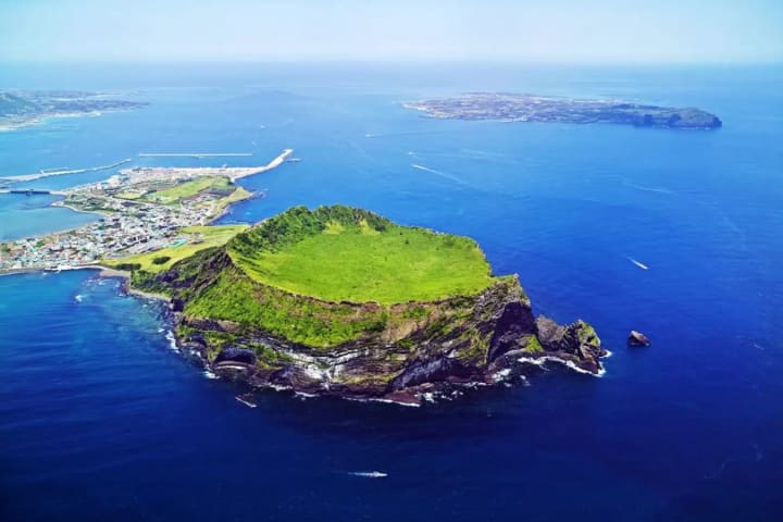
The island was created entirely from volcanic eruptions approximately 2 million years ago, during the time period extending from the Tertiary to the beginning of the Quaternary period, and consists chiefly of basalt and lava. The eruptions took place in the Cenozoic era. It has a humid subtropical climate, warmer than that of the rest of Korea, with four distinct weather seasons. Winters are cool and dry while summers are hot, humid, and sometimes rainy.
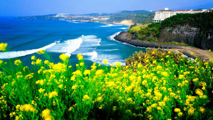
South Koreans consider Jeju Island to be a mystical, mythical island. Until about 100 years ago, this island, located 85 km south of the Korean mainland, was largely cut off from the outside world. The most significant link to the outside was the exiles who were banished to Jeju, mostly for political reasons. Traditional shamanistic religions have been preserved on the island to this day. It is believed that about 18,000 different gods are still worshiped here.
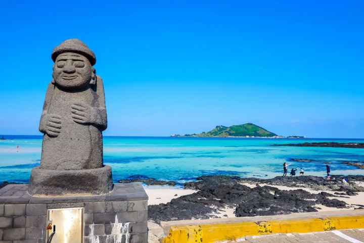
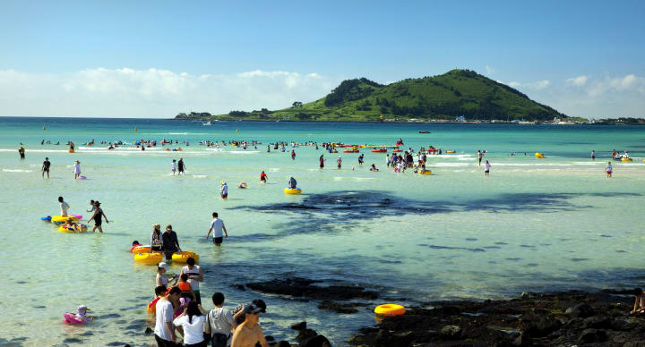
With its beauty, Jeju Island attracts millions of tourists both domestically and internationally each year for sightseeing and relaxation.
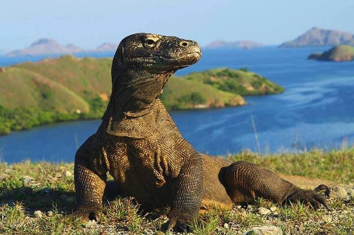
5. Komodo island (Indonesia)
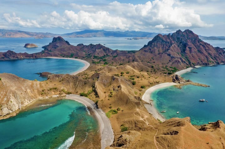
Komodo is one of the 17,508 islands that compose the Republic of Indonesia. The island is particularly notable as the habitat of the Komodo dragon, the largest lizard on Earth, which is named after the island. Komodo Island has a surface area of 390 square kilometres and a human population of over two thousand. The people of the island are descendants of former convicts who were exiled to the island and who have mixed with Bugis from Sulawesi. The people are primarily adherents of Islam but there are also Christian and Hindu congregations.
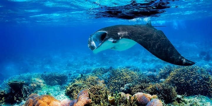
Komodo is part of the Lesser Sunda chain of islands and forms part of the Komodo National Park. In addition, the island is a popular destination for diving. Administratively, it is part of the East Nusa Tenggara province.
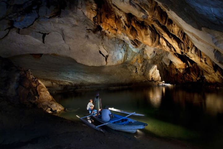
6. PP Underground river (Philippines)
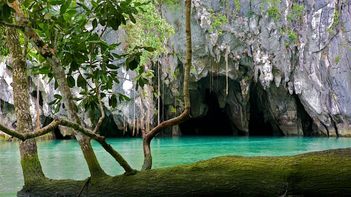
The Puerto Princesa Subterranean River National Park is a protected area of the Philippines located about 80 kilometres (50 mi) north of the city centre of Puerto Princesa, Palawan. The river is also called Puerto Princesa Underground River. The national park is located in the Saint Paul Mountain Range on the western coast of the island. It is bordered by St. Paul Bay to the north and the Babuyan River to the east. The City Government of Puerto Princesa has managed the National Park since 1992. The entrance to the subterranean river is a short hike or boat ride from the town Sabang.
In 2010, a group of environmentalists and geologists discovered that the underground river has a second floor, which means that there are small waterfalls inside the cave. They also found a cave dome measuring 300 m (980 ft) above the underground river, rock formations, large bats, a deep water hole in the river, more river channels, and another deep cave, as well as marine creatures and more. Deeper areas of the underground river are almost impossible to explore due to oxygen deprivation.
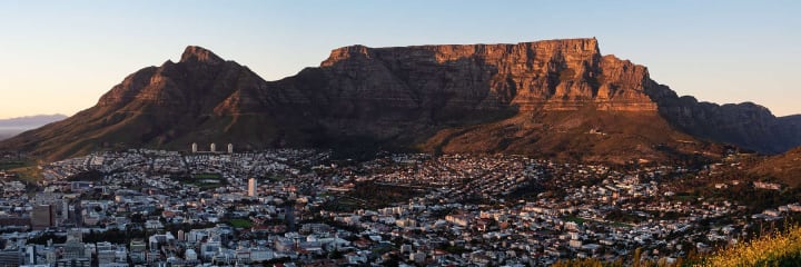
7. Table mountain (Western Cape & City of Cape Town, South Africa)
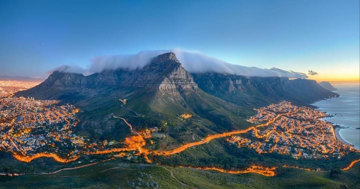
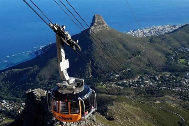
Table Mountain is a flat-topped mountain forming a prominent landmark overlooking the city of Cape Town in South Africa, and is featured in the Flag of Cape Town and other local government insignia. It is a significant tourist attraction, with many visitors using the cableway or hiking to the top. The mountain forms part of the Table Mountain National Park.
The main feature of Table Mountain is the level plateau approximately 3 kilometres (2 mi) from side to side, edged by impressive cliffs. The plateau, flanked by Devil’s Peak to the east and by Lion’s Head to the west, forms a dramatic backdrop to Cape Town. This broad sweep of mountainous heights, together with Signal Hill, forms the natural amphitheatre of the City Bowl and Table Bay harbour. The highest point on Table Mountain is towards the eastern end of the plateau and is marked by Maclear’s Beacon, a stone cairn built in 1865 by Sir Thomas Maclear for trigonometrical survey. It is 1,086 metres (3,563 ft) above sea level, about 19 metres (62 ft) higher than the cable station at the western end of the plateau.
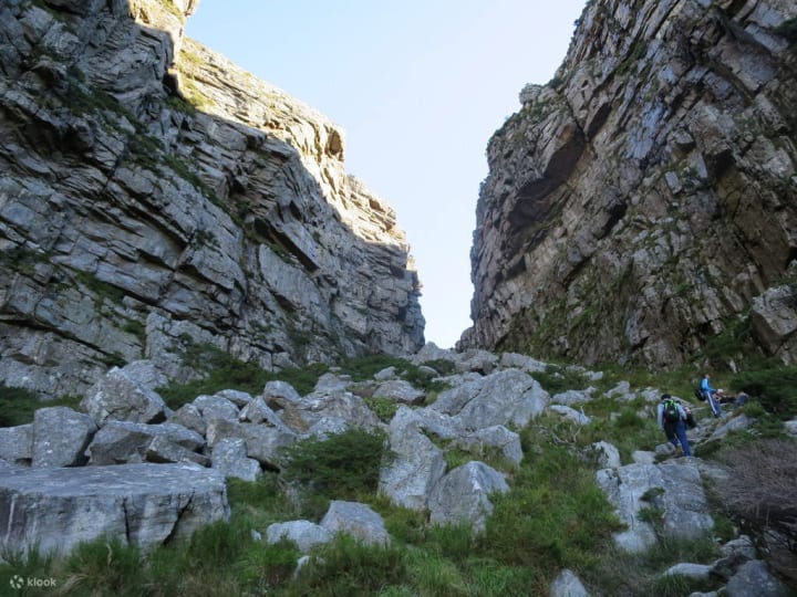
The cliffs of the main plateau are split by Platteklip Gorge (“Flat Stone Gorge”), which provides an easy and direct ascent to the summit and was the route taken by António de Saldanha on the first recorded ascent of the mountain in 1503.
Those are all 7 wonders of nature. Currently, although not widespread, some people with poor awareness have caused harm to these wonders. Therefore, to preserve and protect them, I hope you will raise your awareness. I hope that one day, you will witness these magnificent wonders firsthand!!
About the Creator
A Failed Artist, A Disillusioned Poet, An Underpaid Game Show Host
I took my son and niece to Gori, a small town in Georgia where Joseph Stalin was born. They talked me into visiting the Stalin's Museum, the largest in the post-Soviet space. I had resisted going there because I just can't stand the monster and know enough about him, or so I thought.
By Lana V Lynx27 days ago in FYI
Who Is Dajjal?
In the first year, the earth will reduce its production by one-third. Rainfall from the sky will decrease, and as a result, the earth’s ability to yield crops will diminish. After one year passes, the earth will reduce its production by another one-third, and rainfall will decline even further. In the third year, this situation will lead to severe famine across the world, and the demand for water and food will increase everywhere.
By Sudais Zakwan5 days ago in FYI


Comments
There are no comments for this story
Be the first to respond and start the conversation.