
Geographic Information Systems Market Size and Forecast 2025–2033
How Smart Cities, AI Integration, and Real-Time Mapping Are Driving a US$ 32.04 Billion GIS Market by 2033

Introduction: Mapping the World’s Digital Transformation
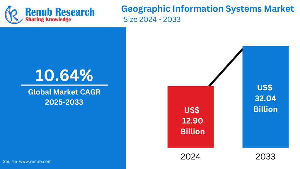
The Global Geographic Information Systems (GIS) Market is entering a new era—one defined by intelligent mapping, real-time analytics, and the rapid expansion of smart cities. According to Renub Research, the GIS market will rise from US$ 12.90 billion in 2024 to an impressive US$ 32.04 billion by 2033, growing at a CAGR of 10.64% between 2025 and 2033.
From climate monitoring and urban planning to defense applications, logistics optimization, and next-generation agriculture, GIS has become the invisible infrastructure powering the world’s most important decisions. The convergence of AI, machine learning (ML), IoT, and cloud computing is not only reshaping the GIS ecosystem—it is expanding its relevance across nearly every industry.
This article explores the evolving landscape of the GIS market, the forces driving its growth, key regional insights, and what the future holds for this transformative technology.
Global Geographic Information Systems Industry Overview
Geographic Information Systems (GIS) are specialized frameworks for gathering, storing, analyzing, and visualizing spatial or geographic data. By integrating data from maps, satellite imagery, sensors, drones, and digital records, GIS enables deeper understanding of spatial patterns, environmental trends, and real-world relationships.
Whether it’s tracking the spread of diseases, planning urban road networks, optimizing delivery routes, or monitoring deforestation, GIS turns location data into actionable intelligence. The technology has become indispensable for:
Government bodies seeking geospatial insights for policy and planning
Enterprises looking to enhance operational efficiency
Environmental agencies monitoring climate events
Military and defense units assessing terrain and surveillance patterns
Smart city planners building intelligent infrastructure
Government investments in urban development, rising demand for location-based services (LBS), and expanding GIS applications in healthcare, agriculture, and defense are collectively accelerating market growth.
Driving Forces of the Geographic Information Systems Market
1. Technological Advancements Fueling GIS Innovation
The GIS landscape is being reshaped by significant technological leaps—most notably AI, machine learning, IoT, and cloud computing.
AI & ML Integration:
Artificial intelligence is enabling predictive modeling, automated mapping, and advanced pattern recognition. Companies worldwide are now using location intelligence to drive cost efficiencies and predictive analytics. A strong example is FedEx, which uses enterprise GIS to monitor its global fleet, optimize routes, and forecast maintenance for aircraft—ensuring smooth, uninterrupted logistics operations.
Cloud-Based GIS:
Cloud platforms have made GIS more scalable, flexible, and cost-effective. Organizations can deploy massive geospatial datasets without investing in expensive in-house infrastructure.
In April 2024, NASA’s Marshall Space Flight Center expanded its Visualization, Exploration, and Data Analysis (VEDA) platform to support Earth Science Data Systems, marking a major step toward advanced cloud-based geospatial visualization.
In July 2023, Schneider Electric partnered with ROK Technologies to migrate ArcGIS and ArcFM systems to the cloud—making utility infrastructure mapping smarter and faster.
These innovations are improving accessibility and opening the GIS market to new user groups and industries.
2. Growing Adoption of Mobile GIS
Mobile GIS has revolutionized on-ground data collection, enabling real-time updates and empowering field teams with instant access to spatial insights. The rise of smartphones, tablets, and rugged mobile devices has significantly expanded GIS deployment in sectors including emergency services, construction, utilities, and urban planning.
A notable example comes from India:
TP Southern Odisha Distribution Limited (TPSODL) launched a mobile GIS app in July 2023 to streamline asset tracking using codes, geotags, and work IDs.
Meanwhile, global leaders continue to innovate:
In May 2023, Leica Geosystems (Hexagon) introduced the Pegasus TRK100, a mobile mapping device designed to support large-scale infrastructure mapping and digital twin creation.
As industries increasingly require real-time decision-making from the field, mobile GIS adoption is set to accelerate worldwide.
3. Rising Importance of Emergency Management & Public Safety
GIS plays a critical role in disaster preparedness, emergency response, and public safety. Accurate location data allows authorities to make fast, informed decisions during floods, fires, earthquakes, and other crises.
Examples from recent years highlight its growing significance:
CentralSquare Technologies partnered with DATAMARK in October 2023 to provide highly accurate GIS data to emergency responders.
In Louisiana, GIS technology powers Virtual Louisiana, a comprehensive platform offering real-time weather updates, evacuation routes, and disaster reporting tools for residents.
In February 2024, Binghamton University released public safety maps to enhance transparency and support emergency communication within communities.
With climate volatility and urban density increasing worldwide, emergency-ready GIS solutions are becoming essential infrastructure.
Geographic Information Systems Market Overview by Regions
North America
North America—especially the United States—is the global leader in GIS adoption. The region benefits from advanced technological infrastructure, strong government investments, and widespread adoption across industries.
Key growth factors include:
Government spending on smart cities, infrastructure modernization, and climate resilience
Defense sector investments in high-resolution mapping
Integration of GIS with IoT, cloud platforms, and AI tools
Increasing use of GIS in logistics and retail for location intelligence
A major development is the strengthened partnership between Trimble and Esri, aimed at supporting greener infrastructure planning and automating workflows for shared customers.
India
India is one of the fastest-growing GIS markets globally. Rapid urbanization, ambitious government programs such as Digital India and the Smart Cities Mission, and infrastructure modernization are creating new opportunities.
Major developments include:
In March 2024, Agribazaar launched an AI-powered GIS command center in Lucknow, supporting crop surveys under the UPDASP initiative.
The MMGEIS program, launched by Esri India and CKS, aims to make India a global geospatial innovation hub.
India’s demand for GIS is also rising across agriculture, transportation, disaster management, and environmental monitoring—making it a strategic market for global GIS vendors.
United Kingdom
The UK is experiencing steady GIS growth driven by:
Urban planning and infrastructure modernization
Climate change mitigation programs
Increasing adoption of location-based services
In 2024, VertiGIS partnered with Esri to strengthen global delivery of advanced GIS solutions, emphasizing co-selling, co-marketing, and integrated strategies.
Sustainability-focused infrastructure projects in the UK continue to fuel demand for precision mapping and geospatial analytics.
Saudi Arabia
Saudi Arabia’s ambitious Vision 2030 initiative has transformed the country into a major GIS adopter. Projects like NEOM, the Red Sea Development, and futuristic smart cities require high-resolution mapping, digital twin modeling, and advanced geospatial planning tools.
GIS demand in the region is expanding across:
Oil & gas
Utilities
Agriculture
Transportation
Environmental management
Integration with IoT, cloud systems, and big data is enhancing operational resilience and enabling data-driven resource planning across the Kingdom.
Market Segmentation Snapshot
By Component
Hardware
Software
Services
By Function
Mapping
Surveying
Telematics & Navigation
Location-Based Services (LBS)
By Device Type
Desktop
Mobile
By Vertical
Transportation & Logistics
Agriculture
Construction
Mining & Geology
Oil & Gas
Aerospace & Defense
Utilities
Government
Others
By Countries (25 Markets Covered)
North America: United States, Canada
Europe: France, Germany, Italy, Spain, United Kingdom, Belgium, Netherlands, Turkey
Asia Pacific: China, Japan, India, South Korea, Thailand, Malaysia, Indonesia, Australia, New Zealand
Latin America: Brazil, Mexico, Argentina
Middle East & Africa: Saudi Arabia, UAE, South Africa
Company Analysis (4 Viewpoints Per Company)
Includes: Overview, Key Persons, Recent Developments & Strategies, Financial Insights
Trimble Inc.
Autodesk Inc.
Bentley Systems Inc.
Hexagon AB
Pitney Bowes Inc.
Beijing SuperMap Software Co. Ltd
L3Harris Technologies Inc.
GE Vernova Inc.
Final Thoughts: GIS Is Becoming the Nervous System of the Modern World
The Geographic Information Systems market is evolving beyond its traditional role of mapping and visualization. It has emerged as a foundational technology enabling smarter cities, resilient infrastructure, predictive analytics, and AI-powered decision-making across industries.
As the world becomes more interconnected and data-driven, the importance of spatial intelligence continues to grow. With major investments, emerging innovations, and global initiatives supporting geospatial adoption, the GIS market is poised for strong, sustained expansion through 2033.
Whether powering the next generation of urban infrastructure or enabling life-saving disaster response systems, GIS is shaping the future—with precision, clarity, and intelligence.
About the Creator
Ben Tom
Ben Tom is a seasoned content writer with 12+ years of experience creating SEO-friendly blogs, web copy, and marketing content that boosts visibility, engages audiences, and drives results.
About Binding Prometheus
I want to start actively advocating on behalf of my own work, and the most valuable part of my canon is, without a doubt, Binding Prometheus, the play I have been working on since 2019 and only finished in 2023 as part of my MA. The play itself is an amalgamation of a million different inspirations. On one end, it evokes the Ancient Greek myth-play, deriving its own title from the earliest extant work of Western drama we have, Aeschylus’s Prometheus Bound. On the other end, it borrows significantly from the sci-fi bulwarks from over the years, namely Mary Shelley’s Frankenstein and Karel Capek’s Rossum’s Universal Robots. The play could be an episode of Black Mirror, I fear. I don’t know. I’ve only ever seen one episode of Black Mirror.
By Steven Christopher McKnight11 days ago in Futurism
Starship: A Breakthrough or an Overhyped Project?
Few space projects in modern history have sparked as much debate as Starship, the ambitious launch system being developed by SpaceX. To its supporters, Starship represents nothing less than a revolution — a machine that could make humanity a multi-planetary species and dramatically lower the cost of spaceflight. To critics, it is an overpromised, underproven concept whose technical challenges may outweigh its potential benefits. So which is it: a genuine breakthrough or an overhyped gamble?
By Holianyk Ihor4 days ago in Futurism


Comments
There are no comments for this story
Be the first to respond and start the conversation.