
Drone light show | What are the principles and technical difficulties of drone performances?
Drone light show
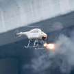
The effect of drone performances is well known. It can not only meet people's visual requirements, but also replace fireworks performances to achieve zero emissions.
In addition, for shooting, drone performances can quickly collect multi-angle image data in a three-dimensional space and provide information support in search and rescue; for logistics, formation flying can flexibly deliver goods and work together to transport heavy objects; for military use, formation flying can penetrate densely and improve the success rate of missions. So its use is still quite extensive.
1. Basic flight control principle of drones
1. Control algorithm
Single drone stable flight is the basis for realizing drone formation flight. The figure below is the key technical principle of drone stable flight. The CPU collects data from the attitude sensor in real time. The attitude sensor includes a three-axis gyroscope, a three-axis accelerometer, and a three-axis magnetometer. The attitude information of these nine axes is used for attitude solution fusion to obtain quaternions and Euler angles. The information collected by the sensor is used as the current attitude, and the target attitude is determined by the channel information of the remote control. The deviation between the two is used as the input control of PID. The attitude control is controlled through the cascade PID, the outer loop angle loop, and the inner loop enters the angular velocity loop. After the inner and outer loop PIDs are adjusted, the output is added to the attitude control to complete the stable control flight of the drone.
2. UAV positioning
(1) Distance measurement positioning
Install a distance sensor on each UAV to calculate the relative distance between each UAV, then perform mathematical modeling and obtain the position of the UAV according to the corresponding algorithm. Its advantage is that the calculated position is relatively accurate, but the amount of calculation is relatively high. In addition, there are few types of distance sensors in three-dimensional space.
(2) GPS + barometer
Use GPS to obtain the two-dimensional plane position of the UAV, and then combine the barometer and ultrasonic module to calculate the altitude, and finally obtain the spatial position of the aircraft. When the aircraft is flying at low altitude, the ultrasonic module is usually used to obtain altitude information with high accuracy, and the barometer is used at high altitude.
(3) Image recognition positioning
Use multiple cameras to obtain the three-dimensional space image of the environment, use image recognition technology to process the image, perform mathematical modeling on the flight space, integrate the position information of the UAVs in different dimensions, and obtain the position of the UAV in three-dimensional space. This method also has a large amount of data calculation in the image recognition process. In addition, due to geographical restrictions, it can only fly in an environment with cameras.
3. Anti-collision trajectory planning
To prevent collisions between drones when changing formations, we set a certain safety distance for each drone. As shown in the figure, a sphere with a fixed distance as the radius and each drone as the center is set as its safety zone, and other drones are not allowed to enter. If the drone needs to pass through the safety zone of other drones during flight, it must detour to reach the target location and cannot travel in a straight line to avoid collisions. 1. Technical points of drone performances
1. Trajectory
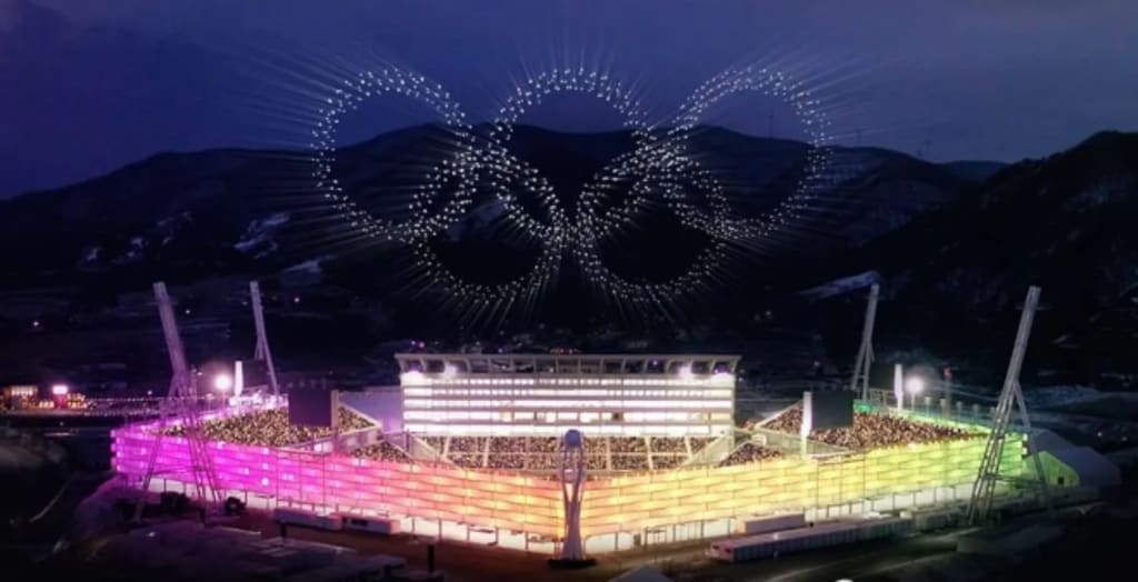
The light show uses drones. It has strong flight control capabilities, can fly forward and backward, hover and pan, and can adjust its position in any direction. The drone presents graphics in the air. Instead of treating each aircraft as a pixel like a display screen, it presents graphics by changing different colors. Instead, each aircraft must fly to a position to adjust its lights. So the flight trajectory and position of each aircraft, including the control of the lights, need to be compiled in advance. These are all computer-controlled and need to be programmed in advance.
2. Instructions
The drone (UAV) can control and realize various aircraft in the air by adjusting the speed of the four rotors. The rotor speed rises when it is fast and falls when the rotor speed is slow. If the speed of the four rotors is different, they will tilt and move to one side, resulting in translation. This requires coordination and control, which is very demanding, otherwise it will turn over. Each drone has a flight control system, which is its core control system. Although the action commands issued from the ground are simple, the flight control system needs to control the speed of the four rotors to specifically implement each command.
3. Communication network design
In the multi-UAV collaborative task self-organizing system, the UAVs are communication network nodes, and their spatial distribution determines the network topology. Different network topologies have different communication performances. Under certain communication topology and performance, communication resources are allocated according to the tasks to be performed to improve communication quality.
3. Technical difficulties in drone performance
So how can so many aircraft not collide? This is the difficulty and focus of flight control, and route planning needs to be done in advance. The flight route of each aircraft must be planned and calculated through the ground, and there must be no intersection, which will cause collisions. The ground is the control center, which is equivalent to a computing system plus a communication system. The ground and the drone can communicate through radio or through 4G or 5G signals. Compared with radio, 4G or 5G signals have a wider bandwidth and can tolerate a large amount of communication.
Large-scale drone performances may have the following problems:
1. Positioning system. This is related. It needs to be very precise. If there is a problem with the system, such as GPS losing satellites, the drone may not be able to find its own formation. The more drones there are, the higher the probability of problems.
2. Communication system. A large number of drones must communicate with each other so that they can know where each aircraft is flying, how to plan its own trajectory, and where it has arrived at. If the communication signal is interrupted, the drone will not be able to find its position.
3. Problems with the aircraft itself. For example, if the drone is underpowered, cannot fly, and cannot control its posture, it will deviate.
About the Creator
xxj
Drone industry practitioners, hobbies of making drones and payloads, modifying drones, and customizing special drones
About Binding Prometheus
I want to start actively advocating on behalf of my own work, and the most valuable part of my canon is, without a doubt, Binding Prometheus, the play I have been working on since 2019 and only finished in 2023 as part of my MA. The play itself is an amalgamation of a million different inspirations. On one end, it evokes the Ancient Greek myth-play, deriving its own title from the earliest extant work of Western drama we have, Aeschylus’s Prometheus Bound. On the other end, it borrows significantly from the sci-fi bulwarks from over the years, namely Mary Shelley’s Frankenstein and Karel Capek’s Rossum’s Universal Robots. The play could be an episode of Black Mirror, I fear. I don’t know. I’ve only ever seen one episode of Black Mirror.
By Steven Christopher McKnight16 days ago in Futurism
Device-as-a-Service Market: Transforming Enterprise Hardware Solutions
📌 Market Overview The Device‑as‑a‑Service (DaaS) market refers to a subscription‑based IT delivery model where organizations procure hardware (like computers, laptops, tablets, and smartphones) paired with software, maintenance, support, and lifecycle management services under one contract. Instead of purchasing devices outright, enterprises outsource procurement, updates, security, and end‑of‑life recycling to DaaS providers. This model shifts traditional capital expenditures (CapEx) to predictable operating expenses (OpEx), helping businesses scale and modernize IT infrastructure efficiently.
By James Smithabout 15 hours ago in Futurism


Comments (1)
I really love your content and how it's crafted , I love it and happily subscribed , you can check out my content and subscribe to me also , thanks for this beautiful one