
Cartography and mapmaking history
Cartography, the art and science of mapmaking, has a long and fascinating history that has evolved over millennia.

The development of maps reflects the changes in human understanding of the world, technological advancements, and cultural interactions. From ancient civilizations to modern digital maps, cartography has played a crucial role in navigation, exploration, and the recording of geography.
(I)Ancient Beginnings
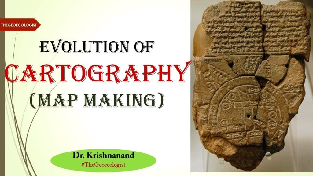
The earliest known maps date back to around 2300 BCE in Mesopotamia. These early maps were often engraved on clay tablets and depicted local areas or important landmarks. The Babylonians created a clay tablet known as the "Babylonian World Map," which shows a simplified, stylized version of the known world at the time, centered around Babylon. This map was not designed for precise navigation but rather to reflect the symbolic and mythical understanding of geography.
In ancient Egypt, maps were used for practical purposes such as land division, especially for irrigation and the measurement of fields after the annual flooding of the Nile River. The Egyptians also created the "Ptolemaic maps" during the Hellenistic period, which aimed to provide a more accurate understanding of the world’s geography.
(II)Greek and Roman Contributions
The Greeks are often credited with laying the foundations for modern cartography. One of the most significant Greek contributions was the work of Ptolemy, a 2nd-century astronomer and geographer. His work, Geographia, compiled knowledge of the world’s geography and introduced the concept of latitude and longitude. Ptolemy’s maps were based on a grid system that helped improve the accuracy of future mapmaking. Although Ptolemy’s maps were often inaccurate by modern standards, they had a profound influence on European and Islamic cartography for centuries.
The Romans also contributed to cartography by creating road maps for military and administrative purposes. These maps helped the Romans maintain control over their vast empire, ensuring that soldiers and merchants could travel efficiently across the empire’s extensive road network.
(III)The Middle Ages and Islamic Golden Age
During the Middle Ages, mapmaking in Europe slowed down, as many classical texts were lost or inaccessible due to political instability and religious restrictions. However, cartography flourished in the Islamic world during the Islamic Golden Age (8th to 14th centuries). Islamic scholars, such as Al-Idrisi, created detailed maps based on their own explorations and the works of earlier Greek and Roman geographers. Al-Idrisi’s Tabula Rogeriana (1154) was one of the most advanced world maps of its time, offering a more accurate representation of the known world, especially Africa, Europe, and Asia.
Islamic maps often used a system of orientation based on the direction of Mecca, with north placed at the bottom of the map. This was a departure from the tradition of placing north at the top, which would later become standard in European cartography.
(IV)The Age of Exploration
The 15th and 16th centuries marked the Age of Exploration, a period of intense European expansion across the globe. This era brought significant advancements in cartography, as explorers sought to map new territories. The most famous cartographers of this period were Gerardus Mercator and Martin Waldseemüller.
Mercator, a Flemish cartographer, introduced the Mercator projection in 1569, a revolutionary method for representing the curved surface of the Earth on a flat map. This projection became a standard for navigational maps because it preserved angles and allowed for easier navigation, especially for sailors. However, it distorted the size of landmasses near the poles, making regions like Greenland appear much larger than they actually are.
In 1507, Waldseemüller produced the first map to use the name "America" for the newly discovered continents. This map, known as the Universalis Cosmographia, was a landmark in the recognition of the New World.
(V)The Modern Era
As the centuries progressed, cartography became increasingly accurate, aided by technological advancements such as the invention of the printing press, the development of telescopes, and, later, the advent of satellites and computers. In the 19th and 20th centuries, the development of topographic mapping allowed for detailed representations of landforms, providing essential tools for military, scientific, and civil purposes.
The invention of photography and aerial surveys also revolutionized cartography. The use of aerial photographs and, later, satellite imagery allowed for precise maps that captured minute details about the Earth's surface. The most notable modern technological advance in cartography is the creation of Geographic Information Systems (GIS), which enable the storage, analysis, and display of vast amounts of geographical data. GIS has become an indispensable tool in urban planning, environmental management, and disaster response.
(IV)Digital Mapping and the Future
The rise of the internet has led to the widespread use of digital maps. Platforms like Google Maps and OpenStreetMap have made mapping more accessible and dynamic than ever before. These digital maps are constantly updated in real-time, enabling users to access the most current geographical information, including traffic data, satellite imagery, and street views.
In the future, cartography will continue to evolve with advancements in artificial intelligence, virtual reality, and real-time data collection. These technologies will allow for even more precise and interactive maps, helping people navigate and understand the world in new and exciting ways.
IN THE END
The history of cartography is a story of human curiosity, exploration, and innovation. From the rudimentary maps of ancient civilizations to the sophisticated digital maps of today, mapmaking has shaped our understanding of the world. As technology continues to advance, cartography will remain a vital tool for navigating both our physical and virtual landscapes.
About the Creator
Badhan Sen
Myself Badhan, I am a professional writer.I like to share some stories with my friends.
Keep reading
More stories from Badhan Sen and writers in Fiction and other communities.
Earth in mythology (Gaia, Terra)
One of the most prominent representations of Earth in mythology are Gaia from Greek mythology and Terra from Roman mythology. Both of these figures play central roles in their respective mythologies, and their stories explore the interconnectedness between Earth, nature, and humanity.
By Badhan Sen12 months ago in Fiction
🅼🅸🅳🅽🅸🅶🅷🆃 🆂🅽🅰🅲🅺🆂
"It's 10 in Tuscon! We all know what that means... It's Time for Midnight Snacks with your man, Gerald Gee! Ready to spend the night together? Me too! I'm full of snacks and can't wait to regurgitate them all back into your hungry ears. Crack a brew! Pop some corn! Anything to get ready for one hell of a show where the talk maybe cheap but the words cut deep...
By Lamar Wiggins6 days ago in Fiction


Comments (3)
HARE SUNDOR KRISHNA LOVE YOU GORGIOUS RPOVU😘😘😘😘😘😘😘😘😘😘😘😘😘😘😘😘😘😘😘😘😘😘😘😘😘😘😘😘😘😘😘😘😘😘😘😘😘😘😘😘😘😘😘😘😘😘😘😘😘😘😘😘😘😘😘😘😘😘😘😘😘😘😘😘😘😘😘😘😘😘😘😘😘😘😘😘😘😘😘😘😘😘😘😘😘😘😘😘😘😘😘
Mapmaking is a great skill to have and those old maps are like art masterpieces to me.
Civilization