
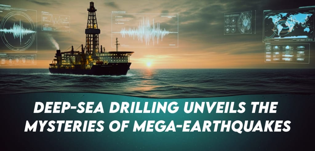
Deep-Sea Drilling Unveils the Mysteries of Mega-Earthquakes
How Cutting-Edge Expeditions into Subduction Zones Are Redefining Tsunami Prediction and Global Seismic Resilience3.5s

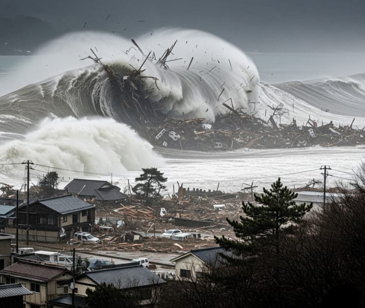
In the depths of our oceans, where massive tectonic plates collide, Earth hides some of its most destructive secrets. These collisions can unleash mega-earthquakes and tsunamis that devastate coastlines and change lives forever. One tragic reminder came in 2011, when a magnitude 9.0 earthquake struck Japan’s Tōhoku region, triggering a massive tsunami that claimed over 18,000 lives.
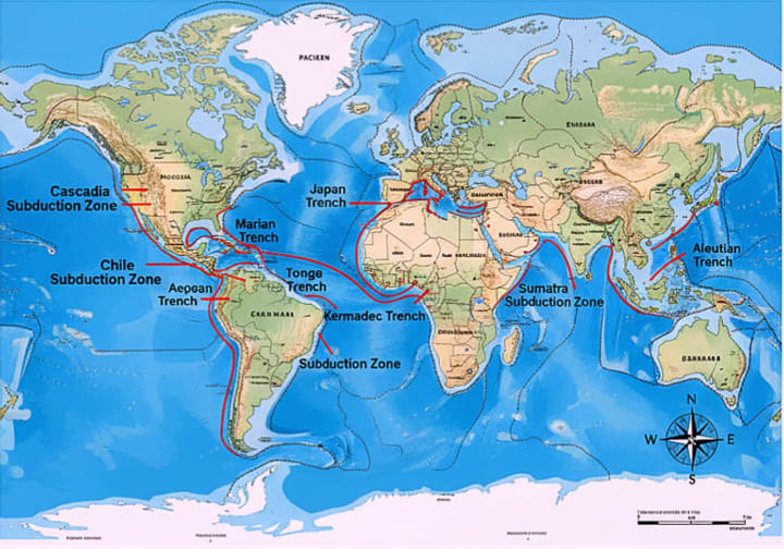
Events like this highlight why scientists are racing to understand these natural disasters. Their mission? To dig deep into the seafloor, collect clues directly from fault zones, and uncover how these giant earthquakes and tsunamis are born. This work is led by global teams under the International Ocean Discovery Program (IODP) an ambitious effort blending advanced technology with geological detective work.
Digging Into the Japan Trench - The JFAST Project
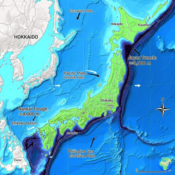
After the Tōhoku earthquake, scientists launched the Japan Trench Fast Drilling Project (JFAST). Using the Japanese research ship Chikyu the largest of its kind they drilled 850 meters below the seafloor in waters nearly 7 kilometers deep. What they found was surprising: the fault that ruptured in 2011 was extremely thin less than 5 meters wide and filled with slippery clay. This weak material allowed the earthquake rupture to travel quickly and reach the shallow seafloor, amplifying the tsunami’s power.
Temperature sensors also revealed heat from friction during the quake, showing just how easily this fault slipped. These discoveries challenged old models of how subduction zones work, proving that “weak spots” in the Earth can produce massive, shallow ruptures.
Exploring Another Danger Zone - The Nankai Trough
Building on JFAST, researchers turned their attention to the Nankai Trough off Japan’s Kii Peninsula, another high-risk earthquake zone. Here, the Philippine Sea Plate pushes beneath Japan at about 4 centimeters per year.
Through the NanTroSEIZE project, scientists drilled thousands of meters into the Earth, recovered sediment samples, and installed long-term observatories. These observatories are connected to undersea cables, providing real-time data on strain, fluid pressure, and seismic activity.
Their results were eye-opening. Even shallow sediments, less than 500 meters deep, showed signs of past high-speed ruptures contradicting the belief that water-rich layers should prevent big slips. And in 2022, drilling deeper into the fault revealed something puzzling: tectonic stress was surprisingly low, as if the fault had recently released its energy. This raised new questions about how stress builds and releases in subduction zones.
A New Frontier - JTRACK 2025
The latest chapter in this story came in 2025 with IODP Expedition 405 (JTRACK). Once again aboard Chikyu, scientists drilled more than 800 meters beneath the Japan Trench. The recovered sediments told a dramatic story. Layers of clay minerals like smectite showed just how slippery the fault is perfect conditions for giant ruptures like the one in 2011. Geological “time capsules” in the sediments recorded traces of past earthquakes and tsunamis. Sensors picked up heat signals left behind by fault movement, and fluid flow studies revealed how water in fractures may determine whether a fault creeps slowly or snaps violently.
One researcher compared the mission to a NASA space expedition because drilling so deep beneath the ocean is just as technically challenging as exploring another planet.
Why It Matters
These groundbreaking projects are more than scientific triumphs they are lifelines for humanity. By directly sampling fault zones, scientists are learning why some earthquakes unleash deadly tsunamis, while others don’t. The data feeds into models that can improve hazard assessments in other vulnerable areas, like Cascadia in the U.S. or Chile in South America. Real-time observatories installed in the seafloor may one day detect warning signs before a mega-quake strikes. As scientist Harold Tobin put it, “With more direct observations like this, we can start to recognize when something anomalous is occurring.”
By peering into Earth’s hidden fault lines, researchers are transforming deep-sea mysteries into life-saving knowledge. Their work may not stop earthquakes or tsunamis but it can help us prepare, adapt, and protect lives when nature’s fury strikes again.
About the Creator
Muzamil khan
🔬✨ I simplify science & tech, turning complex ideas into engaging reads. 📚 Sometimes, I weave short stories that spark curiosity & imagination. 🚀💡 Facts meet creativity here!
Keep reading
More stories from Muzamil khan and writers in Education and other communities.
Ocean Acidification: A Corrosive Threat to Shark Teeth
When Oceans Turn Sour: Why Sharks’ Teeth Are at Risk Imagine biting into your favorite meal, only to find your teeth crumbling with every chew. For sharks, the ocean’s most iconic predators, this nightmare might soon become reality. A new study reveals that ocean acidification caused by rising carbon dioxide (CO₂) emissions is eating away at sharks’ teeth, threatening their ability to hunt and survive.
By Muzamil khan5 months ago in Education
Why Great Customer Service Is Non-Negotiable for Modern Businesses
Excellent customer service is no longer something businesses can choose to offer later. It is a basic requirement in today’s fast-moving market. Customers expect respect, clear communication, and fast solutions. When they do not get these things, they leave. This is why excellent customer service is non-negotiable for businesses that want to survive and grow.
By Apex Service Partners6 days ago in Education
The Devil's Cut
“Comrade, finally you’re awake.” The voice was smooth, sensual. A flickering incandescent bar was all that lit the white, sterile room. All Vladimir remembered was everything going black. He tried to move his arms and found them strapped to the gurney.
By Matthew J. Fromm4 days ago in Fiction


Comments
There are no comments for this story
Be the first to respond and start the conversation.