
“Train of Two Storms” Signals a Major Shift in Bay Area Weather
Foggy Mornings, Clear Super Bowl Evening — Then Rain Returns in Force

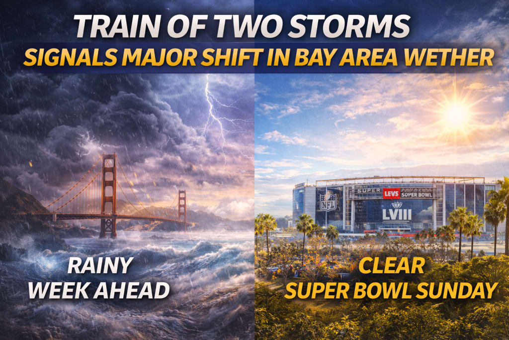
After weeks of relatively dry and stable conditions, the Bay Area is preparing for a noticeable change in weather. Meteorologists are tracking what they describe as a “train of two storms,” a back-to-back weather pattern that could reshape the region’s forecast over the coming days.
While residents and visitors can expect improving skies just in time for Super Bowl 60 in Santa Clara, the calm will be short-lived. Rain, cooler temperatures, and cloudier conditions are set to return, marking one of the most significant weather shifts the region has seen in weeks.
Thick Morning Fog Blankets the Bay Area
Sunday morning began with an unusually dense layer of fog spreading rapidly across the Bay Area. Visibility dropped sharply in some locations, falling to a quarter mile or less, particularly in low-lying areas and along major roadways.
According to Sebastian Westerink, a meteorologist with the National Weather Service’s Bay Area office, onshore winds pushed moist air inland, allowing fog to develop quickly and travel far from the coastline.
“This was a pretty classic marine layer event,” Westerink explained. “Onshore winds moved that fog inland very efficiently during the early morning hours.”
While the fog created challenging driving conditions, forecasters were confident it would not last long.
Clear Skies Expected Just in Time for Super Bowl 60
Despite the gloomy start to the day, the weather forecast brought good news for football fans and outdoor plans. Westerink said the fog was expected to clear dramatically within a few hours, with only some lingering haze near the coastline.
By the time Super Bowl 60 kicks off at Levi’s Stadium in Santa Clara, conditions should be mostly favorable. Skies are expected to turn partly cloudy, with temperatures ranging from the upper 50s to low-to-mid 60s—comfortable for this time of year.
“It’ll be a pretty nice evening, all things considered,” Westerink said. “Much better than what the morning looked like.”
For many, this brief stretch of pleasant weather will feel like a calm pause before winter reasserts itself.
Rain Begins to Return Sunday Night in the North Bay
While much of the Bay Area will stay dry through Sunday evening, rain chances will begin increasing in the North Bay later in the night. These early showers mark the beginning of a broader shift toward wetter conditions.
However, widespread rainfall is not expected to arrive until Tuesday morning, when atmospheric conditions align to deliver a more organized storm system across the region.
Jet Stream Pulls Cold Air from the Gulf of Alaska
The main driver behind the upcoming storms is a jet stream dip pulling colder air southward from the Gulf of Alaska. This shift allows storm systems to move directly into Northern California, bringing sustained rainfall rather than brief showers.
“This will feel very different from the past few weeks,” Westerink noted. “It’ll be cooler, cloudier, and more in line with what people expect from winter weather.”
Most Bay Area communities can expect at least a quarter to half an inch of rain, while higher elevation areas—such as Mount Tamalpais and the coastal slopes of the Santa Cruz Mountains—could see over an inch of rainfall.
A Soaking Rain, Not Just Passing Showers
Meteorologists emphasize that this will be a steady, soaking rain, which is particularly beneficial for soil moisture and water reserves.
“It’s not just a quick hit,” Westerink said. “This is the kind of rain that really soaks into the ground.”
This type of rainfall is especially valuable after a stretch of dry weather, helping replenish groundwater and reduce the risk of returning drought conditions.
A Brief Midweek Break Before Storm Number Two
The first storm system is expected to weaken by Wednesday, transitioning into scattered, spotty showers through the evening. By Thursday, conditions should improve noticeably, with clearer skies and drier weather returning temporarily.
However, the break will be short-lived.
Clouds are forecast to build again by Saturday, setting the stage for a second, potentially heavier storm that will arrive soon after the first.
The “Train of Two Storms” Explained
Forecasters describe the upcoming pattern as a “train of two storms” because the systems will arrive so close together that many people may not even notice the separation.
“We don’t have full confidence on the exact timing yet,” Westerink said, “but early Sunday morning is what the models are suggesting for the second storm.”
Rather than a clean break between systems, residents should expect intermittent rainfall, with brief lulls followed by renewed showers.
How Much Rain Could Fall Overall?
While precise totals are still uncertain, early estimates suggest more than half an inch of rain could fall across much of the Bay Area once both systems pass through. Elevated and coastal regions could see even higher totals.
Forecasters will refine these numbers as the storms approach, and residents are encouraged to stay updated through official weather channels.
Why This Weather Pattern Matters
Although California was officially lifted from drought conditions just weeks ago, meteorologists caution that dry weather can quickly reverse those gains.
“This is exactly what we want to see,” Westerink said. “If we had continued with abnormally dry conditions, drought concerns could have returned faster than expected.”
The upcoming storms highlight how fragile water security can be—and how important consistent winter rainfall remains for the state.
Stay Alert as Conditions Change
As the Bay Area transitions from foggy mornings to rain-filled days, residents should prepare for cooler temperatures, wet roads, and changing travel conditions.
Weather officials advise checking updates from the National Weather Service regularly, especially as storm timing and rainfall totals become clearer.
Conclusion: A Clear Game Day, Then a Wet Week Ahead
The Bay Area is getting the best of both worlds—clear skies for Super Bowl 60, followed by a much-needed return to winter rain. The approaching “train of two storms” signals a meaningful shift in the region’s weather pattern, bringing cooler temperatures and widespread rainfall after weeks of relative calm.
While the fog and rain may be inconvenient, the storms play a critical role in supporting California’s long-term water supply. For now, residents can enjoy a pleasant Sunday evening—then prepare for winter to roll back in, right on schedule.
About the Creator
Adil Ali Khan
I’m a passionate writer who loves exploring trending news topics, sharing insights, and keeping readers updated on what’s happening around the world.
Keep reading
More stories from Adil Ali Khan and writers in Earth and other communities.
Storm Leonardo Triggers Mass Evacuations Across Spain and Portugal
Storm Leonardo has unleashed severe weather across parts of Spain and Portugal, forcing authorities to evacuate more than 11,000 residents as flooding, powerful winds, and widespread disruption threaten public safety. Emergency services in both countries remain on high alert, warning that risks persist even as conditions show signs of gradual improvement.
By Adil Ali Khana day ago in Earth
Greenland's ice loss is being silently accelerated by airborne dust.
The warmer air isn't the only reason why Greenland's ice is melting. By feeding dark algae blooms that absorb sunlight and accelerate ice loss, tiny particles carried by the wind can subtly alter surface conditions.
By Francis Dami5 days ago in Earth
Greenland Declares State of Emergency as Scientists Link the Growing Presence of Orcas to Accelerating Ice Melt
In a landmark decision that reflects the intensifying impacts of climate change, the government of Greenland has officially declared a state of environmental emergency—a rare and solemn move that underscores the accelerating transformation of Arctic ecosystems. The catalyst for this declaration? An unusual and growing presence of orcas—also known as killer whales—in waters once locked in sea ice, a phenomenon scientists say reveals the alarming scale of ice melt in the region.
By Sadaqat Alia day ago in Earth
The Piggy Project
I’ve had so many names in this life I lose track of which ones were ever really mine and which ones I wore because someone needed me to. Some were handed to me before I had words to refuse them, before I knew what they meant, before I knew I could say no. Most weren’t meant to hurt. That doesn’t mean they didn’t leave marks. Marks that told me who I belong to, who I am by way of who claims me, recognizes me in the good and bad, who walks beside me.
By Fatal Serendipity7 days ago in Confessions


Comments
There are no comments for this story
Be the first to respond and start the conversation.