
The "Baby Nor'easter": A Manageable Winter Storm Disrupts the East
fast-moving winter system delivers widespread, moderate snow from the Plains to the I-95 corridor, triggering travel advisories but missing historic benchmarks

Introduction
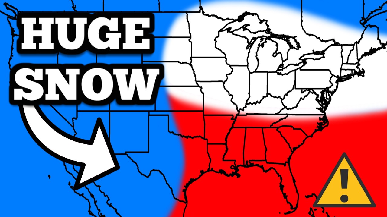
A compact winter storm,informally dubbed a "baby Nor'easter," is tracking across the central and eastern United States. This system is producing a broad swath of light to moderate snowfall, affecting regions from the northern Plains through the Ohio Valley and into the densely populated Interstate-95 corridor in the Northeast. Major cities from Washington D.C. to Boston are anticipating accumulations generally between 1 to 6 inches through Sunday. The storm is causing standard winter travel issues but lacks the intensity or duration to qualify as a major blizzard or historic event.
Storm Origins and Path
The storm developed as a low-pressure system in the central Plains,drawing in moisture from the Gulf of Mexico and cold air from Canada. It is following a classic track for winter weather, moving northeastward. Its progression is relatively swift, which limits the duration of snowfall in any single location. This fast movement is a key reason total accumulations are expected to remain in the manageable range, preventing the prolonged, heavy bands of snow that define larger Nor'easter events.
Expected Snowfall Totals and Timeline
Snowfall began in the northern Plains and Midwest on Friday into Saturday.The system then intensified somewhat as it moved into the Ohio Valley and Appalachians overnight Saturday. For the I-95 cities, the main window for snow is from late Saturday night through Sunday afternoon. Current forecasts project a gradient of accumulation: cities like Washington D.C. and Baltimore may see 1-3 inches, Philadelphia and New York City in the 3-5 inch range, and Boston and southern New England potentially receiving 4-6 inches. Higher amounts are likely in inland and elevated areas away from the coast.
Impact on Travel and Transportation
The primary impact of this storm is on travel.Road conditions deteriorated first in the Midwest, with slick highways reported. As the snow moves east, state transportation departments in the Mid-Atlantic and Northeast have activated salt and plow crews. Air travel is experiencing disruptions; airlines have issued weather waivers for airports in the storm's path, allowing passengers to rebook without fees. Travelers should expect flight delays and cancellations, particularly on Sunday. Public transit systems in major cities may run on reduced schedules or experience delays.
Why It's a "Baby" Nor'easter
Meteorologists and weather enthusiasts use the"baby" term to distinguish this event from larger, more powerful coastal storms. A true, full-fledged Nor'easter is a strong area of low pressure that rotates off the Atlantic coast, often tapping into deep ocean moisture and producing winds strong enough to cause blizzard conditions, coastal flooding, and major urban disruption. This current storm lacks that robust coastal development and intense wind field, resulting in more modest snow rates and lesser impacts.
Preparations and Public Response
Local governments have issued standard winter weather advisories and,in some areas, winter storm warnings. Residents are advised to prepare for slippery roads and reduced visibility during the height of the snow. Standard preparations are recommended: ensuring vehicles have windshield scrapers, having necessary supplies at home, and allowing extra time for travel. The response is measured, reflecting the storm's forecasted middle-of-the-road intensity rather than the emergency mobilization seen for forecasted foot-plus snowfalls.
Comparison to Historic Storms
This event does not approach the scale of historic Northeast blizzards.Storms like the Blizzard of 2016 ("Snowzilla"), the January 2016 storm, or the 1978 blizzard dropped multiple feet of snow, crippled cities for days, and involved much lower pressures and stronger winds. The "baby Nor'easter" is a routine winter weather event for the region, notable more for its wide geographic reach than for exceptional intensity in any single location.
The Role of Coastal Temperatures
A factor limiting snowfall totals right along the I-95 corridor is the proximity to the Atlantic Ocean.Coastal and urban areas often experience marginally warmer temperatures due to the urban heat island effect and ocean influence. This can cause snow to mix with or change to rain, especially at the onset of the event, reducing final accumulation. This dynamic is part of why forecast maps often show lower totals for cities like New York and Boston compared to their immediate western suburbs.
Rural and Inland Impacts
Areas west of the I-95 corridor will see higher and more consistent snow totals.Communities in the Poconos, the Catskills, interior Pennsylvania, and upstate New York are likely to receive 6-10 inches from this system. These regions will experience a longer period of steady snow and colder temperatures throughout the event, leading to greater accumulations and more significant travel difficulties on secondary roads.
After the Snow: Clearing and Melting
Given the modest snow totals,cleanup operations in major metropolitan areas are expected to be straightforward. Plowing and salting will continue through Sunday. A key factor will be overnight temperatures following the storm. If temperatures drop below freezing, melted snow will refreeze into black ice on roads and sidewalks Monday morning. However, a forecasted moderating trend early next week should facilitate melting without major lingering issues.
Conclusion
The"baby Nor'easter" is a textbook example of a widespread, moderate-impact winter storm. It serves as a disruptive reminder of the season, requiring standard precautions and altering travel plans across a large portion of the country. However, its swift pace and limited intensity will spare the Northeast the deep, paralyzing snowfalls that define historic winters. The event highlights the routine challenge of winter weather management for cities and transportation networks, concluding as a notable but not exceptional chapter in the seasonal weather pattern.
About the Creator
Saad
I’m Saad. I’m a passionate writer who loves exploring trending news topics, sharing insights, and keeping readers updated on what’s happening around the world.
Chinese Planetary Engineering: The Great Green Wall and the Reclamation of Climate
There are junctures in history where a civilization no longer chooses between comfort and progress, but between adaptation and extinction. At the dawn of the new millennium, China hit one of those silent thresholds where geography ceases to be a backdrop and becomes an adversary. The desert was advancing, not as a metaphor for decay, but as a physical, methodical, and relentless force. Sand was devouring the horizon, winds grew heavy with dust, and the soil lost its fertile memory, taking with it the promise of social stability.
By Laurenceau Porte4 days ago in Earth
US Warns Airlines About Military Activity in Parts of Latin America
Commercial aviation is built on predictability—clearly defined airspace, coordinated air traffic control, and shared international rules. When that predictability is disrupted, even subtly, the ripple effects can stretch far beyond the cockpit. That is exactly why a recent warning from the United States has caught the attention of airlines, governments, and travelers alike. In early 2026, US aviation authorities issued an advisory warning airlines about military activity in parts of Latin America, urging pilots to exercise heightened caution when flying over certain regions. While no immediate restrictions or flight bans were imposed, the message itself was clear: something in the skies has changed, and the risks—however limited—can no longer be ignored. This development is not just about aviation safety. It reflects a growing intersection between geopolitics, military operations, and civilian infrastructure in a region that has long balanced cooperation with tension. What Exactly Did the US Warn About? The advisory, released through official aviation safety channels, highlighted concerns over potential military activity affecting airspace across parts of Mexico, Central America, South America, and nearby oceanic regions. Airlines were advised to remain vigilant during all phases of flight, including cruising at high altitudes, takeoff, and landing. Unlike routine notices related to weather systems or airport congestion, this warning explicitly referenced security-related risks. These include the possibility of unexpected military movements, temporary airspace disruptions, and interference with navigation systems that modern aircraft rely on for safe operations. Importantly, the warning did not accuse any specific country of wrongdoing, nor did it suggest an immediate danger to passengers. Instead, it served as a precaution—one designed to ensure airlines adjust flight planning, monitoring, and communication protocols accordingly. Why Military Activity Matters to Civil Aviation To the average traveler, military exercises or operations may seem distant from the experience of flying on a commercial jet. In reality, the two worlds often share the same skies. Civilian aircraft depend heavily on satellite navigation, coordinated air traffic control, and stable airspace rules. Military operations—especially those involving fast-moving aircraft, surveillance systems, or electronic equipment—can introduce uncertainty into that environment. Some of the key risks aviation authorities monitor include: Unplanned military aircraft movements that may not follow civilian flight patterns Temporary airspace closures or restrictions that require last-minute rerouting Navigation signal disruptions, whether accidental or intentional Increased congestion in strategic corridors used by both civilian and military flights While these risks are typically managed through coordination and communication, heightened military activity raises the stakes. The FAA’s advisory suggests that such activity has reached a level where additional caution is warranted. The Geopolitical Context Behind the Warning The timing of the advisory is not accidental. Latin America has seen a noticeable rise in security operations and military coordination involving the United States over the past year. These efforts are largely focused on counter-narcotics missions, maritime security, and regional stability, particularly in areas with strategic shipping routes or ongoing political tension. At the same time, broader global dynamics—ranging from great-power competition to shifting alliances—have increased the strategic importance of air and sea routes across the Western Hemisphere. From Washington’s perspective, issuing an aviation warning is not about alarmism. It is about acknowledging that military and security activities in the region may temporarily affect civilian systems, including aviation. How Airlines Are Responding For airlines, advisories like this are not unusual—but they are taken seriously. Most major carriers already operate with layered safety systems that allow them to respond quickly to changing conditions. In practical terms, this warning may lead to: Slight route adjustments to avoid specific airspace Enhanced pilot briefings before flights Increased coordination with air traffic controllers Closer monitoring of navigation and communication systems So far, there have been no widespread flight cancellations or suspensions linked directly to the warning. That suggests airlines view the risk as manageable, provided proper precautions are followed. Reactions from Latin American Governments Some governments in the region have been quick to reassure the public. Officials have emphasized that their national airspace remains safe and fully operational, and that civilian flights continue without disruption. This response highlights an important tension: while the US warning is precautionary, it can still affect public perception. Tourism, business travel, and investor confidence are all sensitive to suggestions of instability—even when no immediate danger exists. As a result, many countries are walking a careful line between cooperating on aviation safety and defending their reputation for stability. What This Means for Passengers For travelers, the key takeaway is simple: commercial aviation remains safe. Warnings like this are designed to prevent incidents, not predict them. Passengers flying through or over affected regions may experience slightly longer flight times or minor schedule adjustments, but there is no indication of increased danger to civilian aircraft. In fact, the existence of such advisories demonstrates how seriously aviation authorities take even low-probability risks. A Sign of a More Complex World The US warning to airlines is a reminder that modern air travel does not exist in a vacuum. As military operations, security concerns, and geopolitical rivalries evolve, civilian systems—from shipping lanes to flight paths—are increasingly affected. This moment underscores a broader reality: the skies are becoming more crowded, more contested, and more interconnected with global politics. Managing that complexity will require continued transparency, cooperation, and vigilance from governments, regulators, and airlines alike. For now, planes continue to fly, passengers continue to travel, and the system continues to work. But behind the scenes, aviation authorities are quietly adjusting to a world where safety is shaped not just by weather and mechanics—but by geopolitics as well.
By Muhammad Hassanabout 14 hours ago in Earth


Comments
There are no comments for this story
Be the first to respond and start the conversation.