
Mount rainier's volcanic activity cosely wached by
Activity cosely wached by
Mount Rainier's Volcanic Activity Closely Watched by Scientists
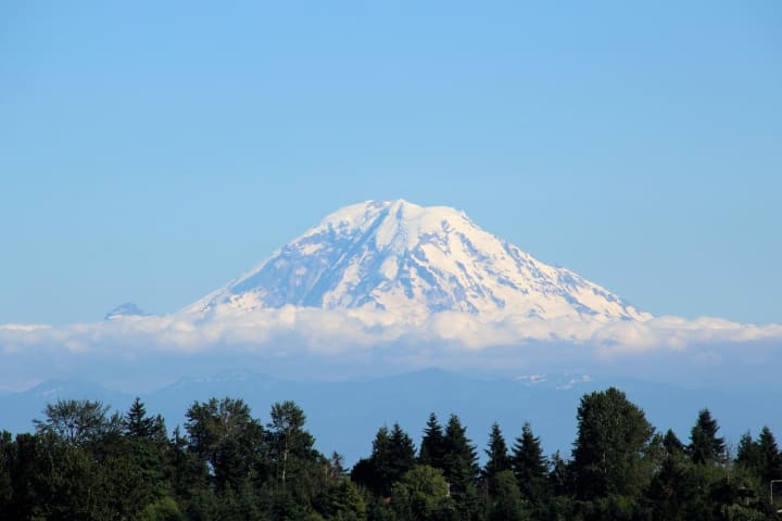
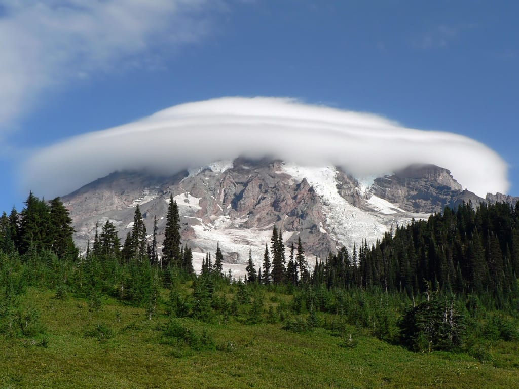
Mount Rainier, an iconic symbol of Washington State, towers at 14,411 feet above sea level. Its majestic snow-capped peak is a defining feature of the Seattle skyline and a beloved destination for hikers and climbers. Yet beneath its picturesque exterior lies a sleeping giant: Mount Rainier is an active stratovolcano, and its potential for future eruptions and associated hazards keeps scientists watching it closely.
A Volcano with a History
Mount Rainier, part of the Cascade Volcanic Arc, was formed by a series of volcanic eruptions over the past half-million years. While it has not erupted since the mid-1800s, it remains classified as an active volcano. Geological evidence shows that Mount Rainier has experienced major eruptions every 500 to 1,000 years on average, and smaller events occur more frequently.
Not only does Mount Rainier have the potential to erupt, but it also poses a number of threats that are especially concerning. Unlike volcanoes that primarily threaten nearby areas with lava flows, Rainier’s most significant dangers are lahars—fast-moving volcanic mudflows that can sweep down river valleys, obliterating everything in their path. Past lahars from Rainier have traveled all the way to the Puget Sound lowlands, reaching areas that today are home to tens of thousands of people.
Why Scientists Are on High Alert
The U.S. Geological Survey (USGS) and the Pacific Northwest Seismic Network (PNSN) maintain a close watch on Mount Rainier’s activity. Using an array of seismic sensors, GPS stations, gas-monitoring equipment, and visual observations, scientists continually monitor the volcano for any signs of unrest.
One reason for this heightened vigilance is Mount Rainier's proximity to highly populated areas. Cities like Tacoma, Puyallup, and Orting sit within historical lahar paths. A sudden eruption—or even a landslide not triggered by an eruption—could produce catastrophic lahars with little warning.
Additionally, Mount Rainier's extensive glacial coverage presents unique risks. It holds more glacial ice than all other Cascade volcanoes combined. An eruption or major rockfall could rapidly melt this ice, sending torrents of water and debris racing down river valleys at highway speeds. The combination of volcanic heat, glacial ice, and steep topography creates a "perfect storm" scenario for disaster.
Monitoring Techniques
Today’s volcano monitoring is a high-tech endeavor. Seismic sensors around Mount Rainier detect tiny earthquakes that often precede volcanic activity. Swarms of small quakes can signal that magma is moving beneath the surface. Similarly, GPS devices can measure even minute ground deformation, indicating that the mountain is swelling with magma.
Gas emissions are another important indicator. Scientists measure gases like carbon dioxide and sulfur dioxide that can escape from the volcano as magma nears the surface. Any unusual increases might signal that an eruption is imminent.
In addition to ground-based sensors, satellite technology plays a critical role. Satellites equipped with radar and infrared imaging can detect ground changes, temperature increases, and gas emissions from space.
Moreover, Mount Rainier is part of the USGS's Cascade Volcano Observatory (CVO) monitoring program. The CVO provides real-time updates, hazard assessments, and scientific research focused on the volcanoes of the Pacific Northwest.
Community Preparedness and Response
Given the risks, local, state, and federal agencies have developed comprehensive emergency plans for Mount Rainier-related hazards. The lahar warning system, for example, is one of the most advanced in the world. It includes a network of sensors placed along rivers that would likely be impacted by a lahar. If a lahar is detected, automated sirens would alert communities downstream, giving residents precious minutes to evacuate to higher ground.
Public education is also a key component of preparedness. Schools in lahar-prone areas regularly conduct drills, and evacuation routes are clearly marked. In places like Orting, located directly in a high-risk zone, evacuation on foot to higher ground is emphasized, as roads could quickly become impassable during an event.
Despite these preparations, scientists stress that the public must not become complacent. Because Mount Rainier has not erupted in living memory, there is a tendency for people to underestimate the risk. Officials urge continued awareness and preparedness for a geologically inevitable event that is not imminent. Recent Observations
In recent years, Mount Rainier has shown low but consistent seismic activity. Occasional small earthquake swarms have occurred beneath the volcano, but these have so far been interpreted as normal "background" activity. Scientists caution that the absence of dramatic changes does not mean the threat is gone—it simply underscores the volcano’s unpredictable nature.
Climate change adds a new wrinkle to monitoring efforts. As glaciers on Mount Rainier retreat due to warming temperatures, the mountain’s structural integrity could be affected, potentially leading to increased rockfalls and landslides even without volcanic activity. These non-eruptive hazards still pose serious risks to surrounding communities.
A Balancing Act of Awe and Caution
Mount Rainier continues to captivate with its beauty and grandeur. Thousands of visitors explore its forests, meadows, and glaciers each year, often unaware of the sleeping giant beneath their feet. For scientists, however, Mount Rainier is more than just a stunning landscape—it is a complex, dynamic system that demands constant attention.
By monitoring its activity, conducting research, and educating the public, scientists hope to reduce the risk that a future eruption or lahar would catch people unprepared. As technology advances, our ability to forecast volcanic events improves, but the ultimate challenge remains: respecting the power of nature while living safely in its shadow.
Mount Rainier may be quiet for now, but its story is far from over. Mount Rainier will continue to be one of the United States' most closely watched volcanoes, making vigilance essential for those who live in its vicinity. Why Scientists Remain on Alert
The U.S. Geological Survey (USGS) and the Pacific Northwest Seismic Network (PNSN) are at the forefront of monitoring Mount Rainier. With a network of seismic stations, GPS receivers, gas sensors, and satellite imagery, scientists look for the slightest signs of volcanic unrest.
Rainier necessitates such vigilance for a number of reasons: Proximity to Populations: About 80,000 people live directly in areas mapped as lahar hazard zones. Rainier poses a threat to suburban neighborhoods, schools, and vital infrastructure, in contrast to more isolated volcanoes. Glacial Cover: Rainier's glaciers, the largest single-peak glacier system in the lower 48 states, add significant risk. Without an eruption, landslides caused by earthquakes or melting caused by volcanic heat could cause devastating floods. Structural Instability: The volcanic rock that forms Rainier is relatively weak and hydrothermally altered (chemically weakened by heat and water over time), making large landslides possible even without magma movement.
Because of these compounding threats, the USGS classifies Mount Rainier as a "Decade Volcano" — one of only 16 volcanoes worldwide selected for intensive study because of their potential for large, catastrophic eruptions near populated areas.
How Mount Rainier is watched over Modern volcano monitoring is a complex science blending seismology, geodesy, gas chemistry, and remote sensing.
Seismology: Earthquakes are a primary early warning sign. A sudden increase in the number, size, or depth of earthquakes beneath Rainier could indicate that magma is rising.
Ground Deformation: GPS and tiltmeters measure changes in the volcano’s shape. A sign that magma is pressurizing underground chambers could be inflation or bulging. Gas Emissions: Fumaroles (gas vents) near the summit release gases like sulfur dioxide. Increasing emissions often accompany magma movement.
Satellite Imagery: Space-based radar systems like InSAR can detect minute changes in ground elevation over time, while thermal imaging can spot hot spots invisible to the naked eye.
Researchers also conduct fieldwork to examine the volcano's structure, past eruptions, and glacial systems in addition to technological monitoring. Warning Systems and Community Preparedness
Recognizing the unique danger posed by lahars, the Mount Rainier Lahar Detection System was installed along the Puyallup and Carbon Rivers. It consists of arrays of sensors that can detect ground shaking and changes associated with lahars. The system can automatically send alerts to emergency management organizations and set off sirens when triggered. In high-risk towns like Orting, Washington, residents participate in regular evacuation drills. Local authorities have mapped out "safe zones" and designed pedestrian evacuation routes, since roads may be cut off quickly during a lahar event. In some communities, sirens and text messages would give people 30 to 45 minutes to flee, a short but crucial window. To avoid traffic jams, public education campaigns emphasize "walking, not driving" during an evacuation. Recent Activity and Ongoing Research
In recent years, Mount Rainier has not shown any signs of imminent eruption. Minor seismic swarms, on the other hand, occasionally occur, alerting both scientists and the general public to the volcano's subsurface activity. In 2009, a small earthquake swarm beneath the mountain prompted closer scrutiny but no surface changes. As part of the National Volcanic Early Warning System (NVEWS), a federal initiative to improve nationwide volcano surveillance, renewed efforts were made in 2019 to expand monitoring networks. Resear
About the Creator
Malted Wheat Flour Market Size and Forecast 2025
Malted Wheat Flour Market Overview Malted wheat flour is produced by germinating wheat grains, drying them, and grinding them into flour. This natural malting process activates enzymes—particularly amylase—that convert starch into fermentable sugars during baking. The result is improved dough fermentation, enhanced texture, increased loaf volume, and a richer, more consistent flavor profile in baked goods.
By Aaina Oberoi3 days ago in Earth
Neutraceutical Packaging Market Size and Forecast 2025–2033
Neutraceutical Packaging Market at a Glance The Neutraceutical Packaging Market is projected to expand from US$ 4.92 billion in 2024 to US$ 7.63 billion by 2033, growing at a CAGR of 4.99% from 2025 to 2033. This steady growth reflects the accelerating global demand for dietary supplements, functional foods, herbal products, and wellness beverages. Rising health awareness, aging populations, sustainability expectations, the rapid growth of e-commerce, and evolving regulatory frameworks are reshaping how nutraceutical products are packaged, protected, and presented.
By jaiklin Fanandish4 days ago in Earth
Wild Card Weekend Recap: What Happens Now?
I think I figured out why I love Wild Card Weekend so much. It's because it's the first playoff anything of the calendar year. The NFL season starts in the fall, and once upon a time, the champion was crowned either on or slightly before New Year's. The evolution of the NFL schedule has resulted in the playoffs starting just into the New Year, and currently, the final week of the season falls on the first weekend of the New Year, with Wild Card Weekend coming a week after that. So yes, chronologically, the NFL's Wild Card Weekend serves as the first playoff anything of the calendar year.
By Clyde E. Dawkins7 days ago in Unbalanced


Comments
There are no comments for this story
Be the first to respond and start the conversation.