
Met Office Names All the UK Areas Facing Snow This Weekend
Full list of regions expected to see snowfall on Saturday and Sunday as wintry conditions return
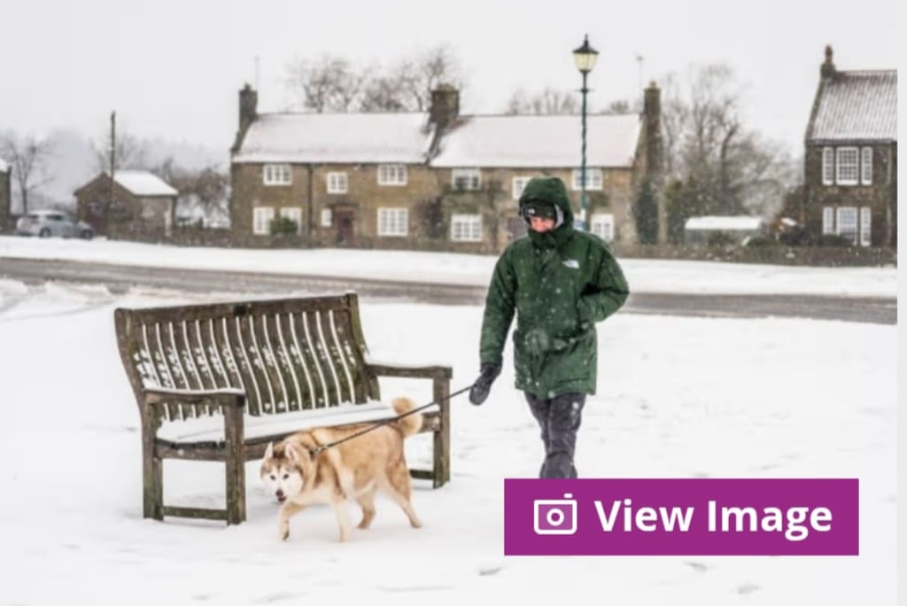
The Met Office has issued fresh forecasts warning that snow is set to affect large parts of the UK this weekend, with wintry conditions expected to develop from Saturday and persist into Sunday. As colder air moves south and meets bands of moisture, forecasters say a mix of snow, sleet, and freezing rain could disrupt travel and daily life across multiple regions.
While the exact depth and duration of snowfall will vary, the Met Office has now outlined the key areas most at risk, prompting local authorities and transport operators to prepare for potential disruption.
Why Snow Is Returning This Weekend
According to meteorologists, the UK is experiencing a shift in weather patterns as colder Arctic air pushes southwards. This colder air mass is colliding with milder, moisture-laden systems moving in from the Atlantic, creating ideal conditions for snowfall—particularly over higher ground, but also at lower elevations in some areas.
Night-time temperatures are expected to fall close to or below freezing in many regions, increasing the likelihood that precipitation will fall as snow rather than rain.
Areas Most Likely to See Snow on Saturday
Scotland
Scotland is expected to see the most widespread and persistent snowfall, especially:
The Highlands
Grampian region
Central Belt (including higher suburbs of Glasgow and Edinburgh)
Perthshire and surrounding upland areas
Snow showers could become heavy at times, with drifting possible over exposed routes.
Northern England
Several northern regions are forecast to experience snow, particularly over hills and moorland:
Cumbria (including the Lake District)
Northumberland
Durham uplands
Pennines across North Yorkshire and Lancashire
Lower-lying areas may initially see rain or sleet before turning to snow as temperatures drop.
Snow Risk Extends South on Sunday
By Sunday, colder air is expected to push further south, expanding the snow risk.
Midlands
Parts of the Midlands could see snowfall, especially overnight and early morning:
East Midlands
West Midlands (higher ground)
Staffordshire Moorlands
Derbyshire Peak District
While accumulations may be patchy, icy conditions could develop even where snowfall is light.
Wales
Wales is also on the Met Office’s snow watch list:
Snowdonia and higher ground in North Wales
Mid Wales uplands
Parts of South Wales Valleys
Coastal areas are more likely to see sleet or cold rain, but inland areas may wake up to snow on Sunday.
Southern England: Marginal but Not Ruled Out
Southern regions face a lower risk, but forecasters stress snow cannot be ruled out entirely.
Areas with a chance of wintry conditions include:
Chiltern Hills
Cotswolds
Parts of the South Downs
Higher areas of Kent and Surrey
In these regions, temperatures will be borderline, meaning snow may fall briefly before turning to rain.
Travel Disruption and Safety Warnings
The Met Office has advised motorists and commuters to prepare for:
Slippery roads
Reduced visibility during snow showers
Delays on rail and road networks
Icy pavements, especially overnight
Local councils are preparing gritting operations, particularly in areas forecast to see sub-zero temperatures.
Rail operators have warned that even light snowfall can lead to knock-on delays, especially during early-morning services.
How Much Snow Is Expected?
Forecasts suggest:
Upland areas could see several centimetres of snow
Lower elevations may see temporary coverings
Snowfall will be heaviest in the north and west
However, the Met Office has stressed that snowfall totals are highly dependent on temperature changes, and small shifts could significantly alter outcomes.
Why Forecasts Can Change Quickly
Snow forecasting in the UK is notoriously difficult. Small variations in air temperature—sometimes just one or two degrees—can mean the difference between rain and snow.
Meteorologists are closely monitoring:
Ground temperatures
Wind direction
Timing of precipitation bands
As a result, weather warnings may be updated at short notice.
Advice for the Public
The Met Office recommends that people:
Check local forecasts regularly
Allow extra time for journeys
Wear suitable footwear to avoid slips
Keep emergency supplies in vehicles
Those in rural or high-altitude areas are advised to be particularly cautious, as conditions can deteriorate rapidly.
What Happens Next?
Looking beyond the weekend, early indications suggest cold conditions could linger into the following week, though snowfall may become more isolated. Forecasters say confidence decreases further ahead, but wintery weather remains a possibility.
Conclusion
With snow forecast across large parts of the UK this weekend, the Met Office is urging people to stay informed and prepared. While not every area will see significant accumulation, Saturday and Sunday are shaping up to be the coldest and most wintry days in recent weeks.
As always, keeping an eye on official forecasts and travel updates will be key to staying safe as winter weather makes its presence felt once again.
About the Creator
Keep reading
More stories from Aarif Lashari and writers in Earth and other communities.
I Never Imagined This!’ How KPop Demon Hunters Could Make History at the Grammys and the Oscars
When KPop Demon Hunters was first announced, even its creators likely did not expect it to spark serious awards-season conversations. Blending high-energy K-pop music, supernatural action, animation, and global storytelling, the project initially seemed like a bold experiment aimed at younger audiences and niche fandoms. Today, however, it is being discussed as a potential history-maker—one that could break barriers at both the Grammys and the Academy Awards.
By Aarif Lashariabout 5 hours ago in Earth
Instructions Included Challenge Winners
For the Instructions Included challenge, we asked writers to tell a story through instructions and to trust the form to carry what could not be said outright. Across the top entries, that trust paid off in many different ways.
By Vocal Curation Team3 days ago in Resources


Comments
There are no comments for this story
Be the first to respond and start the conversation.