
Live Updates: Storm to Bring Heavy Rain to Southern California
Authorities warn residents to prepare as heavy rain and flash floods hit Southern California during a major storm

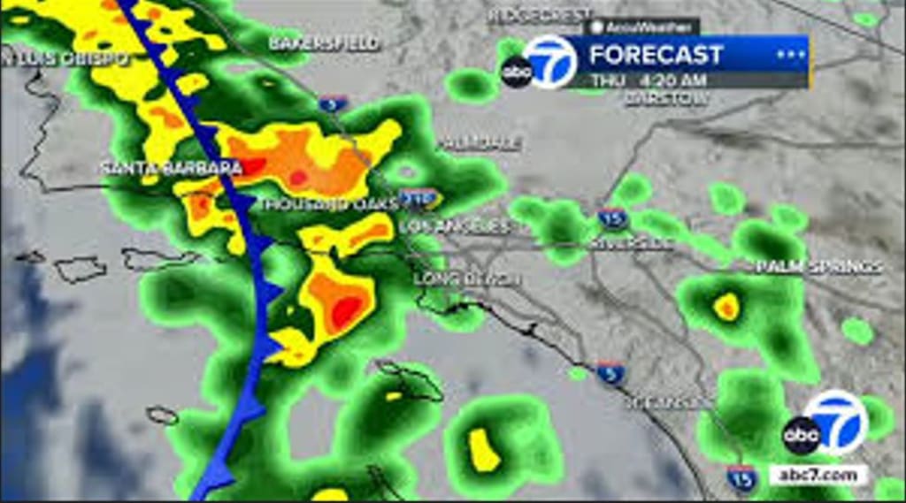
A powerful storm system is heading into Southern California, bringing with it the potential for heavy rain, flooding, and strong winds. As residents prepare for rapidly changing weather conditions, local authorities and weather services are keeping a close eye on developments and issuing live updates to help people stay safe during the event.
Whether you live near the coast or inland, understanding what to expect and how to prepare can make all the difference when a significant storm hits.
Storm Overview: What’s Coming
Meteorologists have confirmed that an atmospheric river — a long, narrow band of moisture in the atmosphere — is expected to reach Southern California over the next 24 to 48 hours. These weather phenomena are known for dropping large amounts of rain in a short period of time, especially in mountainous and foothill regions.
The storm is likely to affect areas from Los Angeles to San Diego and inland valleys, with some locations forecast to receive several inches of rain, especially in the higher elevations.
Live Updates: Key Weather Alerts
⚠️ Flash Flood Watches — Local National Weather Service offices have issued flash flood watches for parts of Southern California, meaning conditions may become favorable for sudden flooding.
💧 Heavy Rainfall Expected — Rain is forecast to intensify through the evening and persist into the next day. In some areas, total rainfall could rival or exceed monthly averages in just a few hours.
🌬 Wind Advisory — Strong gusts are also expected, particularly along the coast and across desert passes, which could lead to tree damage and localized power outages.
These watches and warnings are updated frequently as conditions evolve. Residents are encouraged to check trusted weather sources, local news, and emergency services for the latest information.
Who Is Most at Risk?
While heavy rain can be a concern for anyone in the storm’s path, certain areas and populations are at higher risk:
Flash Flood‑Prone Zones
Dry riverbeds (arroyos)
Urban areas with poor drainage
Mountain and canyon communities
Coastal Areas
High surf and coastal flooding potential
Beach erosion risk
Drivers on Wet Roads
Standing water increases the risk of hydroplaning
Flooded streets can strand vehicles
Road and Travel Impacts
Heavy rain could impact travel throughout the region. Some of the issues to watch for include:
Flooded roadways — Low‑lying streets can fill quickly with water. Never attempt to drive through water covering the road.
Reduced visibility — Rain combined with darkness makes driving more hazardous.
Landslides and mudslides — Steep terrain in Southern California is vulnerable to slope failures during intense rainfall.
Public transportation systems may also experience delays as drivers navigate wet conditions and debris.
How to Stay Safe Before and During the Storm
Here are essential safety tips as the storm approaches:
1. Prepare Your Home
Clear gutters and drains
Secure outdoor furniture
Check roof and windows for leaks
2. Build an Emergency Kit
Include:
Bottled water
Flashlights and batteries
First aid supplies
Non‑perishable food
3. Avoid Unnecessary Travel
If possible, stay home during peak rainfall and only travel if it’s safe.
4. Never Drive Through Floodwater
Just six inches of moving water can knock a person down, and one foot can sweep a vehicle away.
5. Monitor Local Alerts
Follow updates from:
National Weather Service (NWS)
Local news outlets
County emergency management
Community Preparedness and Response
Local authorities and emergency services are already mobilizing to respond to potential issues. Cities and counties may open storm response centers and dispatch crews to monitor problem areas.
Sandbags and traffic advisories may be available in areas prone to flooding. Residents are encouraged to follow guidance from emergency services and heed evacuation orders, should they be issued.
Why These Storms Matter
Storm systems like this one play an important role in Southern California’s climate, helping recharge water supplies that have been strained by drought conditions in recent years. However, rapid rainfall can also overwhelm infrastructure, especially in urban areas not designed to handle intense bursts of stormwater.
What’s expected to benefit water resources can also bring hazards — which is why preparedness and awareness are crucial.
Looking Ahead
As the storm moves through the region, conditions will continue to change rapidly. Heavy rain may continue for the next several days, with the potential for multiple rounds of precipitation.
Residents, commuters, and visitors should stay informed and make safety their top priority. Watching live updates through trusted weather services and official emergency channels will help you navigate this storm with confidence.
About the Creator
Asad Ali
I'm Asad Ali, a passionate blogger with 3 years of experience creating engaging and informative content across various niches. I specialize in crafting SEO-friendly articles that drive traffic and deliver value to readers.
At Least 22 Dead as Crane Collapses Onto Train in Thailand
Thailand has been plunged into mourning after a devastating accident in which a construction crane collapsed onto a moving passenger train, killing at least 22 people and injuring dozens more. The incident, described by officials as one of the deadliest infrastructure-related accidents in recent years, has raised urgent questions about construction safety, urban development, and oversight in the country.
By Aarif Lashari5 days ago in Earth
My New Book is Finally Here
My poetry collection Beautiful and Brutal Things is done. It's actually done and finally published over 270 pages. Over a year of my life went into this book. More than a year, really. Long days at my computer, sometimes seven days a week because I couldn't stop even when I probably should have. Then two months of editing that felt harder than the writing itself. But it's finished, and I'm still standing, and the book is real.
By Tim Carmichaela day ago in BookClub


Comments
There are no comments for this story
Be the first to respond and start the conversation.