
La Niña Is Dissolving Rapidly, Signalling a Shift in Global Weather Patterns
Climate scientists monitor transition toward neutral conditions and potential El Niño development


Understanding La Niña and the ENSO Cycle
La Niña is a climate pattern defined by cooler‑than‑average sea surface temperatures in the central and eastern equatorial Pacific Ocean. It is one phase of the El Niño–Southern Oscillation (ENSO), which also includes El Niño (a warmer phase) and a neutral state in between. These patterns influence global weather by altering atmospheric circulation, rainfall distribution, and temperature trends across many regions of the world.
The ENSO cycle develops over several months and can affect local weather conditions thousands of miles away from the Pacific. For example, La Niña has been associated with wetter conditions in some regions and drier conditions in others, while El Niño tends to produce opposite effects.
---
Recent Changes in La Niña Conditions
According to recent analyses, the La Niña event that has influenced global weather patterns over the past several months is dissolving more rapidly than initially expected. Cooler ocean surface temperature anomalies tied to La Niña have been weakening, particularly in the key Niño regions of the tropical Pacific. This trend has been confirmed by shifts in ocean temperature data and changes in atmospheric conditions across the region.
Strong westerly wind bursts in the Pacific have contributed to this rapid breakdown of La Niña conditions. These winds act to mix warmer water from below the surface into areas that were previously dominated by cooler waters, gradually eliminating the “cold pool” that is characteristic of La Niña. As a result, sea surface temperature anomalies have moved closer to average values.
---
Impact on Weather Forecasts and Seasonal Outlooks
The weakening of La Niña has implications for seasonal weather forecasts. Weather models are now indicating that the cooling influence of La Niña may continue to diminish through the early spring. Eventually, conditions in the tropical Pacific are likely to return to what scientists refer to as “ENSO‑neutral,” where neither La Niña nor El Niño is present.
ENSO‑neutral conditions are associated with more typical weather patterns that are less strongly influenced by extremes from either La Niña or El Niño. Once the Pacific reaches this state, seasonal weather behaviour tends to align more closely with long‑term averages for temperature and precipitation.
Additionally, some long‑range forecasts point to the possibility of El Niño conditions beginning to form later in 2026. If El Niño develops, it could bring its own set of global impacts, influencing rainfall patterns and temperatures in various regions by the latter part of the year or into early 2027.
---
Regional Weather Effects and Monitoring
While La Niña conditions weaken, their residual influence may still be reflected in seasonal weather patterns, particularly across parts of North America, Asia, and the Pacific. For example, cool sea surface temperatures in the equatorial Pacific historically correlate with certain rainfall trends and circulation features that affect weather thousands of miles away.
Climate agencies, including the World Meteorological Organization (WMO) and the United States Climate Prediction Center (CPC), continue to monitor ocean and atmospheric indicators closely. Forecasts issued by these organizations guide planning for climate‑sensitive sectors, such as agriculture, water resource management, and disaster preparedness.
Forecasters emphasize that although La Niña’s influence may be declining, the dynamics of ENSO are complex and can still manifest in weather variability before fully transitioning to neutral conditions.
---
Global Climate Context
The transition of La Niña toward neutral conditions is occurring while the broader climate system continues to experience warming due to increased greenhouse gas concentrations. Long‑term temperature records show that even with La Niña, which typically exerts a cooling effect on global average temperatures, recent years have remained among the warmest on record.
This context highlights that natural climate variability, like ENSO phases, interacts with human‑driven climate trends. Scientists underscore the need to consider both natural and long‑term influences when interpreting weather and climate data.
Understanding how phenomena like La Niña evolve and transition over time helps governments, planners, and communities anticipate shifts in weather risks. ENSO forecasting aids in preparing for potentially wetter or drier seasons, heat waves, and other climate‑related outcomes tied to fluctuations in ocean‑atmosphere interactions.
---
Scientific Monitoring and Forecast Tools
Monitoring the transition of La Niña involves tracking sea surface temperatures, atmospheric pressure patterns, trade wind behaviour, and other climate indicators across the Pacific Ocean. Data from satellites, ocean buoys, and climate models inform these assessments and help project future conditions.
Satellite observations have shown shifts in sea level and ocean temperature patterns that correspond with the weakening of La Niña. For example, cooler surface waters — which are denser — have previously contributed to slower sea level rise in certain regions, but as those anomalies diminish, sea level behaviour may realign with longer‑term warming trends.
Projections for ENSO involve combining outputs from multiple climate models to assess likely conditions months in advance. This modelling approach enhances confidence in predictions of transitions between La Niña, neutral, and El Niño states.
---
What to Expect Next in 2026
As the ENSO cycle moves toward neutral conditions, regions around the globe may see shifts in their typical seasonal weather patterns. For sectors like agriculture and energy, this transition is closely watched because it influences rainfall, temperature extremes, and water availability.
If an El Niño phase develops later in 2026, it could bring contrasting effects to those associated with La Niña. El Niño has historically been linked with warmer global temperatures, shifts in rainfall distributions, and changes in storm activity in various parts of the world.
Experts stress that ENSO phases do not act in isolation, and other climate drivers also play roles in shaping local and regional weather. Therefore, seasonal predictions incorporate multiple data sources and indicators to provide balanced outlooks.
---
Implications for Policy and Planning
Climate agencies and governments often use ENSO forecasts as part of broader climate planning strategies. These include water resource management, drought preparedness, agricultural planning, and disaster response coordination. Knowing whether La Niña, neutral conditions, or El Niño are likely can influence decisions in these areas.
Accurate and timely updates on ENSO conditions also help inform public advisories and risk communication. Awareness of shifting climate patterns enables communities to prepare for potential weather impacts associated with these natural climate cycles.
---
About the Creator
Saad
I’m Saad. I’m a passionate writer who loves exploring trending news topics, sharing insights, and keeping readers updated on what’s happening around the world.
What Went Right This Week: The Good News That Matters
In a world often dominated by breaking news alerts, crises, and uncertainty, it can be easy to overlook the positive developments quietly shaping our lives. Yet every week brings stories of progress, resilience, and human ingenuity that deserve attention. From breakthroughs in health and science to acts of kindness and environmental wins, good news still happens—and it matters.
By Aarif Lashari6 days ago in Earth
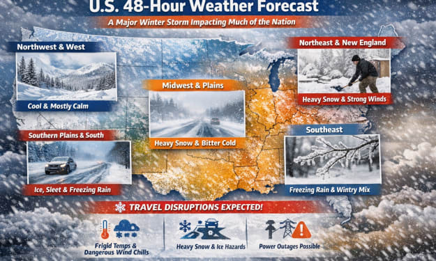
US weather forecast
General Nationwide Pattern (Next 48 Hours) 1. Widespread Winter Storm Across Much of the U.S. A powerful winter storm is forecast to affect large swaths of the country through the next two days. It is expected to bring heavy snow, ice, freezing rain, and dangerously cold temperatures from the Southern Plains into the Midwest, East Coast, and parts of the Southeast.
By USA daily update 6 days ago in Earth


Comments
There are no comments for this story
Be the first to respond and start the conversation.