
Hurricane Francine Slams Louisiana with 100 mph Winds
Category 2 Storm Unleashes Torrential Rain and Dangerous Winds in the Gulf Coast

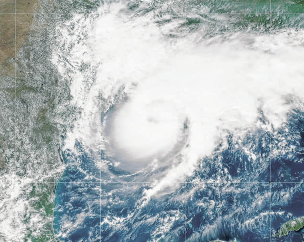
Hurricane Francine intensified into a powerful Category 2 storm on Wednesday evening, slamming into the Gulf Coast with relentless winds, torrential rain, and dangerous storm surges. The storm made landfall just after 5 p.m. in Terrebonne Parish, Louisiana—about 30 miles southwest of Morgan City—bringing sustained winds of 100 mph. Local communities had already begun to feel the storm’s fury long before the center arrived, with hurricane-force winds extending 40 miles from its core and tropical-storm-force winds stretching as far as 140 miles.
“If it picks up more strength, that’s a concern” said Terrebonne Parish Sheriff Timothy Soignet as he tracked Francine’s progress. The hardest-hit areas were expected to be Morgan City, Bayou Vista, and Houma, where winds of 60-80 mph were forecasted, with gusts reaching up to 95 mph. Low-level regions just east of the storm’s center faced storm rising as high as 10 feet.
In New Orleans and Baton Rouge, tropical-storm-force wind speeds over 40 mph were expected to knock down trees and power lines, leading to widespread power outages. Francine's impact was worsened by rising sea levels along the Gulf Coast, which have increased in height by roughly six inches in the last 14 years, exacerbating flooding risks.
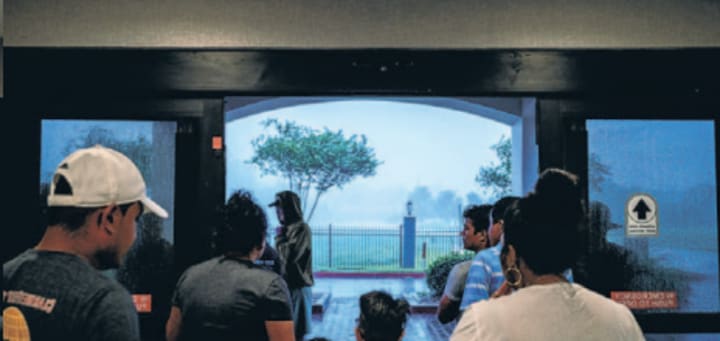
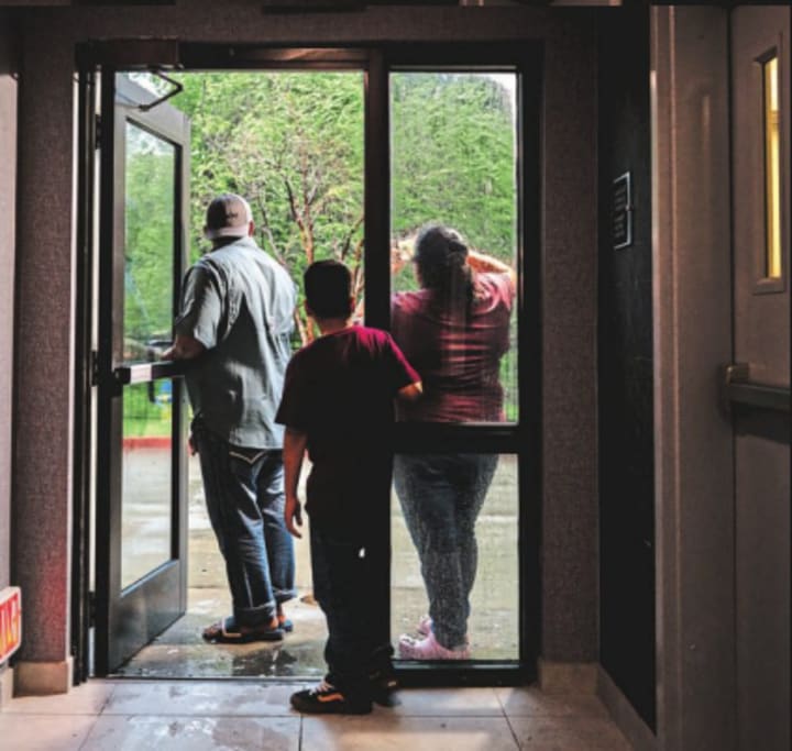
New Orleans residents were urged to stay off roads and shelter in place, while a curfew was implemented in Terrebonne Parish. Mandatory evacuations were also ordered for residents in the parish’s lowest-lying coastal areas, such as Isle de Jean Charles—a community already resettled due to rising sea levels and erosion.
As Francine approached, streets in Houma evacuated, save for a few residents making last-minute preparations. Chris Bundy, 72, who endured weeks without power after Hurricane Ida in 2021, loaded a generator into her cart at Lowe’s. “I’ve been through a lot of hurricanes in my life, she said. Still, after having to live without power for three scorching weeks in the aftermath of Hurricane Ida in 2021, Bundy decided to upgrade her preparations for Francine. Just before the store’s early closure Wednesday morning, Bundy loaded a generator into her cart.
Soignet’s biggest concern was the storm surge, particularly on the north-eastern side of the hurricane, which typically bears the worst of the surge. “That’s always a concern. But honestly, our levees have been holding up pretty good," Soignet said.
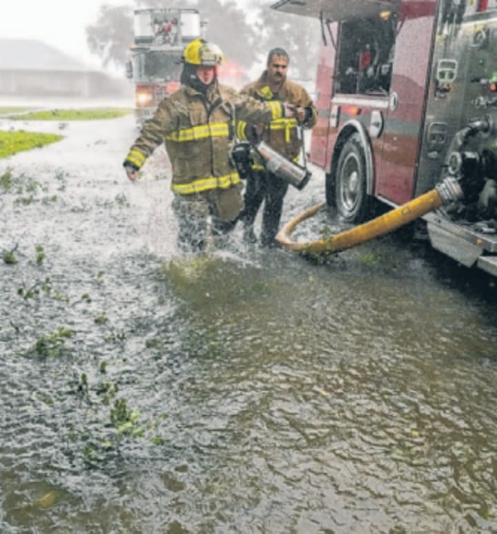
Coastal parishes across Louisiana braced for Francine’s wrath. High-water vehicles and former military equipment were prepared for rescue operations, with mutual aid ready from neighboring parishes like Assumption and Plaquemines.
Louisiana Governor Jeff Landry warned residents to "everyone in the state to be cautious and vigilant” he said during a press briefing.
In Mississippi, officials declared states of emergency in coastal areas like Harrison and Jackson counties, deploying over 100,000 sandbags. Schools across the region canceled classes, and Mississippi Governor Tate Reeves urged residents to take precautions.

Entergy, the largest utility provider in Louisiana, cautioned that customers in the storm’s direct path could lose power for over a week. Meanwhile, the Mississippi utility company warned that drought conditions could cause more trees to fall, increasing the likelihood of downed power lines.
Despite an earlier quiet hurricane season, Francine signaled the start of what experts predict could be a busy few months. The National Hurricane Center is tracking four more disturbances, any of which could develop into tropical storms or hurricanes in the coming weeks.
Louisiana, often in the path of major hurricanes, is no stranger to devastation. Since 2017, the state has faced seven hurricanes, with Francine threatening to join the ranks of previous storms like Katrina in 2005 and Ida in 2021.
As Francine’s wind and rain barreled inland, forecasters warned of torrential downpours that could dump 4-8 inches of rain across southern Louisiana and Mississippi, with isolated totals exceeding 10 inches. Flash flooding is expected in urban and river areas. The storm could stall near Memphis by Thursday night, raising concerns of heavy rain and flooding in the Mississippi Valley.
In addition to rain, the National Hurricane Center warned of possible tornadoes late Wednesday in parts of southeastern Louisiana, southern Mississippi, Alabama, and Florida. The threat of tornadoes will continue into Thursday as the storm tracks up north.
Francine’s path includes St. Martin Parish, where Sheriff Becket Breaux has already stationed deputies to assist residents, particularly in low gradient areas where flooding is likely.
Back in Houma, Warren Renfroe, a retired ship captain, prepared to ride out the storm on his houseboat. Confident in his preparations, Renfroe stocked his boat with enough fuel and supplies to last two weeks. it’s still important to maintain a healthy respect for Mother Nature. “She’s bad to the bone,” he said.
About the Creator
Temoor Dar
💡Topic: Entrepreneur and Writer💡
♟️Hobbies: Traveling, Poems, Playing Chess and Solving Puzzles♟️
🎂Born: July 7, 1991🎂
📍Born in Stockholm, Sweden, and now a Londoner since 1996📍
📚Lifelong Learner📚
🌟Wisdom from Mentors🌟
Keep reading
More stories from Temoor Dar and writers in Earth and other communities.
President Trump Calls Putin to Discuss Ending the Wars in Iran and Ukraine
Introduction In a significant diplomatic move, U.S. President Donald Trump recently held a phone conversation with Russian President Vladimir Putin to discuss ongoing conflicts in the Middle East and Eastern Europe. The call focused on the war involving Iran and the prolonged Russia-Ukraine conflict, both of which have raised global concerns about stability, security, and economic consequences. The conversation highlights growing international pressure to find peaceful solutions to these major conflicts.
By shaoor afridi6 days ago in Earth


Comments
There are no comments for this story
Be the first to respond and start the conversation.