
Drone Usage for Surveying and Mapping in Civil Engineering
Drone survey and mapping

Drones have revolutionized surveying and mapping in civil engineering by offering efficient, accurate, and cost-effective solutions. Equipped with advanced sensors and cameras, drones can capture detailed aerial data, making them an essential tool in modern construction and infrastructure projects. Here's a breakdown of how drones are used in civil engineering, their benefits, and their applications.
1. Introduction to Drone Surveying
Drone surveying refers to using unmanned aerial vehicles (UAVs) equipped with cameras and sensors to capture aerial images of the land. These drones provide engineers and surveyors with real-time data to create maps, 3D models, and digital elevation models (DEMs). With drones, the surveying process is faster, safer, and less labor-intensive compared to traditional methods.
2. Benefits of Drones in Surveying and Mapping
Drones bring several key benefits to surveying and mapping in civil engineering:
Speed and Efficiency: Drones can complete surveys in a fraction of the time required for traditional methods. According to experts, drone surveys can be up to 90% faster than manual surveys, drastically reducing project timelines.
Safety: Surveying with drones eliminates the need for engineers to physically navigate dangerous terrains, reducing risks associated with working in difficult-to-access areas.
Accuracy: Modern drones use technologies like photogrammetry and LiDAR to capture precise data, resulting in highly accurate maps and 3D models.
Cost-Effective: Drones reduce labor and equipment costs associated with traditional surveying, making them a more affordable option for large-scale projects.
3. How Drones Work in Surveying
During a drone survey, the UAV flies over the survey area, capturing multiple high-resolution images. These images are then processed using specialized software to create a detailed map or 3D model of the site. There are two primary types of drone mapping techniques:
Photogrammetry: This involves capturing a series of overlapping images, which are stitched together to create 2D orthomosaic maps or 3D models. Photogrammetry is ideal for large areas and provides high-resolution images suitable for detailed analysis.
LiDAR (Light Detection and Ranging): LiDAR drones use laser pulses to measure distances and create accurate 3D models, even in areas with dense vegetation. This technology is particularly useful for topographic surveys and monitoring elevation changes.
4. Applications of Drones in Civil Engineering
Drones are increasingly being used in a variety of civil engineering applications, including:
Topographic Surveys: Drones can create accurate topographic maps and 3D models that are essential for planning infrastructure projects, such as roads, bridges, and buildings.
Land Management and Development: UAVs help engineers assess land conditions, plan construction activities, and manage land use efficiently by providing detailed aerial views of the site.
Road and Rail Construction: Drones are used to monitor large-scale linear projects like roads and railways, providing real-time updates on progress and helping to identify potential issues.
Volumetric Measurements: For earthworks and mining projects, drones can calculate the volume of materials like soil or rock, which is critical for project planning and cost estimation.
Slope Monitoring: UAVs can survey steep terrains and monitor slopes for stability, making them invaluable for projects in hilly or mountainous regions.
5. Technologies Supporting Drone Surveying
To achieve high accuracy, drones often rely on Ground Control Points (GCPs), Real-Time Kinematic (RTK) GPS, and Post-Processing Kinematic (PPK) systems. These technologies help georeference the images captured by the drone, ensuring precise measurements.
GCPs: These are physical reference points on the ground with known coordinates. The drone uses these points to enhance the accuracy of the survey data.
RTK and PPK: RTK provides real-time GPS corrections during the drone flight, while PPK processes the GPS data after the flight, improving the precision of the final map or model.
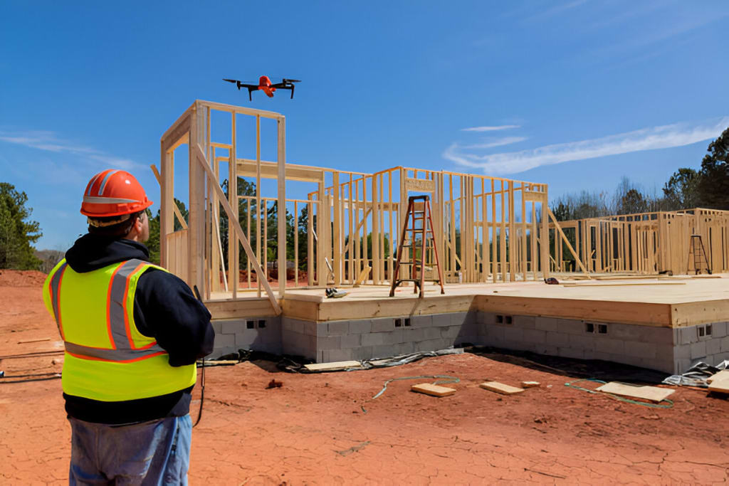
6. Drone Mapping in Construction
In construction, drones play a vital role in site monitoring, progress tracking, and identifying potential problems. Construction teams use drones to capture images of job sites, helping to ensure the project stays on schedule and meets design specifications.
7. Real-World Case Studies
Several case studies highlight the effectiveness of drones in civil engineering projects:
In large-scale infrastructure projects like road construction, drones equipped with LiDAR sensors are used to measure soil and monitor earthworks accurately. This helps in making quick decisions on the ground and keeps the project on track.
Drones have been used in forest management projects, capturing data over large areas to create 3D point clouds that help in managing resources and monitoring environmental changes.
8. The Future of Drone Surveying in Civil Engineering
As technology continues to evolve, drones are expected to play an even more significant role in civil engineering. With the ability to integrate AI and machine learning, drones will soon be able to provide even more detailed analyses, making construction and infrastructure projects faster, safer, and more efficient.
9. Dhaksha Drones and Their Role in Civil Engineering
Dhaksha Drones, a leading drone company in India, is at the forefront of this technological revolution. Their advanced drones are equipped with the latest LiDAR and photogrammetry capabilities, providing precise data for land surveying, construction, and infrastructure projects. With a focus on accuracy and innovation, Dhaksha Drones are transforming how civil engineers approach mapping and surveying tasks, contributing to more sustainable and efficient construction practices.
In conclusion, drones have proven to be a game-changer in civil engineering, offering faster, safer, and more accurate surveying solutions. As drone technology continues to advance, their applications in this field will only expand, shaping the future of construction and infrastructure development.
- Top Benefits of Using Bio Products in Sustainable Agriculture
About the Creator
Manoj Rajput
As a passionate content writer, I enjoy exploring and sharing insights across diverse niches like technology, robotics, agriculture, smartphones, and many more. Through my blogs, I aim to provide valuable, well-researched content.
Keep reading
More stories from writers in 01 and other communities.
How to Choose the Best Mobile App Development Company in Canada 2026
Choosing the right app development partner in 2026 isn’t just a procurement decision—it’s a strategic move that can define whether your digital product scales or stalls. The Canadian tech ecosystem has matured rapidly, with agencies offering everything from rapid MVP builds to enterprise-grade platforms powered by AI and cloud-native architectures.
By alan michael6 days ago in 01


Comments
There are no comments for this story
Be the first to respond and start the conversation.