
LiDAR Drone Market and The Applications
Since their commercialization in the mid-2000s, the rising demand for drones has resulted in a various intriguing application

Since their commercialization in the mid-2000s, the rising demand for drones has resulted in a various intriguing application. From aerial imagery to intricate search and rescue operations, drones have become essential tools for hobbyists and businesses globally. The LiDAR drone market development has opened up chances to map areas that were previously inaccessible or challenging to reach.
The LiDAR drone market refers to any aerial drone flight system equipped with the sensor. These drones facilitate the scanning of extensive outdoor spaces or indoor areas. This consequently makes it simpler and more accessible to collect accurate data.
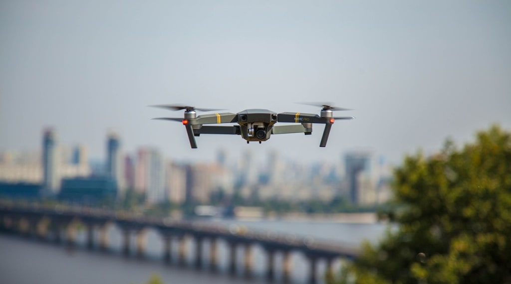
These are aircraft that can be controlled remotely from the ground or flown autonomously with internal software. They serve a range of purposes. That includes monitoring environmental changes and aiding in search efforts following natural disasters. That makes it easier to scan vast areas.
From a professional perspective, drones are invaluable tools that offer businesses innovative solutions for their daily operations. Smaller drones can be used for marketing imagery. While larger drones are ideal for mapping tasks. Conversely drones are excellent for hobbyists looking to capture aerial video footage or participate in racing events.
LiDAR is an aerial surveying technique which produces digital 3D real world representations. Much like radar, it emits pulses that reflect off surfaces and return back to its sensor. It has been a staple in the toolkits of surveyors. That makes it especially ideal for accurately surveying large areas. These sensors have become increasingly versatile in recent years. It is largely due to the advancements in SLAM technology. We can now use these sensors for mapping in handheld devices. It can also be useful on vehicles or through drones.
Throughout the photogrammetry procedure, a drone takes multiple images of the environment being mapped. The overlapping images allow every part on the ground to be viewed from various angles and perspectives. This process further gathers the essential information necessary to generate a 3D model. In encompasses details about shape and elevation. While photogrammetry is not as precise as LiDAR, it offers a richer visual representation of an area through its use of color.
The Applications
The LiDAR drone market size is growing. That is because utilizing this drone for mapping enables surveyors to effectively and safely capture data from areas or features that are difficult to access from ground perspective. For fast and ongoing surveys of expansive locations, it is indeed the best option.
1. Mining
Perfect for capturing challenging environments. This technology gives surveyors a complete perspective on project progress.
2. AEC
This method allows for the consistent aerial capture of construction sites without disrupting daily operations. This enables effective tracking of changes over time.
3. Forestry
This method allows for the effective capture of forests with substantial canopies. It particularly provides an accurate assessment of deforestation and carbon levels.
4. Heritage
Aerial documentation of historical sites or monuments can be achieved through this approach. This employs less intrusive methods for data collection.
5. Disaster management
This approach is applicable at every stage of the disaster management initiatives. From assessing damage in a nuclear disaster to analyzing affected areas for search and rescue efforts.
6. Utilities
Another application of the LiDAR drone market is for utilities. It provides a reliable way to perform regular and safe inspections of utilities including power lines. It therefore enables the tracking of environmental changes in their vicinity over time.
About the Creator
Mark Twain
I'm dedicated to producing interesting, thoroughly researched articles, and I enjoy turning concepts into expressive language. Together, let's use the storytelling medium to make your vision a reality.
Keep reading
More stories from Mark Twain and writers in Writers and other communities.
Greece Organic Food Market: Pros and Cons
The world has seen an increased shift towards healthier eating habits. That includes more preferences for organic food. This also happens in Greece among other nations. As more consumers take more concern into what they eat, there has been a growing demand for Greece organic food market.
By Mark Twainabout a year ago in Writers
Emerging Trends in Healthcare RAG Systems
Retrieval-Augmented Generation (RAG) is rapidly evolving in healthcare, driven by the need for accuracy, explainability, and regulatory compliance. Below are the key trends shaping how healthcare organizations are adopting and scaling RAG systems.
By Lilly Scott3 days ago in Writers
Book Review: "The Queen" by Andrew Morton
You're probably wondering why on earth I would read this book. It was free and it was a fair length. That was basically it at first. But another reason is because I enjoyed the show The Crown and so, it only makes sense to read a book that goes through separating facts from fictions - and to be fair, there aren't a lot of fictions about the show it seems. From the birth of the little princess and the way in which her father was reluctantly to become the king, all the way to meeting and marrying the veteran prince, Duke of Edinburgh and even down to the death of her father, queendom and beyond, this book actually gives us a lot about a woman who basically embodied the greatness and modernisation of the British 20th Century.
By Annie Kapur7 days ago in Geeks


Comments
There are no comments for this story
Be the first to respond and start the conversation.