
Top 11 mysterious places blurred on Google Maps, what is being hidden?
There are some secret locations that are obscured or blacked out on Google Maps. Even if you zoom in all the way, you can't see it, so you can only curiously predict.

Hidden places on Google Maps
1. Faroe Islands of the Kingdom of Denmark
2. Commission on Atomic and Alternative Energy in France
3. Area 51 in Nevada, USA
4. San Blas Islands in the Caribbean
5. Airport in North Korea
6. Social Security Building of the Spanish Armed Forces
7. Jeannette Island (Russia)
8. Girona Province, Spain
9. Munitiecomplex, Veenhuizen, Netherlands
10. Patio de los Naranjos (Spain)
11. Moruroa Island (Polynesia)
1. Faroe Islands of the Kingdom of Denmark
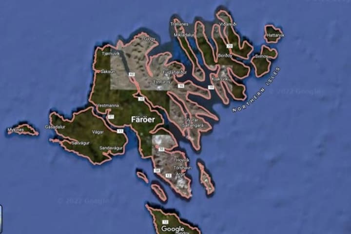
Although it is an interesting place to visit, half of the Faroe Islands of the Kingdom of Denmark are obscured on Google Maps. The reason is said to be because there is a military base located in this area. Therefore, only the middle part of the island with the capital Torshavn is visible on the map.
2. Commission on Atomic and Alternative Energy in France
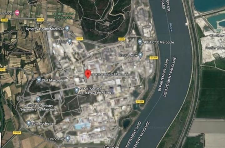
In France, near the city of Avignon there is the Marcoule national nuclear research center, which is a branch of the Atomic Energy Commission. This location is also obscured on Google Maps for "research purposes".
3. Area 51 in Nevada, USA
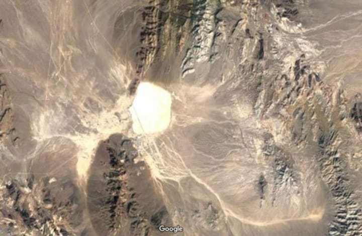
The world-famous Area 51 in Nevada, USA is also highlighted in white on Google Maps. Many rumors say that Area 51 is where research on alien life forms is conducted.
4. San Blas Islands in the Caribbean
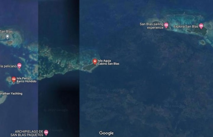
The San Blas Islands are located off the northern coast of the Isthmus of Panama and consist of 365 individual islands. On Google Maps, in the center of the archipelago there appears a thick black bar and everything to the right of it is obscured, while the left part is still clearly visible.
5. Airport in North Korea
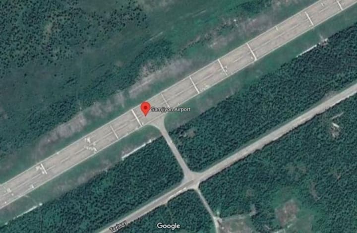
On Google Maps, the airport in Samjiyon Province, North Korea has been covered with a gray layer to hide important aviation objects.
6. Social Security Building of the Spanish Armed Forces
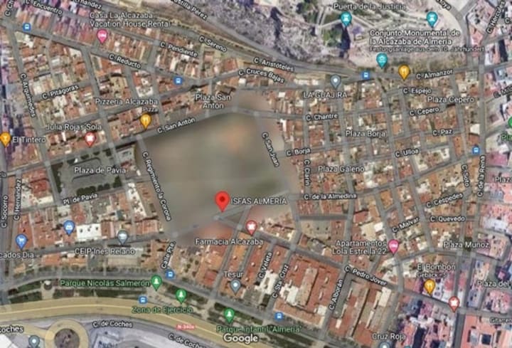
This building belongs to the Spanish armed forces, located in the city of Almeria in the Andalusia region. On Google Maps, the image of this building is so obscured that its shape cannot be seen.
7. Jeannette Island (Russia)
Jeannette Island is quite small, with a length of only about 2km, located in the Eastern Siberian Sea. In the center of the island there is a 350m high mountain peak. Nearly the entire island is constantly covered by ice.
Many people believe that this island is blacked out because this area is still in a sovereignty dispute between Russia and the United States.
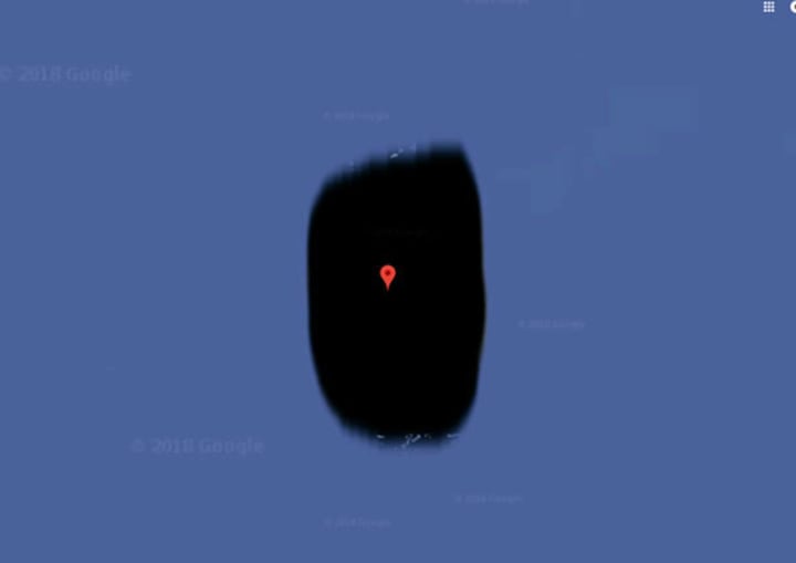
8. Girona Province, Spain
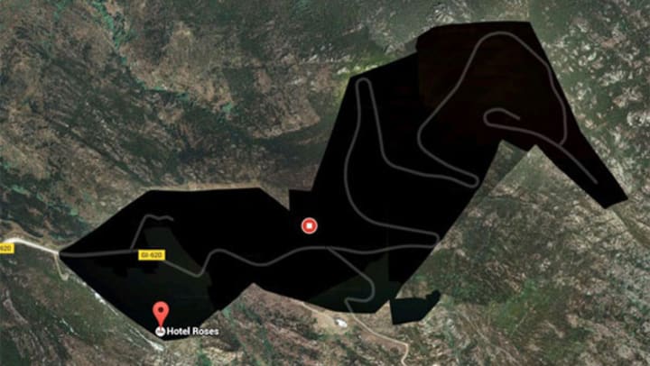
A black mass appeared in the northeast area of Girona, a province of Spain. There is nothing outstanding around this area. However, in that black space there is a hotel called Roses. Many rumors say that this hotel is a resort for the rich and famous. Therefore, there was an intervention to cover it up, avoiding the curious eyes of outsiders.
9. Munitiecomplex, Veenhuizen, Netherlands
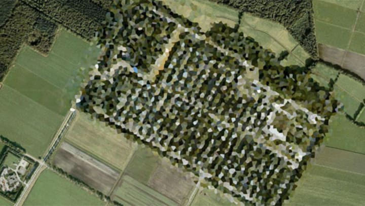
Viewed from above, this square piece of land looks like an oil painting. Many people believe that this area is actually an ammunition depot of the Dutch army and was hidden on the map by the government of the windmill country.
10. Patio de los Naranjos (Spain)
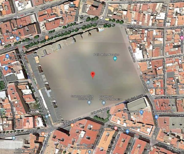
Google has completely blurred a fairly square campus called Patio de los Naranjos, located in the Spanish city of Almeria. This makes many people curious and trying to find out. According to many rumors, this area is related to projects being built for some important government purpose.
11. Moruroa Island (Polynesia)
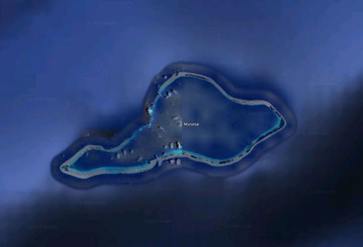
Moruroa is a coral island in the Polynesian national archipelago owned by the French Republic. Images of this island are never clearly displayed on Google Maps. Until now, no one knows the reason why, but many rumors say it is related to the history of the island. Between 1966 and 1996, the island of Moruroa was the site of French nuclear testing, with a maximum total of 181 gruesome tests taking place.
About the Creator
HK Decor
Telling stories my heart needs to tell <3 life is a journey, not a competition
If you like what you read, feel free to leave a tip,I would love some feedback
https://s.shopee.vn/7fFUMxnnBx?share_channel_code=8
Fun Times at Globe Life Field
Before the 2025 calendar year concluded, one of my goals for 2026 was to travel more. Most recently, I did just that. In my previous story about going on vacation to my hometown of Arlington, Texas, I discussed taking part in a stadium tour at Globe Life Field. I loved every minute of it and everyone who was part of the tour were excellent. In this story, I'll give my opinions about what I thought about GLF.
By Mark Wesley Pritchard 4 days ago in Wander


Comments (1)
Everything is so interesting, thank you for sharing