
Georgia Off the Beaten Path
Sightseeing in the US State of Georgia

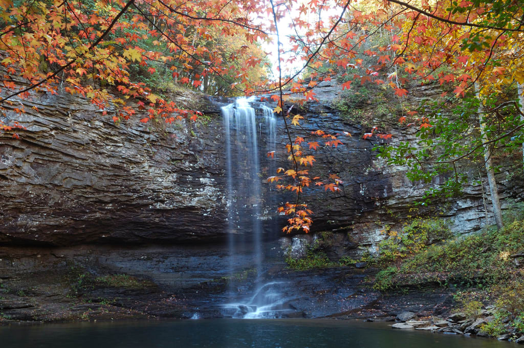
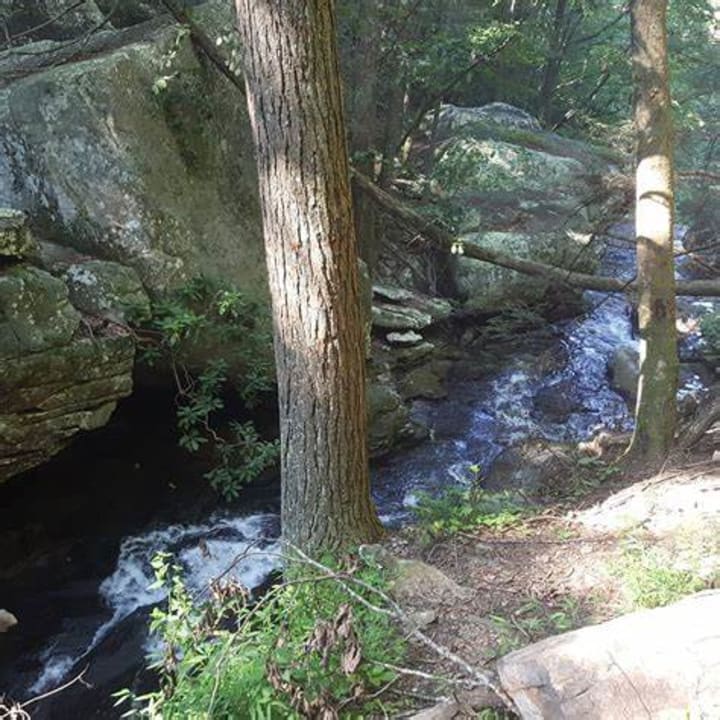
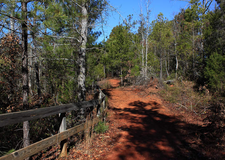
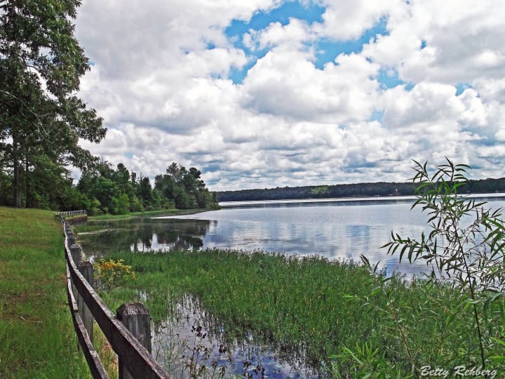
Cloudland Canyon State Park is located in Trenton. The Sitton Gulch Creek has carved a large gorge through the western edge of Lookout Mountain making the elevation between the highest and lowest points more than 1,000 feet. There are wonderful scenic views of rugged rock faces, ridges, valleys, and waterfalls.
Hemlocks, dogwoods, holly, mountain laurel, and rhododendrons fill the forests.
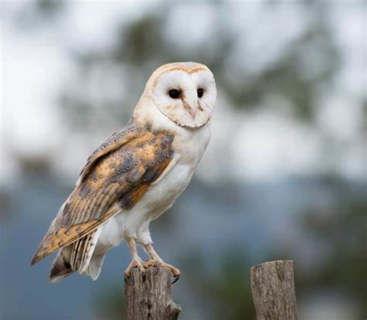
For hikers and nature lovers, there is the 4.7 mile Rim Loop Trail which leads through thickly wooded mountain terrain. Along the way, one can see cardinals, red-tailed hawks, barn owls, and pileated woodpeckers. Gray foxes and white-tailed deer can often be seen and on occasion a bobcat. There are several picnic areas and a playground.
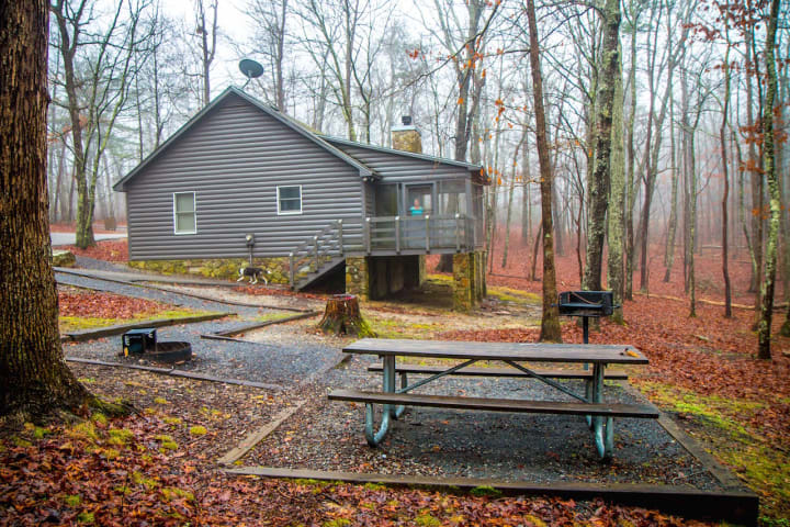
Among the activities to be enjoyed here are hiking, camping, swimming, and even tennis. Accommodations include rustic cabins with fireplaces and screened porches, family camping areas, and more remote primitive sites accessible only on foot.
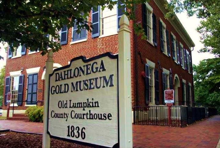
Dahlonega Courthouse Gold Museum prospectors came rushing to this area when word spread that gold had been found here in Cherokee country in 1828. This led to the illegal annexation of much of the Indian’s ancestral land. In less than 10 years more than $1.7 million in gold had been shipped to the Philadelphia Mint. One of the new districts created from Cherokee Territory was Lumpkin County. Dahlonega takes its name from a Cherokee word meaning “precious yellow” and it became the county seat. Today one can visit the handsome 1836 brick building which served for nearly 130 years as the courthouse.
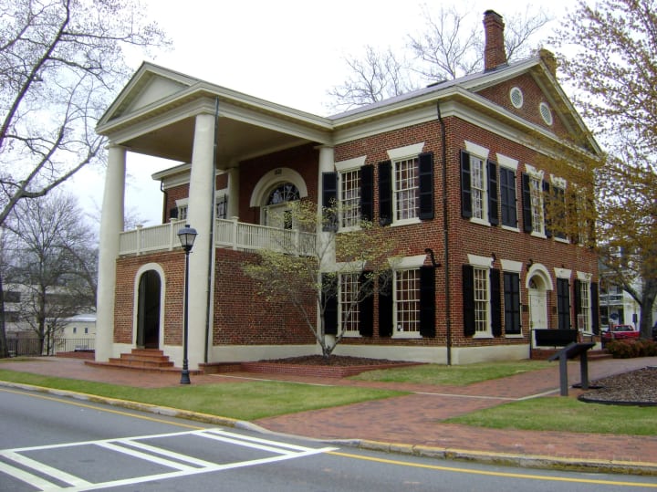
The Lumpkin County Courthouse is the oldest courthouse in Georgia. Here one can see many interesting reminders of the quest for gold. Visitors are introduced to the region’s history by a short talk and a 12-minute slide show. Exhibits and paintings illustrate the sad fate of the Cherokees and show the methods used in gold mining. Among the many fascinating displays are gold nuggets and coins, a working miniature model of a stamp mill, and a chart showing Georgia gold-production totals from 1832 to 1942.
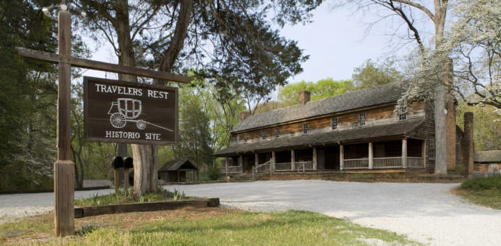
Traveler’s Rest is located east of Toccoa. In the early 1800s, the Tugaloo River Valley was inhabited by the Cherokee Indians. It became a busy crossroads for stagecoach and riverboat travelers. An enterprising local plantation owner Devereaux Jarrett bought a small wayside inn in 1833 and expanded it into a long, rambling structure with eight rooms on the ground floor and five more above. The building housed an inn, a store, a post office. and a home for the Jarrett family. The outbuildings surrounded by white oaks and American holly include slave cabins and a loom house. It was designated as a National Historic Landmark on January 29, 1964.
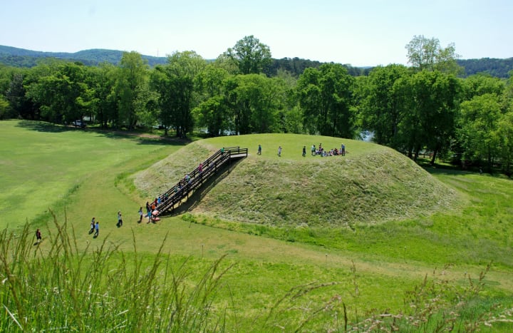
Etowah Mounds Historic Site – From 1000 A.D. to 1500 A.D. the Etowah Indians lived on this 54-acre site. Here along the river that is in their name, the Indians built a village with two public squares or plazas, three great earthen mounds with flat platform tops, and several lesser mounds. The plazas were used as gathering places for the villagers and other Indians who came for commerce, important festivals, and burial ceremonies. The largest of the mounds (63 feet high, with a platform a ½ acre in extent) is thought to have been a temple as well as the priest ruler’s residence. Excavations of one of the smaller mounds revealed the burials of more than 500 of the tribal elite.
Today the plazas are overgrown with grass and the great mounds loom over them in silence. One can see traces of the moat and the burrow pits from which earth was taken to construct the mounds. Climbing atop the highest mound you can see on the eastern horizon a deep notch in the Allatoona Mountain range. When the summer solstice (about June 22nd) arrives the sun rises through this notch, a phenomenon that may have figured in Etowah rituals.
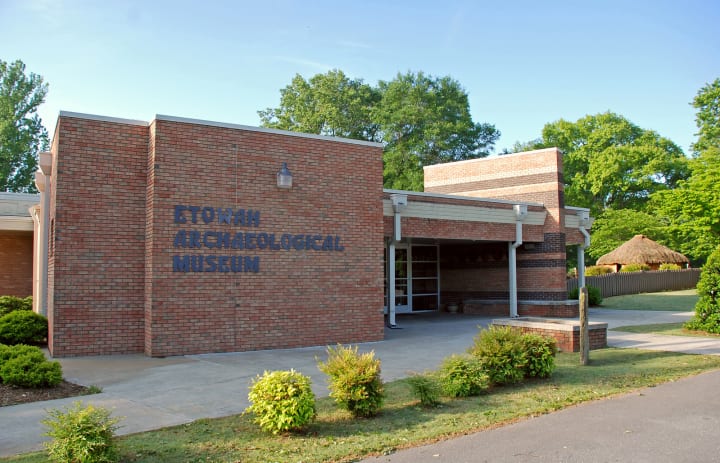
Near the entrance of the site is the Etowah Archaeological Museum which displays artifacts, slides, and a diorama depicting the life of the Etowah.
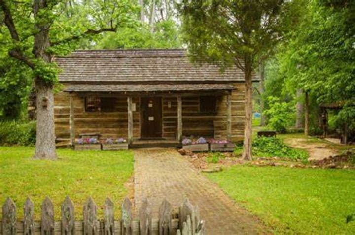
Uncle Remus Museum in Eatonton is where the fabulous characters from the Uncle Remus stories were born – Brer Rabbit, Brer Fox, Sis Goose, and others. The author Joel Chandler Harris was born in Eatonton and the slaves “Uncle” George Terrell and “Uncle” Bob Capers worked on Joseph Addison Turner’s plantation. Turner was a lawyer, a scholar, and the publisher of a small newspaper. He gave Harris his first job at the age of 13. The museum is housed in two connected slave cabins. In these simple log structures the world of tar-baby, the laughing place, and the brier patch are brought to life by dioramas and other exhibits.
Colorful scenes in each of the windows depict the countryside of a southern plantation during the anti-bellum days. A replica of Uncle Remus’s fireplace is at one end of the cabin and around it are displayed the various 19th century household articles mentioned in the tales. Against one wall of the cabin hangs a large portrait of Uncle Remus and Joseph Sydney Turner, the Little Boy in the stories and the son of Joseph Addison Turner. The first editions of many of Harris’s works, including his stories of the Old South and the Reconstruction days are on display, and copies of his and other children’s books are on sale.
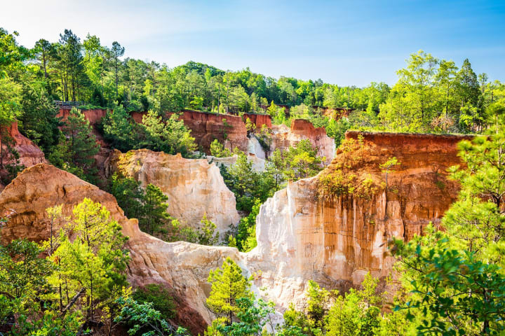
Providence Canyon State Park is a scenic 200-acre canyon area (massive gullies as deep as 150 feet were caused by poor farming practices during the 1800s) which is dominated by the 1,208-acre park. Here wild plants and shrubs grow including the rare Plumleaf Azalea whose flowers range in color from orange to various shades of red. It blooms from July to September. Other indigenous plants include verbena, maypop, wild ginger, and prickly pear.
There is a two-mile trail called the Canyon Rim Trail which has 20 overlooks. It winds past clumps of sumac and stands of hickories and slash pines. One may see raccoons, opossums, and hawks circling overhead. The park also offers picnic groves, two short trails leading to the canyon floor, and an eight-mile backpacking trail.
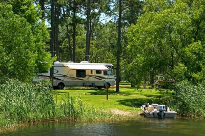
Camping and cottages are available at nearby Florence Marina State Park on beautiful Lake Walter F. George.
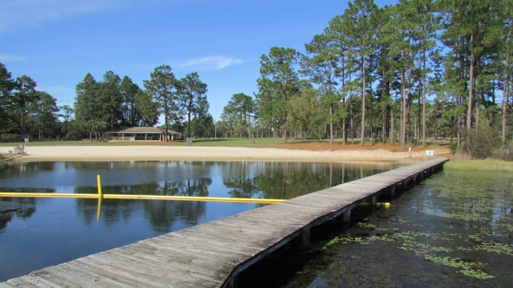
Seminole State Park was named for the Indians that lived in the region before settlers came. Activities here include boating, water skiing, canoeing, and swimming. The main feature here is Seminole Lake which is a favorite with fishermen. The lake's shallow waters contain more species of fish than any other lake in Georgia. It is reputed to have the best largemouth bass fishing in the U.S. Other fish to be caught here are crappies, jack, bream, catfish, and yellow perch. Along the lakefront, one can find picnic tables beneath shelters.
You can also view the lake from rented cottages, tents, and trailer campgrounds which are shaded by longleaf pines, poplars, sweet gums, and cedars. Pioneer camping is available in the more remote areas of the park where the blooming of dogwoods and wild blackberries signal the arrival of spring. Bird watchers can view several species of large hawks and the gopher tortoise which is an endangered species can also be found here. Observant visitors may also see alligators, osprey, bald eagles, and other wildlife.
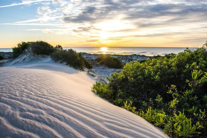
Cumberland Island National Seashore – This historic sandpit which is the southernmost of Georgia’s sea islands has been inhabited for some 4,000 years. To help protect their holdings in Florida the Spaniards built a fort here in the 16th century. A Franciscan mission was established and many Timucan Indians were converted. The Spanish called the island San Pedro. In the 18th century, an Indian who had visited the Duke of Cumberland in England suggested changing the name of the island in honor of him. This small island, about 18 miles long and 4 miles at the widest point supports a fascinating range of ecological zones, each with its own population of plants, birds, and animals.
The beach is great for swimming and is frequented by shorebirds that follow the tides. The grass and the sand are stabilized by sea oats and low-growing plants carpet the meadows between the dunes. At the place where the soil is the deepest a maritime forest of oaks, magnolias, red bay, and various pines has been established and a salt marsh sanctuary on the estuary side supports its own waving sea of cord grass. The sloughs and ponds are home to alligators, otters, and minks. Wild horses may also be seen. The island has walking trails and camps for backpackers. There is a museum displaying Indian artifacts and interprets the history of the island.
About the Creator
Rasma Raisters
My passions are writing and creating poetry. I write for several sites online and have four themed blogs on Wordpress. Please follow me on Twitter.
Keep reading
More stories from Rasma Raisters and writers in Wander and other communities.
Beautiful Porvoo
Porvoo counts as Finland’s second oldest town and is a lovely city that is rich in history. It attracts tourists from all around the world and over the years has developed into an eastern node of metropolitan Helsinki. The city is situated in the eastern Uusimaa region right on the coast of the Gulf of Finland.
By Rasma Raisters2 years ago in Wander
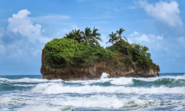
Worth the Wait: Puerto Viejo, Costa Rica
Beach bumming in a small Caribbean beach town sounded like a perfect way to end our 6-month trip through Mexico and Central America. Or so we thought. The foul, fishy stench of rotten seaweed hit our nostrils as we stepped from the cramped bus and looked out at a rather depressing, empty, and underwhelming black sand beach. It was pouring with rain, and we had to quickly fish out our ponchos. We thought, this couldn’t be it, could it?
By Sh*t Happens - Lost Girl Travel3 days ago in Wander


Comments
There are no comments for this story
Be the first to respond and start the conversation.