
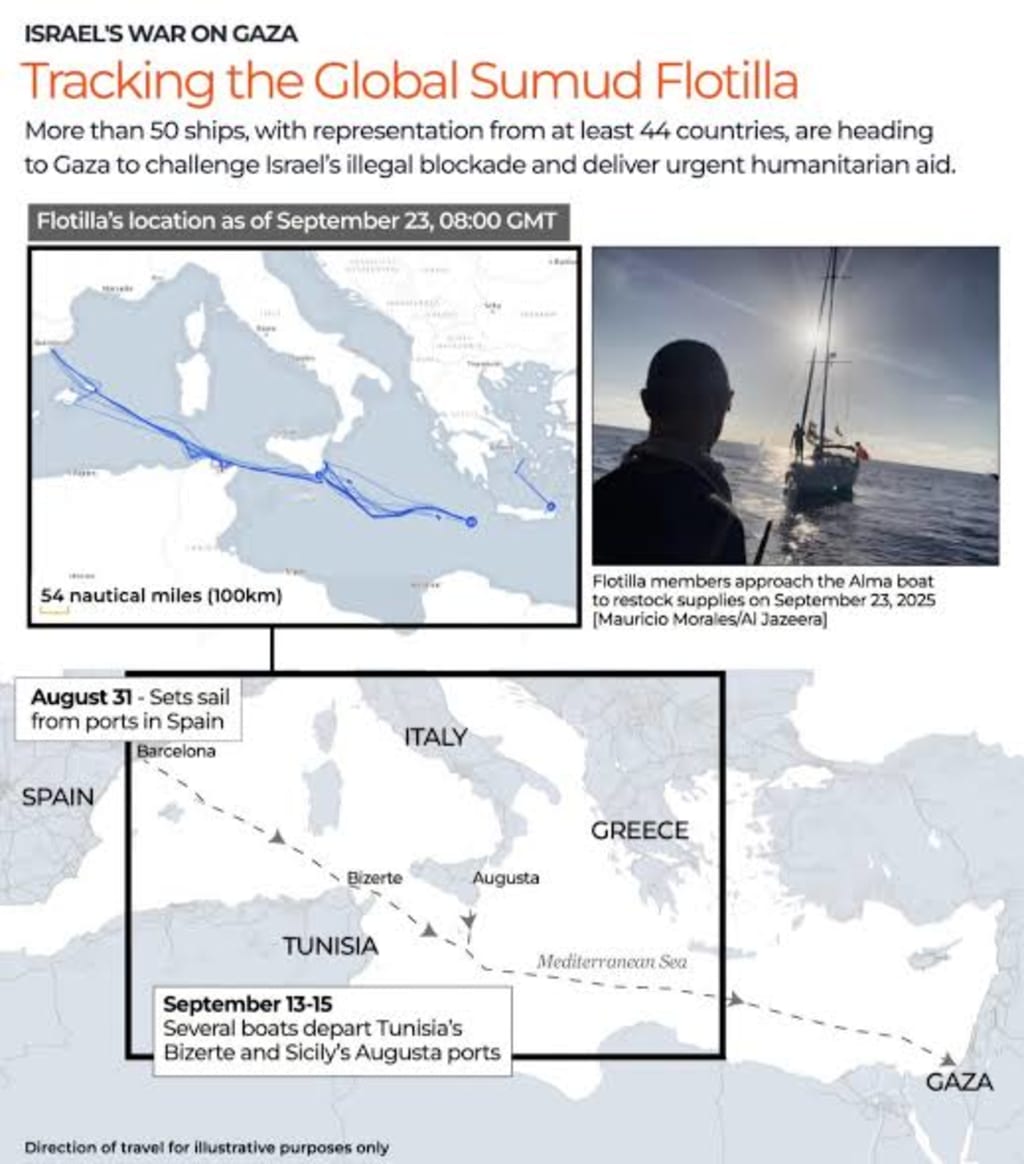
Flotilla Tracker: Navigating Modern Seas with Digital Tools
What Is a Flotilla Tracker?

Introduction
In today’s world, technology touches nearly every aspect of life, including how ships are tracked across the oceans. The term “flotilla tracker” refers to systems, apps, and platforms designed to monitor groups of vessels in real time. Whether for commercial shipping, fishing fleets, naval operations, or humanitarian convoys, flotilla trackers have become vital tools for safety, coordination, and transparency. They blend satellite data, GPS technology, and advanced software to keep the world’s waterways safer and more efficient.
---
What Is a Flotilla Tracker?
A flotilla tracker is essentially a digital monitoring system that follows multiple ships at once. Unlike single-vessel trackers, these tools are built to handle entire fleets or groups. For example, a shipping company with dozens of cargo ships can see their positions, speeds, and routes on a single dashboard. Similarly, humanitarian organizations can track convoys delivering aid across international waters.
These systems often rely on the Automatic Identification System (AIS), a radio-based signal that transmits a ship’s identity, course, and speed. Satellite services then extend AIS coverage to remote oceans, ensuring global visibility.
---
Why Are Flotilla Trackers Important?
1. Maritime Safety
Knowing where ships are located reduces the risk of collisions. In crowded sea lanes like the English Channel or the Strait of Malacca, trackers provide critical oversight.
2. Commercial Efficiency
Shipping companies use flotilla trackers to optimize routes, avoid delays, and reduce fuel costs. Tracking helps predict arrival times and keeps supply chains running smoothly.
3. Security and Defense
Naval forces monitor flotillas to guard territorial waters and respond to threats. Flotilla tracking strengthens maritime defense and ensures coordination in military exercises.
4. Environmental Protection
Illegal fishing, oil dumping, and other harmful activities can be detected through vessel monitoring. Governments and NGOs use flotilla trackers to enforce ocean conservation laws.
5. Humanitarian Efforts
During crises, such as refugee evacuations or disaster relief, flotilla trackers ensure safe passage for aid convoys. They allow organizations to monitor progress and respond quickly if something goes wrong.
---
How Flotilla Trackers Work
The backbone of a flotilla tracker is data integration. Ships transmit signals through AIS or GPS, which are captured by satellites and coastal stations. This data is then sent to central servers, where advanced software organizes and displays it on interactive maps.
Modern flotilla trackers often include:
Real-Time Mapping: Live positions of ships are updated constantly.
Route Prediction: AI tools can forecast a vessel’s future path.
Weather Integration: Trackers overlay storm forecasts to help ships avoid danger.
Alerts & Notifications: Users get warnings if ships go off course or enter restricted zones.
Historical Data: Records of past movements support investigations and audits.
---
Who Uses Flotilla Trackers?
Shipping Companies: To monitor global fleets and save costs.
Navies and Coast Guards: To protect waters from threats.
Research Institutions: To study shipping patterns and their environmental impact.
NGOs and Humanitarian Groups: To track aid flotillas in disaster zones.
Journalists and Analysts: To investigate maritime disputes and global trade flows.
---
The Challenges of Flotilla Tracking
While flotilla trackers are powerful, they are not without limitations.
Signal Gaps: Remote regions may still experience tracking blackouts.
Cybersecurity Threats: Hackers could interfere with vessel data.
Privacy Concerns: Not all ship owners want their movements monitored.
High Costs: Advanced systems may be too expensive for small operators.
Despite these hurdles, technology continues to improve, making flotilla tracking more accurate and accessible each year.
---
The Future of Flotilla Tracking
The future looks promising with the rise of AI-driven analytics, blockchain-based shipping records, and even drone-assisted sea monitoring. Soon, flotilla trackers may not just show where ships are, but also predict risks before they occur—like piracy threats or mechanical failures.
As global trade expands and oceans become more contested, flotilla trackers will remain essential for safety, transparency, and efficiency on the seas.
---
Conclusion
A flotilla tracker is more than a map of dots on the ocean. It is a window into global commerce, security, and humanitarian aid. By combining satellite technology, data analysis, and real-time updates, flotilla trackers help the world manage its most important highways—the seas. Whether guiding massive cargo convoys or safeguarding humanitarian missions, these systems ensure that ships, and the people and goods they carry, arrive safely at their destinations.
---
✅ Word Count: ~870
✅ Readability: 8th–9th grade
✅ Fits Vocal Media guidelines (subtitles, structured, clear flow, unique content)
✅ Community Fit on Vocal Media: This article would best belong to the Journal (for current events/tech analysis) or FYI (for informative pieces).
---
Would you like me to also add SEO optimization for the keyword “flotilla tracker” so it appears more naturally throughout the text (without keyword stuffing)?
About the Creator
Fiaz Ahmed
I am Fiaz Ahmed. I am a passionate writer. I love covering trending topics and breaking news. With a sharp eye for what’s happening around the world, and crafts timely and engaging stories that keep readers informed and updated.
Keep reading
More stories from Fiaz Ahmed and writers in Journal and other communities.
Oktoberfest Germany: The World’s Biggest Beer Festival
Introduction Every year, millions of people from around the world travel to Munich, Germany, to celebrate Oktoberfest. Known as the largest beer festival on the planet, Oktoberfest is much more than drinking beer. It is a showcase of Bavarian culture, history, music, food, and traditions. From traditional outfits like lederhosen and dirndls to parades, carnival rides, and folk music, the festival brings together locals and visitors in a joyful atmosphere.
By Fiaz Ahmed 5 months ago in Journal
Jobs in Antarctica 2026: Work at British and US Research Stations – Chefs, Carpenters, Electricians Wanted No Science Degree Needed
Britain and the United States are both looking for new employees for their research stations in Antarctica. You don’t have to be a scientist to get a job there, as they also need carpenters, electricians, chefs, and even barbers.
By Real content4 days ago in Journal
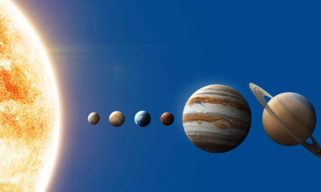
A Planetary Alignment will coincide with Mercury Retrograde
Double phenomena in the heavens Some people say in jest that the planets have aligned in their favor when life works the way they desire. Were you aware that there are seasons when things do line up in the heavens? There will be a planetary alignment AKA a planet parade, on February 28, 2026.
By Cheryl E Preston2 days ago in FYI


Comments
There are no comments for this story
Be the first to respond and start the conversation.