
How Satellites Measure the Sea Level: A View from Orbit on Earth's Health
Space

When we talk about climate change, one of the most alarming indicators is the rising sea level. It’s not just a statistic it’s a threat. Rising oceans can swallow coastal cities, displace millions, sink island nations, and shift global weather patterns. But how exactly do scientists monitor such gradual changes in something as vast and dynamic as the world’s oceans especially when the difference can be measured in millimeters? The answer lies above us, orbiting Earth: satellites.
Why Satellites?
Before satellites, sea level measurements were localized and land-based. Tide gauges placed along coastlines measured how high the water rose relative to fixed land points. But here’s the catch: land moves too. Tectonic activity, erosion, and even human activity can cause the land itself to rise or fall, skewing the data.
On top of that, tide gauges are few and far between. They can’t capture what’s happening across the open ocean the 70% of the planet that’s inaccessible by foot or even by ship. Satellites, on the other hand, can. From hundreds of kilometers above, satellites provide global, consistent, and highly accurate measurements of sea level across the entire Earth.
How It Works
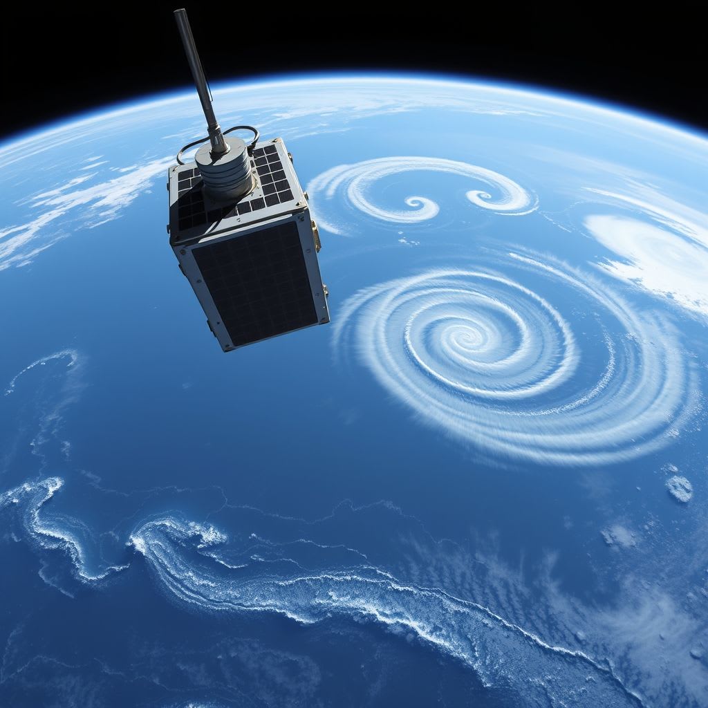
The core technology behind this measurement is a device called a radar altimeter. Here’s how it works:
A radar altimeter sends a pulse of microwave energy directly down to the ocean’s surface. The pulse hits the water and reflects back to the satellite. By calculating how long it takes for the signal to return and knowing the speed of light, scientists can determine the distance between the satellite and the ocean’s surface down to a precision of centimeters, and in some cases, even millimeters.
But that’s only part of the story. The satellite’s exact position in orbit is also known, thanks to GPS and laser tracking systems. By subtracting the measured distance from the satellite’s altitude, scientists can determine the sea surface height relative to the center of the Earth.
But What About Waves and Wind?
The ocean is anything but smooth. Waves crash, tides ebb and flow, and winds whip up surface turbulence. Wouldn’t all that motion interfere with the measurements?
Absolutely but scientists account for that. The raw data from altimeters are filtered through sophisticated algorithms and are cross referenced with data from other instruments. For example, satellite borne radiometers measure atmospheric water vapor (which can affect signal delay), and onboard weather sensors help correct for wind and wave conditions. What emerges is an averaged sea surface height, stripped of short-term noise and revealing long-term trends.
The Satellites That Changed Everything
Satellite altimetry was revolutionized in 1992 with the launch of TOPEX/Poseidon, a joint mission between NASA and the French space agency CNES. It was a game changer finally offering stable, accurate, and continuous data on sea level rise.
Since then, a series of satellites have carried the torch: Jason-1, Jason-2, Jason-3, and most recently, Sentinel 6 Michael Freilich, launched in 2020. This new generation of satellites is even more precise, thanks to advancements in instrumentation and global cooperation between NASA, ESA, NOAA, and other agencies.
Thanks to these missions, we now know that global sea levels are rising by about 3.3 millimeters per year and that rate is accelerating.
What Can Satellites See from Space?
A lot more than you might expect. Satellites have revealed:
- The melting of polar ice sheets in Greenland and Antarctica, which pours billions of tons of freshwater into the ocean each year.
- Thermal expansion as ocean water warms, it expands and takes up more space, causing sea levels to rise.
- Short-term events like El Niño, which temporarily raise or lower sea levels in specific regions.
Even subtle phenomena, such as underwater volcanic activity or tectonic shifts, can be detected through satellite altimetry.
Why It Matters
Measuring sea level from space isn’t just a scientific curiosity it’s a vital tool for survival. These measurements help:
- Forecast floods and storm surges, giving coastal communities time to prepare.
- Model climate change scenarios, improving the accuracy of future projections.
- Refine navigation systems by updating nautical charts and sea condition forecasts.
- Support emergency response and international planning for climate adaptation.
And perhaps most importantly, they provide undeniable evidence of what’s happening to our planet.
Looking Ahead
As technology advances, future satellites will be even more precise, and with the integration of artificial intelligence, the speed and depth of data analysis will improve dramatically. Eventually, we may not only be able to measure the impacts of climate change we might be able to anticipate and prevent some of its worst consequences.
Final Thoughts
Every centimeter of rising ocean captured from space tells a part of Earth’s story a story of change, challenge, and resilience. Satellites are our eyes in the sky, silently watching the pulse of the planet’s most powerful force: water. While we look up to the stars, they are looking back down at the sea.
And in their data lies the truth about our future.
About the Creator
Keep reading
More stories from Holianyk Ihor and writers in Futurism and other communities.
Asteroids with Moons — How Is That Possible?
When you hear the word “moon,” the first image that probably comes to mind is that huge, glowing satellite lighting up the night sky beside Earth. But what if I told you that moons aren’t just reserved for planets? Some asteroids tiny compared to planets can have their own moons too. It sounds like science fiction, but it’s a fascinating scientific reality.
By Holianyk Ihor7 months ago in Futurism
About Binding Prometheus
I want to start actively advocating on behalf of my own work, and the most valuable part of my canon is, without a doubt, Binding Prometheus, the play I have been working on since 2019 and only finished in 2023 as part of my MA. The play itself is an amalgamation of a million different inspirations. On one end, it evokes the Ancient Greek myth-play, deriving its own title from the earliest extant work of Western drama we have, Aeschylus’s Prometheus Bound. On the other end, it borrows significantly from the sci-fi bulwarks from over the years, namely Mary Shelley’s Frankenstein and Karel Capek’s Rossum’s Universal Robots. The play could be an episode of Black Mirror, I fear. I don’t know. I’ve only ever seen one episode of Black Mirror.
By Steven Christopher McKnight17 days ago in Futurism
Gaming Peripherals Market Size and Forecast 2025–2033
Gaming Peripherals Market: An Industry in Rapid Transformation The global gaming peripherals market is entering a decisive growth phase as gaming continues to evolve from a leisure activity into a mainstream form of digital entertainment and professional competition. According to Renub Research, the Gaming Peripherals Market is expected to grow from US$ 4.94 billion in 2024 to US$ 9.10 billion by 2033, registering a compound annual growth rate (CAGR) of 7.02% from 2025 to 2033. This expansion reflects not only the surging popularity of gaming worldwide but also the rising demand for high-performance devices such as gaming mice, mechanical keyboards, headsets, controllers, and other immersive accessories.
By Aaina Oberoi5 days ago in Futurism


Comments
There are no comments for this story
Be the first to respond and start the conversation.