
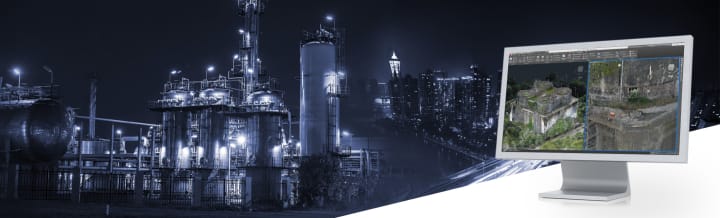
How AI Can Enhance 3D Laser Scanning
AI Revolutionizing 3D Laser Scanning

Efficiency is the key to construction success. The pressing problems with outdated manual documentation approaches gave birth to the usage of laser scanning for AEC applications. However, this is not the end of the evolutionary road. In these AI times, we do have one more revolution in project documentation rolling out now. It is AI for laser scanning! By streamlining certain scanning and data processing workflow steps, artificial intelligence (AI) has the potential to change the 3D laser scanning market. Businesses may cut costs and improve project outcomes by using AI in the scanning process to increase accuracy, speed, and efficiency.
Applications of AI in 3D Laser Scanning
AI has a vast potential for various industries and laser scanning is not left untouched. Read the comprehensive details on each pointer about applications of AI in laser scanning below.
- Fastening Up the Laser Scanning Process
By optimizing the scanner's motions and settings in real-time, artificial intelligence systems can speed up the laser scanning process. Using information about the geometry of the item or space being scanned, these algorithms can automatically choose the optimal scanning route, angles, and resolutions. As a result, the project may be completed more quickly since less time is spent on-site and human interaction is reduced.
- Providing Intelligent Insights While Scanning
Throughout the scanning process, AI may offer comments and insights in real-time. AI-driven software, for instance, can identify regions that require a second scan because of poor data quality. It guarantees that the final point cloud is as precise and comprehensive as feasible. AI may also help with the automatic creation of semantic information by helping to detect and categorize things in the scanned environment.
- Automating Point Cloud Data Processing
Processing the enormous volumes of point cloud data produced by 3D laser scanning is one of the most time-consuming tasks. By automatically filtering, segmenting, and aligning point clouds, AI can greatly expedite this procedure. Machine learning algorithms may be trained to detect and eliminate noise, identify characteristics, and even recreate missing data.
AI in Construction: Paving the Way for Smart Construction with Artificial Intelligence
- Scan to BIM/CAD Automation
Converting point cloud data to computer-aided design (CAD) or building information model (BIM) models may be automated with AI. Accurate 3D models may be automatically generated by applying machine learning algorithms to identify architectural features. Those features could be doors, windows, structural components, or even MEPF system within the point cloud. This lowers the requirement for manual modeling and raises the workflow's general efficiency from Scan to BIM/CAD.
Scan to BIM/CAD automation Tools to automate your laser scanning workflow
Several AI tools are already being used to enhance the laser scanning workflow. These tools can identify discrepancies between the as-built conditions and design models and generate reports. The intention of these tools is to significantly reduce the time and effort required for quality control and assurance. Here are some popular Scan to BIM/CAD automation tools used in the industry:
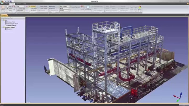
ClearEdge3D EdgeWise
EdgeWise is a rapid as-built modeling platform that utilizes advanced algorithms to streamline scan-to-BIM workflows, enhancing model accuracy and speed.
Faro As-Built
The FARO As-Built Software Suite enables architects and engineers to generate realistic building plans using exact as-built data, ensuring precise and efficient design. It is compatible with CAD and BIM systems both.
Leica CloudWorx
With Leica CloudWorx CAD plugins, users may work with reality capture data in AutoCAD, Revit, BricsCAD, and Bentley, among other CAD systems of their choice. This facilitates effective visualization, analysis, and 3D modeling, which speeds up the development of 2D drawings.
Pointfuse
PointFuse transforms point cloud data into user-friendly segmented 3D mesh models to help with decision-making in a variety of projects and sectors.
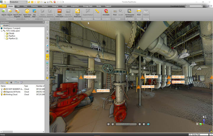
Trimble RealWorks
Trimble RealWorks is an efficient point cloud tool designed for efficient data processing and analysis. It offers functionalities such as inspection, calibration, modeling, and deep processing. Available in various editions, Trimble transforms data into valuable knowledge suitable for various industries and applications, using advanced precision technology.
GeoSLAM Hub
GeoSLAM HUB enables users to gather measurements, build floor designs, and manage data using SLAM processing. It provides fast workflows, data fidelity, and ongoing data collection for accurate construction.
Scantobim
With this Revit plugin, you can save 70% of your time by using Revit to extract walls, ducts, pipelines, and conduits from point clouds. This eventually will help you save about $42/month.
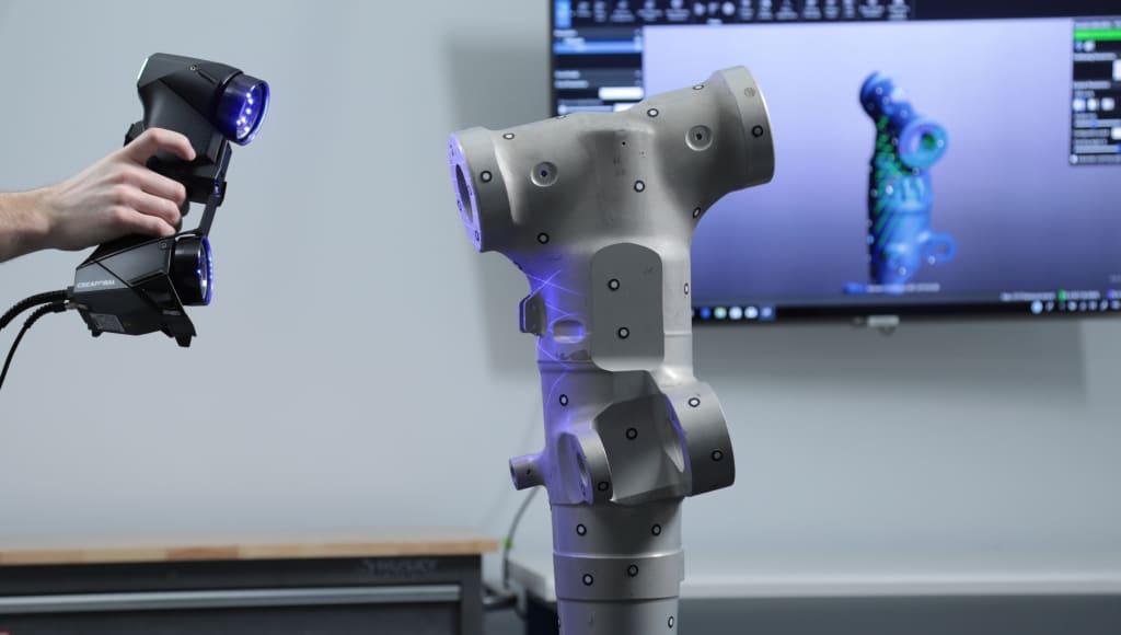
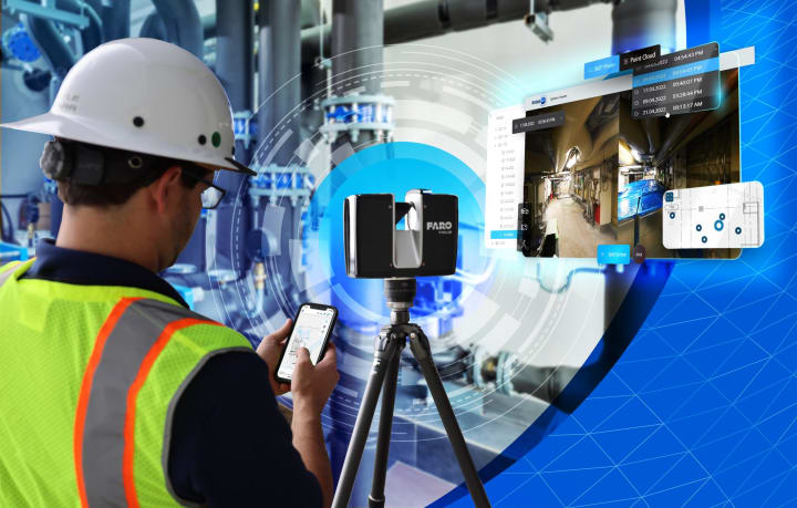
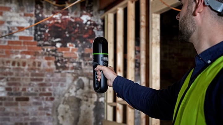
AI-powered laser scanners
Artificial intelligence (AI) gadgets have progressed from being inert objects to helpful companions and helpers; now, 77% of devices in use contain AI features. There will be 27.6 billion AI-enabled gadgets in use by 2027, up 57.4% from 2023. And one of the prominent ones among those would be AI-powered laser scanners. Given below are examples of AI-powered laser scanners and systems that you can buy right now:
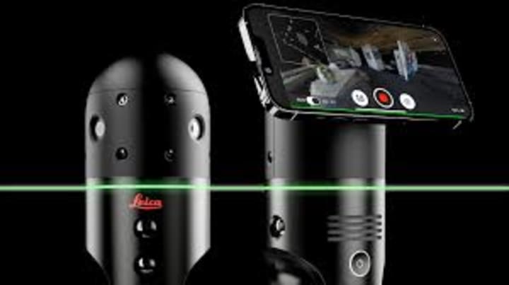
Leica BLK2GO
The BLK2GO is a portable laser scanner that creates 3D digital twins for large buildings, structures, or environments. It uses GrandSLAM technology for real-time space mapping and provides precise data for floorplans, BIM models, and 3D renders.
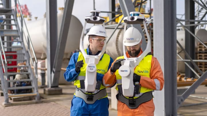
NavVis VLX
NavVis VLX laser scanning systems, powered by SLAM technology, are wearable devices for surveyors and reality capture specialists. It provides detailed data capture in complex environments, meeting professional needs and exceeding expectations.
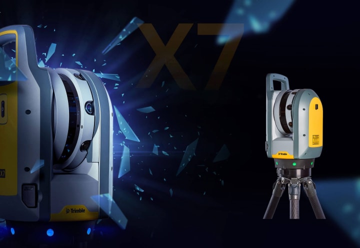
Trimble X7
The Trimble X7 3D laser scanning system is a user-friendly, fast, and accurate tool for surveyors and geospatial professionals. It utilizes Trimble Perspective field software for intuitive workflows and real-time data processing, with scan speeds up to 500 kHz.
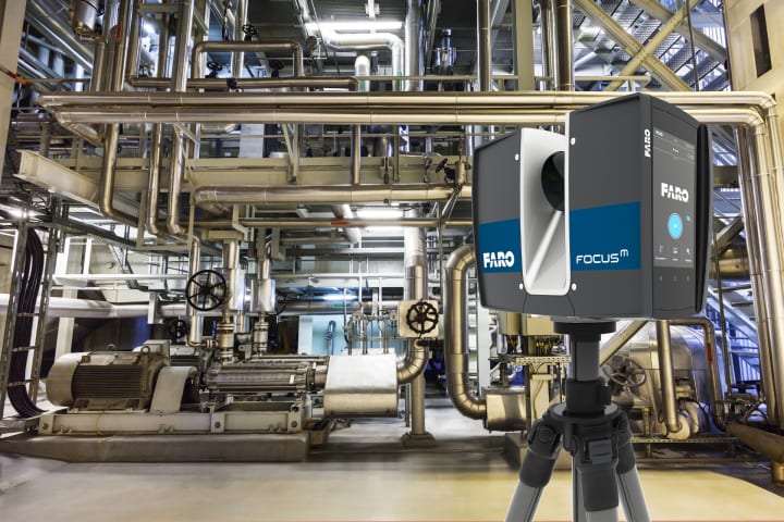
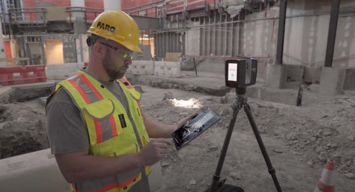
FARO Focus S
FARO Focus Premium and Focus Core are new 3D imaging tools, capturing images quickly and efficiently with hybrid reality capture and a 50% time-saving scan mode.
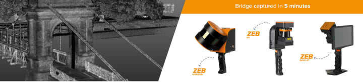
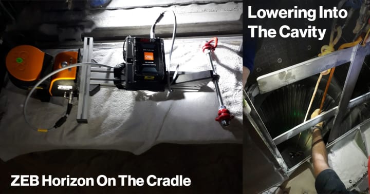
ZEB Horizon by GeoSLAM
The ZEB Horizon RT is a versatile mobile LiDAR scanner suitable for construction, mining, and forestry tasks. Its automation capabilities offer cost savings and faster job turnarounds through various scanning methods.
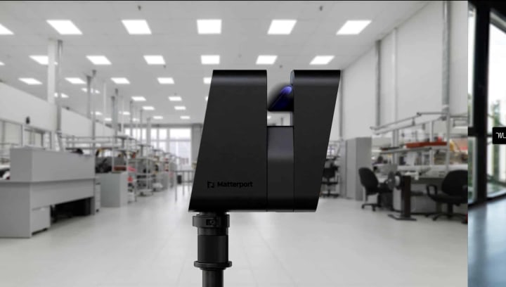
Matterport Pro3
The Pro3 camera, totally based on digital twin technology, creates vivid, life-like color digital twins in any space, including outdoors. It has a custom 20MP sensor and 12-element lens. It offers record-time scans and continuous scanning for efficient facility management.
Construction companies can stay ahead of the curve in a field that is changing quickly and help to build the future of smart construction by embracing AI.
You would love to read these article well
The Future of condtruction Technology: Autodesk's Vision And Roadmap
About the Creator
Alishna Brown
I am a renowned author, speaker and educator on BIM technology in the Architecture, Engineering, and Construction (AEC) industry. With over a decade of experience in the field, I have become a thought leader and consultant.
Keep reading
More stories from Alishna Brown and writers in Education and other communities.
Advance AEC Projects with BIM Technology
It might be difficult to transition from offline or partially online company practices to fully digitalized operations. The best course of action is to leave everything up to the professionals. Guide your business process with progressive BIM technology and industry experts so that you can profit from next-level change. Utilize cutting-edge tools, novel concepts, and the business insights of Building Information Modeling and you can surely grow your business.
By Alishna Brown3 years ago in Education
Me and Study: Nights I Didn’t Tell Anyone About
There were nights when the world slept, and I stayed awake with my books like they were the only witnesses to my existence. No one knew about those hours—not my friends, not my family, not even the version of me I showed during the day. These were the nights I didn’t talk about, because explaining them felt heavier than living through them.
By Inamullah Momand 5 days ago in Education


Comments
There are no comments for this story
Be the first to respond and start the conversation.