
Major Winter Storm Sweeps the Western and Midwestern United States
Millions are under weather alerts for heavy snow, dangerous cold, and flooding as a powerful system moves across the country.

A Widespread Weather Event Unfolds
A significant winter storm system is impacting a large portion of the United States. As of Sunday, December 7, 2025, over 18 million people are under various winter weather alerts. The storm is affecting regions from the West Coast through the Rocky Mountains and into the Midwest. This event combines multiple hazards, creating a complex and dangerous situation for millions of residents.
The Storm's Path and Primary Impacts
The system originated over the Pacific Ocean, pushing into the West Coast earlier this weekend. It then strengthened as it moved inland. The primary impacts are divided into three main categories. These are heavy mountain snow, bitterly cold wind chills, and coastal flooding. Each region is experiencing a different combination of these threats based on geography.
Heavy Snow Targets the Rockies and Plains
The most intense snowfall is occurring in the higher elevations. The Sierra Nevada, Cascades, and Rocky Mountains are seeing measured snowfall in feet, not inches. The National Weather Service has issued Winter Storm Warnings and Blizzard Warnings for these areas. Travel through mountain passes has become extremely dangerous or impossible. Heavy snow is also spreading into the northern Plains states.
Dangerous Cold Follows the Snow
Behind the initial surge of snow, a mass of Arctic air is plunging southward. This is leading to dangerously low temperatures and wind chills. Wind Chill Warnings and Advisories are in effect from Montana down to Nebraska. In these areas, wind chills are predicted to drop to -30 to -50 degrees Fahrenheit. This level of cold can cause frostbite on exposed skin in less than 10 minutes.
Coastal Flooding and Rain in the West
While the interior mountains see snow, the storm is bringing a different threat to the coasts. In California and the Pacific Northwest, strong onshore winds are combining with high astronomical tides. This is creating a risk of coastal flooding in low-lying areas. Meanwhile, lower elevations are experiencing heavy rainfall, which could lead to localized flooding, especially in areas with recent burn scars.
Midwest Braces for a Multi-Day Impact
The storm's effects are expected to be prolonged in the Midwest. States like Iowa, Minnesota, Wisconsin, and Illinois are under Winter Storm Watches. The system is forecast to deliver a mix of snow, sleet, and freezing rain over several days. The main concerns are significant snow accumulations and the potential for ice build-up on trees and power lines, which could cause outages.
Disruption to Travel and Commerce
The storm is causing major disruptions. Thousands of flights have been canceled or delayed at major airports from Seattle to Denver to Chicago. State departments of transportation are urging people to avoid non-essential travel. Interstate closures, particularly in mountain regions, are disrupting freight and supply chains ahead of the holiday season.
Emergency Preparations and Public Advice
Local and state emergency management agencies are activating resources. Shelters are opening in some major cities for unhoused populations vulnerable to the cold. Officials are advising the public to prepare emergency kits for their homes and vehicles. The kits should include food, water, medications, and warm blankets. People are also advised to check on neighbors, especially the elderly.
The Science Behind the Storm's Intensity
Meteorologists point to a strong jet stream dip, or trough, as the driver of this event. This pattern is pulling both abundant Pacific moisture and direct Arctic air southward. The clash between these air masses is fueling the storm's intensity. While winter storms are normal, the specific alignment of factors is creating an unusually extensive and potent system.
Climate Context and Changing Patterns
Scientists are often asked about the role of climate change in such events. A warmer atmosphere holds more moisture, which can potentially lead to heavier snowfall rates during winter storms. Furthermore, some research suggests that a warming Arctic can contribute to more frequent disruptions of the polar vortex. This can send bursts of extreme cold further south. This storm is consistent with those evolving patterns.
Safety Recommendations for Residents
For those in affected areas, key safety actions are critical. Stay indoors during the worst of the snow and cold. If you must go outside, wear multiple layers of loose-fitting clothing. Protect your extremities. Keep your vehicle's gas tank at least half full to prevent fuel line freeze. Allow faucets to drip slightly to prevent pipes from freezing. Never use generators or grills indoors due to carbon monoxide risk.
Looking Ahead: The Storm's Evolution
The system is expected to slowly push eastward through the early part of the week. The heavy snow threat will gradually shift from the Rockies to the Great Lakes region. The bitter cold air, however, will settle in and remain over the northern Plains and Midwest for several days after the snow ends. Residents should prepare for a extended period of harsh winter conditions.
A Reminder of Seasonal Preparedness
This storm serves as a stark reminder of the power of winter weather. It underscores the importance of personal and community preparedness at the start of the season. Ensuring your home is winterized, your vehicle is serviced, and your family has a plan can reduce risk. Staying informed through official weather forecasts is the best way to make safe decisions.
The Importance of Verified Information
During widespread weather events, misinformation can spread quickly. Residents are urged to rely on information from the National Weather Service and their local emergency management offices. Avoid sharing unverified storm reports or forecasts on social media. Accurate information is essential for public safety and effective response.
Conclusion: A Nation Weathering the Storm
As of December 7, 2025, a large part of the nation is facing a severe test from winter. The combination of snow, ice, wind, and cold presents a serious hazard. The focus now is on resilience, community support, and heeding official warnings. The storm's full impact will be assessed in the coming days, but the priority remains the safety and well-being of everyone in its path.
About the Creator
Saad
I’m Saad. I’m a passionate writer who loves exploring trending news topics, sharing insights, and keeping readers updated on what’s happening around the world.
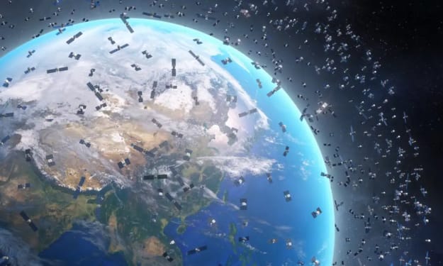
China’s Ambitious Satellite Plan: 200,000 Satellites and Counting
China has submitted an astonishing application to the International Telecommunication Union (ITU) to launch 200,000 satellites over the coming years. To put this into perspective, the entire world currently operates far fewer than this number. Even SpaceX’s Starlink project, one of the largest satellite networks globally, has plans for around 42,000 satellites. China’s proposal signals an unprecedented escalation in space activity and raises important questions: what are these satellites for, and what implications do they hold for global technology, security, and the environment? The Purpose Behind the Numbers At first glance, launching 200,000 satellites may seem excessive, but China’s goals are strategic and multifaceted. Experts suggest that these satellites could serve several purposes: 1. Global Internet Coverage China is aiming to build a massive low-Earth orbit (LEO) satellite network, similar to Starlink and OneWeb. By positioning thousands of satellites closer to Earth, they can provide high-speed internet to remote regions, rural areas, and even ships or aircraft in the oceans. This could help China expand its digital influence globally, offering connectivity in areas where traditional internet infrastructure is weak or non-existent. 2. Enhanced Military and Surveillance Capabilities A satellite network of this scale is also a game-changer for defense and surveillance. Satellites can monitor troop movements, track ships, and provide early warning systems. China’s military has been investing heavily in space-based technology, and these satellites could be a crucial part of modernizing its intelligence, surveillance, and reconnaissance (ISR) capabilities. 3. Scientific Research and Earth Observation Some of these satellites may be dedicated to Earth observation, collecting data on climate, agriculture, natural disasters, and urban development. With thousands of satellites constantly orbiting the planet, China could achieve near real-time monitoring of environmental changes and resource management, giving scientists and policymakers an unprecedented level of insight. 4. Competition in the Commercial Space Sector China’s plan is not purely for government use. The commercial potential of satellite networks is massive, from providing satellite internet services to supporting the burgeoning space economy. Companies under Chinese state and private ownership could leverage this infrastructure to offer services domestically and internationally, challenging Western tech giants in global space markets. The Scale of the Ambition Launching 200,000 satellites is not just ambitious; it’s historic. If approved and executed, China would operate more satellites than all other countries combined, fundamentally reshaping how space is utilized. However, there are serious logistical challenges. Manufacturing, launching, and maintaining hundreds of thousands of satellites requires enormous resources, advanced technology, and careful orbital planning to avoid collisions. China has made major progress in its space launch capacity, with frequent missions through the Long March rocket family and ongoing developments at the Wenchang and Jiuquan Spaceports. Yet, sustaining such a colossal fleet will test even the most advanced space programs. Global Implications The potential consequences of China’s satellite plan are profound, both technologically and geopolitically. 1. Space Traffic Management A network of 200,000 satellites could drastically increase the risk of collisions in orbit. Space debris is already a growing concern, and introducing tens of thousands of new satellites may exacerbate this problem. International cooperation and sophisticated traffic management systems will be essential to prevent catastrophic accidents in space. 2. Geopolitical Tensions China’s space ambitions may intensify global rivalry in space technology, particularly with the United States, Europe, and other spacefaring nations. Control over satellite networks can translate into strategic advantages, from military surveillance to dominance in global communications infrastructure. This may lead to a new phase of space competition reminiscent of the Cold War’s space race. 3. Impact on Astronomy Astronomers have already expressed concern over satellite mega-constellations interfering with observations. Thousands of bright satellites moving across the night sky can distort telescope images and hinder research into deep space phenomena. If China proceeds with 200,000 satellites, the challenge to professional and amateur astronomers will be enormous. 4. Global Connectivity Revolution On the positive side, if managed responsibly, China’s satellite network could revolutionize global connectivity, bringing internet access to millions of people who currently have none. It could accelerate digital development in underserved regions, support education, and foster global commerce in unprecedented ways. Regulatory Hurdles The ITU regulates global satellite usage, including frequency allocation and orbital slots. For China to launch 200,000 satellites, it must secure approval from the ITU, which evaluates whether such an immense network could interfere with other countries’ satellites or violate international agreements. This is not a mere formality—approval for a project of this scale could take years and may require negotiations with multiple nations. Conclusion: A Bold Step Toward the Future China’s application to launch 200,000 satellites is a bold statement about the future of space and global technology. It reflects the country’s ambition to dominate in digital infrastructure, military capability, and commercial space enterprise. While challenges abound—from space debris and regulatory hurdles to geopolitical tensions—the potential benefits are significant, particularly for connectivity and scientific advancement. As the world watches China’s next steps, one thing is clear: the age of satellite mega-constellations is here. How humanity navigates the risks and rewards of this new frontier will shape the future of communication, security, and our presence in space for decades to come.
By Muhammad Hassan4 days ago in Earth
At Least 22 Dead as Crane Collapses Onto Train in Thailand
Thailand has been plunged into mourning after a devastating accident in which a construction crane collapsed onto a moving passenger train, killing at least 22 people and injuring dozens more. The incident, described by officials as one of the deadliest infrastructure-related accidents in recent years, has raised urgent questions about construction safety, urban development, and oversight in the country.
By Aarif Lashari5 days ago in Earth
How to Succeed at the Benson Directory®
Congratulations and welcome to the Benson Directory® employee #22391! As our newest call handler, you will have the privilege of speaking with dozens of unique and interesting people on a daily basis as well as the opportunity to earn bonuses for high performance. Contained within this handbook you will find a set of ease to follow instructions designed to help you settle in to your new role and begin paving the way to success.
By S. A. Crawford2 days ago in Fiction


Comments
There are no comments for this story
Be the first to respond and start the conversation.