Meteorologists Warn of an Unusually Early Arctic Breakdown in February — Atmospheric Signals Not Seen in Decades
A Rare Disruption at the Top of the World Could Reshape Weather Patterns Across the Northern Hemisphere

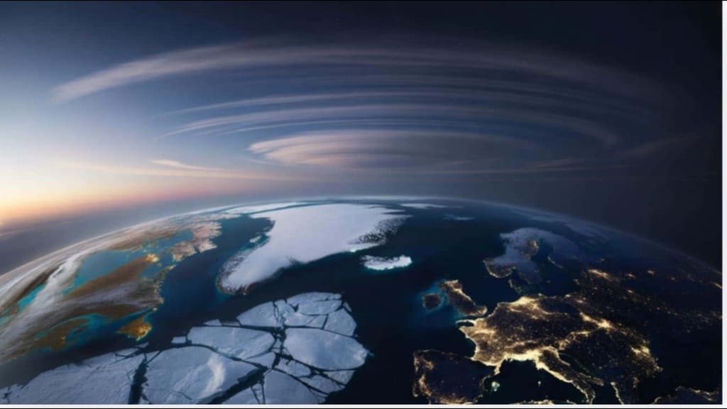
As winter deepens in the Northern Hemisphere, meteorologists are raising alarms about something unusual unfolding high above the Arctic Circle: an Arctic breakdown forming in February marked by atmospheric signals not seen in decades. While much of the world may still be shivering through routine winter weather, scientists watching from weather centers and research institutions are seeing patterns in the atmosphere that suggest one of the earliest and most pronounced disruptions of the Arctic’s typically stable winter circulation in modern memory.
This “breakdown” refers to a weakening and distortion of the polar vortex — the huge swirl of frigid air that normally hangs over the North Pole during the winter, acting as a cold reservoir that locks freezing air in place. What’s striking this year is both how early this weakening appears to be occurring and how strong the signals are that physicists and forecasters usually associate with spring or late winter, not early February.
What Exactly Is an Arctic Breakdown?
The polar vortex isn’t a movie villain — it’s an enormous high‑altitude cyclone of cold air, spinning in the stratosphere and troposphere above the Arctic. Under normal winter conditions, this vortex is compact and strong, effectively containing the coldest air near the pole. But when the vortex weakens — or even collapses — it can no longer hold that cold air in place. Instead, Arctic air streams out toward lower latitudes, while warmer air surges into northern regions.
Meteorologists talk about stratospheric warming, pressure anomalies, and jet stream distortions when they discuss how this process unfolds. What’s happening now are warming pulses climbing from lower latitudes into the Arctic stratosphere, warping the vortex’s usual form and setting off signals that experienced forecasters say are unusually early in the season.
For most people, the earliest sign of these changes won’t be the esoteric charts seen by atmospheric scientists — it will be subtle shifts in local weather patterns: unexpected warm spells followed by sudden cold snaps, bumpier jet stream behavior, and more frequent extremes than typical for this time of year.
Why This Year’s Signals Are Unusual
It’s rare for a major breakdown of the Arctic winter circulation to materialize this early. In the past, similar disruptions — such as the famous “Beast from the East” cold outbreak in Europe in 2018 — were associated with Sudden Stratospheric Warming (SSW) events that typically developed later in the winter or even into early spring. This year, the signals are lining up much earlier and with a distinct intensity, prompting forecasters from Europe to North America to watch closely.
Several key factors raise eyebrows among scientists:
Unusual stratospheric warming pulses rising into high latitudes sooner than expected.
Pressure anomalies that are reminiscent of decades‑old reanalysis patterns — signals that veteran meteorologists haven’t seen this early in the season.
A wavier jet stream, meaning the normally tight atmospheric currents are bending unpredictably, setting the stage for more volatile weather at mid‑latitudes.
This combination is not just a curiosity: it suggests the Arctic winter environment may be entering uncharted territory in terms of timing and structure, with potential consequences for weather across Europe, Asia, and North America.
From the Arctic to Your Backyard: How the Breakdown Can Affect Weather
An Arctic breakdown isn’t a single event that happens in isolation — its effects ripple downward through the atmosphere. When the vortex weakens, the jet stream tends to shift from a smooth, circular path into a more meandering pattern. These bends can act like atmospheric forks in the road, steering cold Arctic air south into regions unprepared for sudden cold snaps — and simultaneously allowing warmer air to surge northward into the Arctic itself.
The result? That weird sequence of weather many people have noticed in recent winters — sudden warm spells followed by dramatic cold returns, snow one week and thawing the next. With this early breakdown signal, such volatility could arrive sooner and be more frequent than average.
For communities, this means planning not just for one type of weather — like snow — but for rapid swings that can stress infrastructure, complicate travel, and affect energy demand as heaters and cooling systems cycle unpredictably. Farmers and emergency planners may need to pay even closer attention to long‑range forecasts than usual.
Climate Change and the Arctic’s Shifting Baseline
Underlying these unusual atmospheric signals is a broader backdrop of a rapidly warming Arctic. Scientists have documented that the far north is warming at roughly four times the global average, thinning sea ice and altering established seasonal rhythms. Sea ice that once formed thick and early in the winter is now thinner and more fragile, making it easier for atmospheric waves to punch through and destabilize the vortex.
This doesn’t mean every Arctic breakdown is directly “caused” by climate change, but the warming Arctic amplifies the likelihood and intensity of atmospheric distortions. In a climate system already stressed by rising temperatures, weather patterns are more prone to surprises and extremes.
What Experts Recommend
Meteorologists and climate scientists are urging the public to stay informed but not alarmed. Because these atmospheric shifts can produce a range of outcomes — from warm anomalies to deep cold blasts — the key is preparedness:
Watch updates from credible national weather services.
Understand that even mild forecasts can precede abrupt cold snaps.
Be ready for rapid temperature swings and localized extremes.
Pay attention to marine and coastal forecasts, as sea ice changes can influence local conditions.
Conclusion
An unusually early Arctic breakdown forming in February — with atmospheric signals not seen in decades — is more than an intriguing meteorological trend. It’s a reminder of how dynamic and interconnected Earth’s atmosphere truly is. What begins high above the frozen North can reach into millions of lives thousands of kilometers away, shaping the weather we live with and how we prepare for it.
As this story continues to unfold in the weeks ahead, scientists will watch closely — not just for dramatic headlines, but for the nuanced ways in which our atmosphere’s “seasonal script” may be quietly rewriting itself.


Comments
There are no comments for this story
Be the first to respond and start the conversation.