Map drone solutions
Bio
Map Drone Solutions is a firm that offers drone-based services for various applications, including construction and aerial inspection. Their construction services include pre-bid services, site surveys.
Stories (6)
Filter by community
How Surveyors Measure Elevation with High Precision?
Accurate elevation data is one of those behind-the-scenes details that most people don’t think about, until it becomes a problem. A home built a few inches too low, a commercial site that doesn’t drain properly, or a property flagged incorrectly for flood risk can lead to costly consequences. That’s why professional surveyors place so much emphasis on precise elevation measurements, especially in a geographically diverse state like Georgia.
By Map drone solutions2 months ago in Chapters
Smart Infrastructure’s Future: Drone Thermal Inspection in Georgia
Technological innovation has completely transformed how we view, maintain, and protect infrastructure. Among the most revolutionary advances in this field is thermal imaging via unmanned aerial vehicles, more commonly known as drones. In recent years, drone thermal inspection has rapidly emerged as a critical tool across industries such as energy, construction, agriculture, and environmental monitoring.
By Map drone solutions4 months ago in Journal
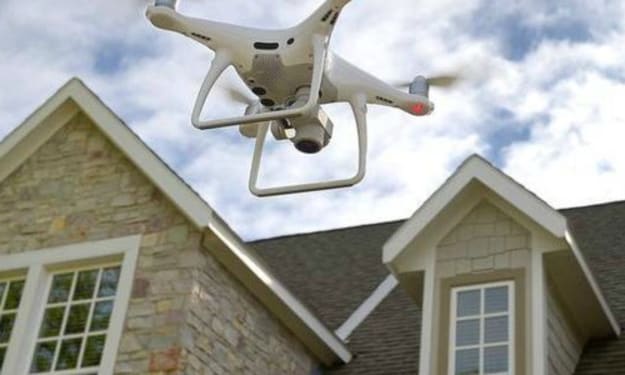
The Future of Roof Inspections: Drone Building Roof Inspection Surveys
Roof inspections are a critical part of property maintenance, particularly for commercial and residential buildings. Traditionally, roof inspections required inspectors to climb ladders, use scaffolding, or even rely on drones for specific views. However, advancements in technology have made roof inspections safer, quicker, and more accurate, with the rise of drone-based roof inspection surveys leading the way. In this article, we will explore how these innovative surveys are revolutionizing roof inspections and why they are becoming the preferred method for homeowners, businesses, and roofing professionals alike.
By Map drone solutions10 months ago in Journal
The Role of Elevation Services in Georgia’s Flood Risk Management
Flooding is one of the most significant natural disasters that can strike communities, particularly in areas with a history of heavy rainfall, coastal storms, or rapid urbanization. In Georgia, the risk of flooding is amplified due to the state’s varied geography, ranging from coastal plains to mountainous regions. One of the most effective strategies to mitigate the impacts of flooding is the accurate assessment of land elevation. Elevation measurements in Georgia play a crucial role in understanding flood risk, planning for flood events, and implementing effective flood management policies. In this post, we will explore the importance of elevation measurement services in Georgia and how they contribute to the state’s flood risk management efforts.
By Map drone solutionsabout a year ago in Journal
Commercial vs. Residential Roof Inspections: What You Need to Know
In recent years, drone technology has revolutionized various industries, and roof inspections are no exception. The use of drones for inspections offers a safer, more efficient, and cost-effective solution compared to traditional methods. Whether for commercial or residential properties, understanding the best drone for roof inspections can make a significant difference in how effectively and safely inspections are carried out. This article delves into the best drone options available for both commercial and residential roof inspections, outlining their features, benefits, and considerations for use.
By Map drone solutionsabout a year ago in History