
Top Mammoth Hikes: Mono Lake, Rainbow Falls, Devils Post Pile National Monument, Red Cones Trail.
Hiking in Mammoth Lakes, California.

Mammoth Lakes is located in the Sierra Nevada mountains in Northern California. This beautiful mountain town attracts visitors for each season, from winter skiing to summer hikes surrounded by an abundance of alpine lakes. This article will cover saltwater Mono Lake, Rainbow Falls, Devils Postpile National Monument, and Red Cones Trail.
Ted Konigsmark author of Geologic Trips California: Sierra Nevada describes the geologic history behind Mammoth. This historical description is what many locals spoke to me about while hiking the landscape of the Sierra Mountains. I highly recommend Ted Konigsmark's text which is linked above in the title. "The Mammoth area is one of the most volcanically active areas in the lower 48 States. From Bishop to Mono Lake...(there are) volcanoes, domes, craters, fumaroles, hot springs, and many different types of volcanic rocks, including rhyolite, andesite, basalt, obsidian, pumice, tuff, and welded tuff....Much of this volcanic activity is associated with the Long Valley Caldera, the remains of a huge volcano that erupted 760,000 years ago. Most of the remaining volcanic activity is associated with the Inyo and Mono Craters, a trend of domes and craters that extend from the Long Valley Caldera north to Mono Lake. All of the volcanic features in this area lie along the fault zones that define the eastern escarpment of the Sierra Nevada... The volcanism began four million years ago... and has continued up to the present time. During uplift, the earth’s crust was stretched, faulted, and broken along the mountain front and magma from deep within the crust made its way upward along the broken rocks in the fault zones"(2003).
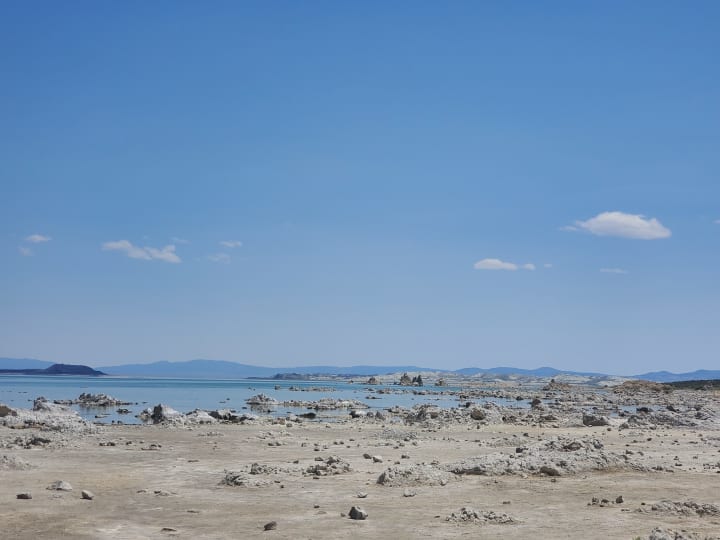
Mono Lake is a saline lake located north of Mammoth, home to brine shrimp, millions of birds: American Avocet, Western and Least Sandpipers, Snowy Plover, White-faced Ibis, Dowitcher, along with the occasional rare appearances of Whimbrel, Baird's Sandpiper, Sabine's Gull, Black Tern, and Parasitic Jaeger, and world-famous tufa towers. Since 1978 Mono Lake Committee has restored its surrounding lands and tributary streams (Mono Lake supplies water to Los Angeles). To learn more about the education, restoration, and donation process click here.
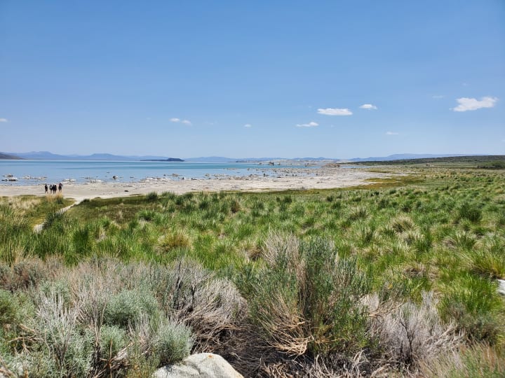
I drove south to Mono Lake (pronounced moe-no instead of mono the infectious disease) from Tahoe in June 2021. The vast body of water brightens the drive immediately. I found a 12 car pay parking lot, wheelchair accessible, and walked out toward the volcanic earth surrounding the water. The feeling of "other planetary exploration" is found as one walks the beach. I was spoiled with the fact that only one other person was on the beach. These moments almost alone with nature, are thrilling to behold.
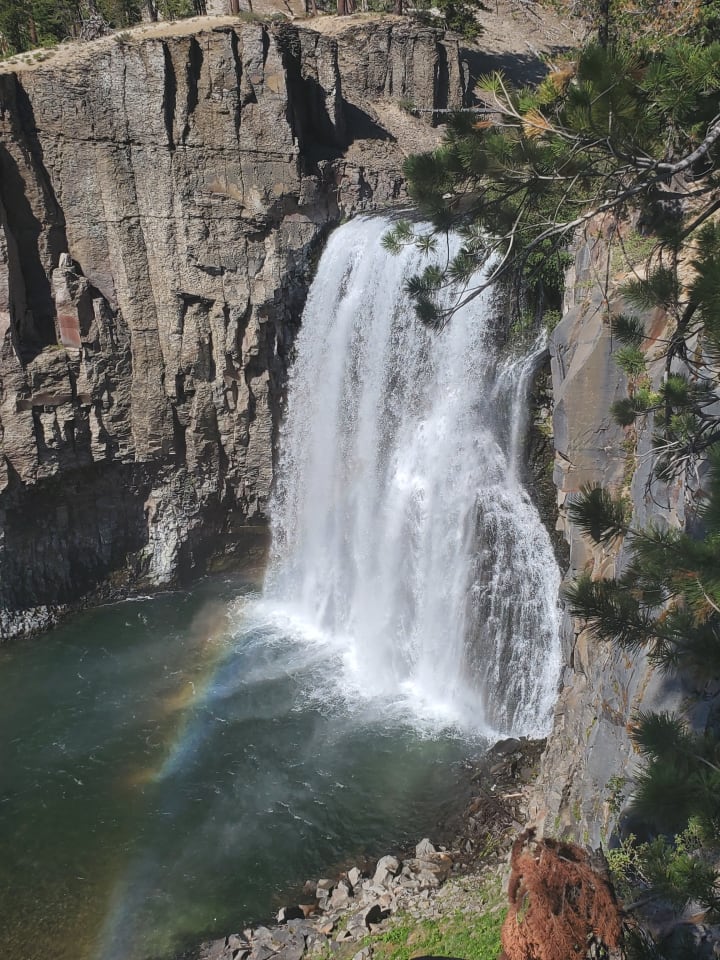
Rainbow Falls at 101-feet, is the highest waterfall on the Middle Fork of the San Joaquin River, in the eastern Sierra Nevada mountains of California. During summer, the rainbows can easily be viewed at the base of the fall. Rainbow Falls is inside the Inyo National Forest, entrance is charged by vehicle or free with a national park pass. For more information on Inyo National Forest camping, fishing and directions click here. From the parking lot, the walk to Rainbow Falls is only 2.5 miles. The dirt path and falls are pet-friendly. Many families bring picnics, wear bathing suits, and make an afternoon out of playing at the base of the fall.
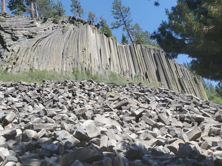
Devils Postpile National Monument is a one-mile walk, along the same route to Rainbow Falls! Devils Postpile is made up of thousands of hexagonal basalt columns formed 100,000 years ago when lava flow slowed and then cooled and cracked. You can view Devils Postpile from the base and hike up to the top, where you can view the hexagonal shape up close. The hexagonal pattern atop makes one think of a sci-fi film in which the pattern is a map for extraterrestrial visitors.
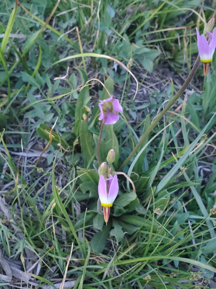
As you walk along the trail to Devils Postpile there is a variety of flowers and vegetation, below is a picture of the Alpine Shooting Star, a delicate beautiful flower.
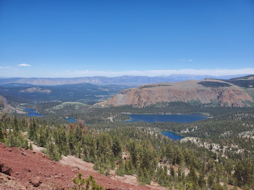
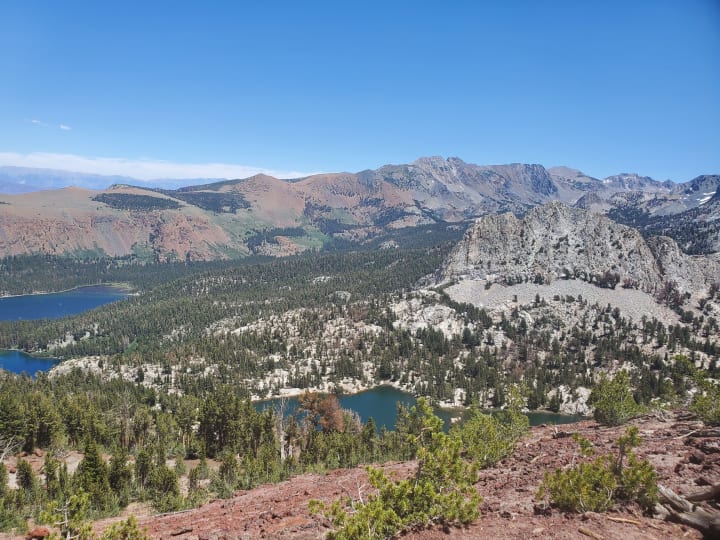
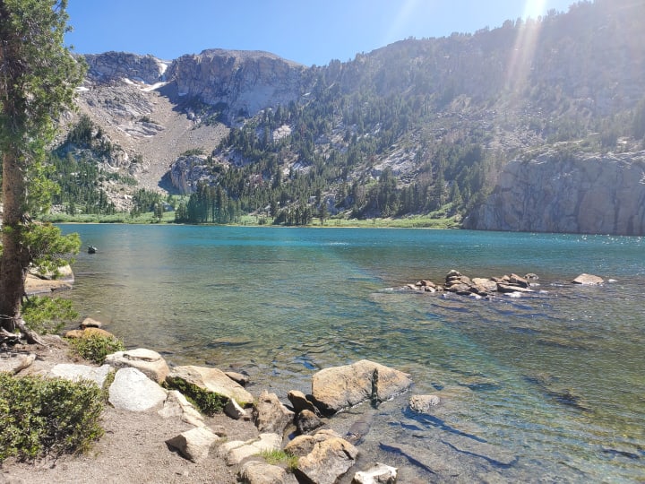
Red Cones Trail starts from Horseshoe Lake. This trail goes past McCloud Lake and over the relatively gentle Mammoth Pass. Several trail junctions offer options to access the John Muir trail near Crater Meadow or Reds Meadow. The picture below and the cover picture for this article are from the summit of Red Cones Trail. As you hike back down there are lakes to swim in and relax.
If you are looking for places to eat after these nature outings check out my article Eat Like a Local in Mammoth.
Thank you for reading this article. If you want to share your Mammoth experience with me, you can find me on Instagram at Tess._1531. If you enjoy supporting artists click the heart/like button and donate a tip; I appreciate it.
About the Creator
Keep reading
More stories from Tess Timmons and writers in Wander and other communities.
Death Valley, California Road Trip
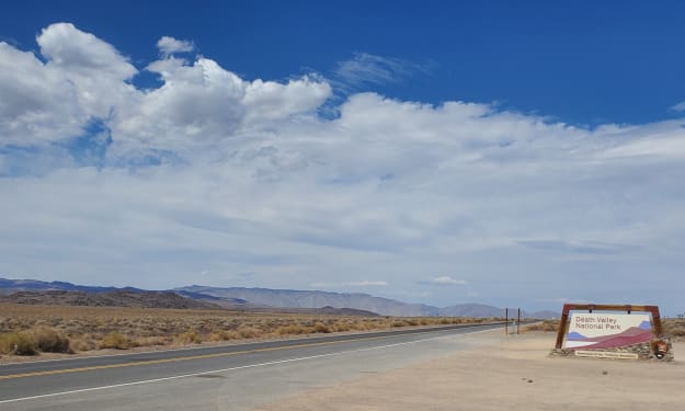
Have you ever been called by nature? Death Valley National Park called my name; I’m deeply grateful I listened. I visited the hottest place on Earth during the hottest year ever recorded! On July 9, 2021 Death Valley reached 130 degrees, record-breaking heat. I was there June 21-22, 2021, the temperature reached 107, with a refreshing wind during the day.
By Tess Timmons4 years ago in Wander
Merzouga, Morocco Golden Dunes by Morocco Family Vacation
Standing at the edge of the Sahara in Merzouga, watching golden dunes stretch endlessly into the horizon, I realized this was one of those rare travel moments that stays with you forever especially when you experience it with your children.
By Ariel Cohenabout 12 hours ago in Wander


Comments
There are no comments for this story
Be the first to respond and start the conversation.