
Hyperspectral Imaging's role in remedying mining's environmental impacts
Pixxel Space

Featured snippet: Discover how hyperspectral imaging satellites are transforming mining through mineral extraction and environmental restoration. These satellites provide insights into mineral compositions and heavy metal identification. Explore the integration of this technology in mining operations, paving the way for a future where innovation and preservation coexist.
In an era of constant technological innovation, a new earth observation technique has emerged, promising to reshape industries and foster sustainable practices. Enter hyperspectral imaging satellites, an innovative approach that holds the potential to revolutionize the mining sector. Although known for its potential in detecting and extracting valuable resources, hyperspectral imagery plays an equally crucial role in restoring our planet's delicate balance by supporting the remediation of mining impacts.
The challenge with closed mine sites and hyperspectral imaging's solution
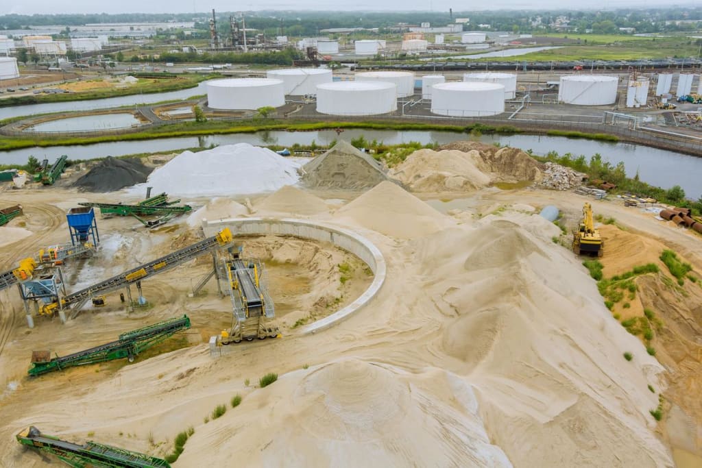
Historically, extracting minerals essential for everyday activities has taken a toll on the environment. Traditional mining practices have left scars on the Earth's surface, and their consequences linger long after mining sites are closed. However, novel Earth compliance techniques, including hyperspectral imaging satellites, are rewriting the narrative of mining's ecological footprint by providing extensive coverage at high spatial and spectral resolutions.
The allure of space-based hyperspectral imaging lies in its capacity to deliver a vivid, spectral capture of the scene below. Unlike traditional satellite imagery, such as multispectral imaging, these instruments capture the world in bands of light invisible to the human eye and conventional sensors. This expanded spectral capture reveals mineral signatures and elemental compositions with remarkable precision. This newfound vision transforms the role of satellites from passive observers to active agents of environmental regeneration.
Environmental remediation and heavy-metal management
Central to mining's environmental challenge is the management of heavy metals — essential yet perilous elements. Hyperspectral imaging's end-member classification discerns these elements with unparalleled accuracy. Materials, including copper, lead, and zinc, each possess a unique spectral signature.
This technological progress enables mining operations to not only identify deposits but also direct their extraction with precision, minimizing waste and the accidental release of these heavy-metal envoys into the surrounding natural and urban environments.
Abandoned mine lands (AMLs) can pose serious threats to human health and the environment, often featuring unsupervised tailing dams, unstable slopes, contaminated soils, and compromised water bodies. For these issues, hyperspectral imaging emerges as a technologically based remedy for these threats.
Tailings dams are some of the largest engineered structures on Earth. These earth-filled embankment dams are built to store all the byproducts of mining operations in place. Monitoring tailing dam stability has historically been a challenge. Hyperspectral imaging satellites provide a unique perspective of these structures, in particular the contaminants present.
Soil and water contamination pose serious threats to ecosystems far beyond mining sites. Different contaminants have different spectral signatures, and soils and vegetation also have altered signatures when contaminated.
Therefore, hyperspectral imaging sensors utilize their high spectral resolution to detect polluted soils or water bodies, facilitating precise containment and rehabilitation strategies. This objective approach to environmental restoration offers hope for ecosystems diminished by industrial activities while also aiding timely decisions to protect communities and economies.
Environmental monitoring and industry commitment
Hyperspectral imaging satellites orbiting our Earth act as vigilant guardians against environmental hazards stemming from mining activities, including leaks and leaching.
By detecting variations in spectral signatures, hyperspectral imaging provides early warning of contamination events. Swift intervention becomes possible, ensuring that soils and waters remain untainted and the delicate balance of ecosystems is preserved. AMLs which may otherwise go overlooked can be actively monitored for signs of ecological deterioration.
The urgency surrounding the challenges posed by AMLs has sparked commitment from prominent mining corporations. Initiatives like the Mining Association's Collaborative Agreement for AML Restoration enable formal commitments by industry leaders to address the aftermath of mining activities. Through this collaborative pact, MiningCo and other major players have committed to integrating monitoring practices and timely interventions and embracing cutting-edge technologies for environmental risk mitigation.
Combining hyperspectral data with other remotely sensed datasets
The integration of hyperspectral imaging data with other Earth observation datasets and remote sensing technologies provides insights that extend from the laboratory to the boardroom. Mining engineers, equipped with high spectral resolution data, make informed decisions that streamline resource management, operational efficiency, and environmental integrity.
In particular, the combination of hyperspectral imaging and LiDAR (light detection and ranging) techniques could be revolutionary for preventing landslides around mining sites. By accurately assessing terrain composition and identifying subtle surface changes, these advanced technologies enable the detection of slope instability, enhancing site safety and minimizing environmental risks.
Linking space and sustainability
Collaboration between mining enterprises and hyperspectral satellite imagery companies enables the sustainable integration of this technology in daily operations. Commercial hyperspectral satellite imagery providers, such as Pixxel, who are aware of the industry's environmental imperatives, offer tailored solutions tailored to the mining industry's unique demands. This synergy foreshadows an era where technological innovation meets the preservation of our planet.
Towards a remediated future
Hyperspectral imaging technology continues to evolve, introducing improved algorithms and detection capabilities across several industries and applications, including agriculture and emissions detection. This technology, once reserved for high-paying, exclusive clients, is now available commercially as readily deployable missions.
In the chronicles of mining advancements, hyperspectral imaging emerges as the bridge between exploration and restoration. With its ability to unravel mineral locations, classify heavy metals, and mend environmental conditions, this technology marks a new chapter in mining's legacy.
Pixxel is a leading remote sensing company planning to launch a constellation of hyperspectral imaging satellites. These earth observation satellites will provide near-real-time imagery with a spatial resolution of 5 m and unprecedented spectral fidelity. Get in touch with Pixxel's skilled sales team to find out more about how hyperspectral imagery can help your organization.
About the Creator
Pixxel Space
https://www.pixxel.space/ is a space technology company working towards creating the world's highest resolution hyperspectral imaging satellite-imaging constellation.
Keep reading
More stories from Pixxel Space and writers in Serve and other communities.
Hyperspectral Imaging Made Easy For The Agriculture Industry
As ground-breaking technology infiltrates the world of food production and distribution, big agricultural corporations stand to benefit from such advancements. One such technology that has revolutionised the agriculture industry is hyperspectral imaging.
By Pixxel Space2 years ago in Earth
Stolen Bike, Not Valor
Koa was riding his new electric bike through the city park not too far from the US Embassy where he served in an Asian country. The ride was a part of his daily evening workout. He didn't really like the idea of an electric bike because he thought it was lazy. Besides, Koa had another good mountain bike he'd bought here used and it gave him a much better workout. But this one was his girlfriend's gift for his 29th birthday that she had taken the trouble to ship to him across the ocean. Koa felt obliged to ride it out at least occasionally, but promised himself not to use the battery. He even took it off the bike, to avoid the temptation.
By Lana V Lynx26 days ago in Serve


Comments (1)
Nice work hard