
Winter Storm Watch: Central Ohio Could See Up to 12″ of Snow This Weekend
National Weather Service issues winter alerts as storms strengthen; travel impacts and dangerous cold expected through Sunday.

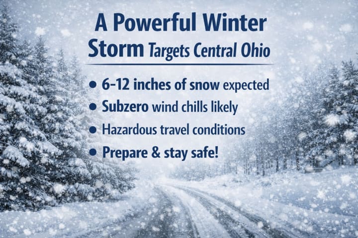
A powerful winter storm is set to impact central Ohio this weekend, bringing the potential for 6 to 12 inches of snowfall. Meteorologists are urging residents to prepare for hazardous travel conditions, reduced visibility, and rapidly dropping temperatures. Alongside heavy snow, subzero wind chills are expected, making outdoor exposure dangerous. Power outages and disruptions to daily routines are also possible as the storm intensifies. Local authorities recommend stocking up on essentials and limiting unnecessary travel. This could be one of the most severe winter events of the season for the region. Stay informed, stay warm, and prioritize safety as the storm approaches.
Central Ohio could see up to 12 inches of snow this weekend as a potentially major winter storm moves into the region. Forecasters warn that heavy snowfall, dangerous wind chills, and icy conditions may create hazardous travel and widespread disruptions. Residents are being urged to prepare early, limit unnecessary trips, and stay updated on weather alerts. If projections hold, this storm could rank among the most impactful winter events of the season.

COLUMBUS, Ohio — A powerful winter storm is beginning to take shape across much of the central, southern, and eastern United States, with central Ohio firmly in its path this weekend. Meteorologists say the region could receive several inches of snow as the system strengthens and pushes eastward.
The National Weather Service has already issued a Winter Storm Watch for multiple counties in central Ohio, signaling the potential for hazardous conditions. The watch stretches far beyond Ohio, covering areas from New Mexico and Texas through the Carolinas and up into the northeastern United States. Forecasters warn that this widespread system could bring significant snowfall, dangerous travel conditions, and bitter cold in its wake.
Residents are being urged to stay alert, prepare early, and monitor official updates as the storm develops. If current projections hold, this could become one of the most impactful winter weather events of the season across large portions of the country.
Things to Know About the Upcoming Winter Storm
Much of the Columbus, Ohio area could receive between 6 and 12 inches of snow.
A Winter Storm Watch has been issued for central Ohio counties and is set to take effect at 7 a.m. Saturday.
Snow is expected to begin Saturday afternoon or evening and continue through Sunday night.
Impacts are likely to increase the farther south you travel.
Heavy snow combined with strong winds could lead to dangerous and difficult travel conditions.
Residents are urged to prepare in advance, monitor weather updates, and avoid unnecessary travel as the storm unfolds.

**How Much Snow Is Expected in Columbus, Ohio?**
The latest forecast from the 10 Weather Impact Team suggests that Columbus could be in line for a significant snowfall as this winter storm shifts its heaviest impacts farther north. By the time the system wraps up early Monday morning, the Columbus metro area is likely to receive **8 to 12 inches of snow**, placing it among the hardest-hit regions.
Across central and southern Ohio, totals are expected to range from **6 to 12 inches or more**, with the highest accumulations likely **south of I-70**. Forecasters warn that these totals could still fluctuate as the storm evolves, but current projections point to a major snow event with widespread travel disruptions.
Residents are encouraged to prepare for heavy snow, monitor updated forecasts, and limit unnecessary travel as conditions worsen through the weekend.

Light snow could begin in central Ohio as early as 4 p.m. Saturday, marking the start of what may become a significant winter weather event. While exact timing is still evolving, forecasters expect snowfall to intensify through Saturday evening and continue overnight, with steady and heavier bands developing as the storm strengthens.
This system has the potential to deliver one of the largest snowfalls of the season, if not the biggest. Meteorologists are closely analyzing incoming data to refine the forecast and provide the most accurate updates as confidence increases. Residents are advised to stay alert and prepare for rapidly changing winter conditions.

**How Cold Will It Be This Weekend in Central Ohio?**
Alongside the incoming snow, central Ohio is bracing for a sharp drop in temperatures, with readings expected to fall into the **single digits as early as Friday evening**. This cold surge will bring **widespread and prolonged subzero wind chills**, making outdoor conditions feel dangerously cold.
From Friday night into early Saturday, wind chills could range between **–5°F and –15°F**, raising concerns about frostbite and exposure risks. While some uncertainty remains about the exact track and strength of the storm, forecasters are confident that Ohio will face a significant winter impact.
**What’s Certain for Ohio:**
* Snow is expected from **Saturday afternoon or evening through Sunday night**.
* Impacts will increase the **farther south** you go.
* Snow and gusty winds will combine to create **difficult and hazardous travel conditions**.
Residents are urged to prepare for extreme cold, stay updated on weather alerts, and limit unnecessary travel as the storm unfolds.
About the Creator
Keep reading
More stories from S.A Charles and writers in Journal and other communities.
Valentino Garavani
In the golden age of couture, when fashion was less about speed and more about soul, one name quietly rose to become synonymous with timeless elegance: Valentino Garavani. To speak of Valentino is to speak of romance, discipline, beauty, and a lifelong devotion to the art of dressing the world’s most admired women.
By S.A Charles3 days ago in Art
Learning to Surrender Control to God
Surrender is one of the most misunderstood ideas in the Christian life. For many people, the word itself triggers resistance. It sounds passive, frightening, or even irresponsible. We are taught to plan carefully, protect ourselves, and stay in control. Faith, however, introduces a different way of living, one that asks us to loosen our grip and trust Someone beyond ourselves.
By Sound and Spirit6 days ago in Journal
Rage
Content Warning: Domestic Violence, Assault Rage D. A. Ratliff “Who did this?” My voice echoed through the house. All I wanted was a cup of tea, but one of the twins, running through the house like maniacs, knocked it over. My nerves tingled, and every muscle in my body felt coiled like a spring. Survival seemed out of reach.
By D. A. Ratliff4 days ago in Fiction


Comments (1)
Stay safe. We’ve got sleet and ice coming our way, and I’m terrified. The last ice storm I was in was treacherous—power was out for a week.