
Mega-Tsunami Threat, How Could a 1,000-Foot Wave Strike the U.S. Pacific Coast?
Mega Tsunami Warning

Overview: A Catastrophic Scenario Unfolds
Scientists are raising alarm over a potential mega-tsunami—a wave nearly 1,000 feet high—that could devastate parts of the U.S. Pacific Coast. The trigger: a massive earthquake along the Cascadia Subduction Zone (CSZ), a 600-mile-long fault stretching from Northern California to Vancouver Island
Researchers at Virginia Tech, led by geoscientist Tina Dura, estimate a 15% chance of an earthquake magnitude 8.0 or greater occurring in the next 50 years along this zone
Such a quake could abruptly sink coastal land by up to 6.5 feet, dramatically altering floodplains and amplifying tsunami threat
This alarming scenario highlights an urgent need for advanced preparedness, early warning systems, and robust infrastructure planning to safeguard vulnerable communities.
Why Now? The Science Behind the Fear
The Cascadia Subduction Zone: A Sleeping Giant
The CSZ lies off the U.S. West Coast, where the oceanic Juan de Fuca Plate subducts beneath the North American Plate, generating immense tectonic stress.
Geological records trace mega-earthquakes in this region back centuries. Notably, a giant quake in 1700 triggered a tsunami that reached distant shores like Japan
Earthquake Probability: Rising Odds
A Virginia Tech study places a 15% probability of an M 8.0+ quake in the next 50 years
Some earlier estimates suggested a higher likelihood—between 10–15% for M 9+, or even 37% for M 8+ events
Land Subsidence and Coastal Flooding
A quake of this magnitude could cause coastal land to drop up to 6.5 feet, instantly expanding flood zones and inundating infrastructure
Tina Dura warns that this would create urban uninhabitability and slow recovery, especially in major cities like Seattle and Portland
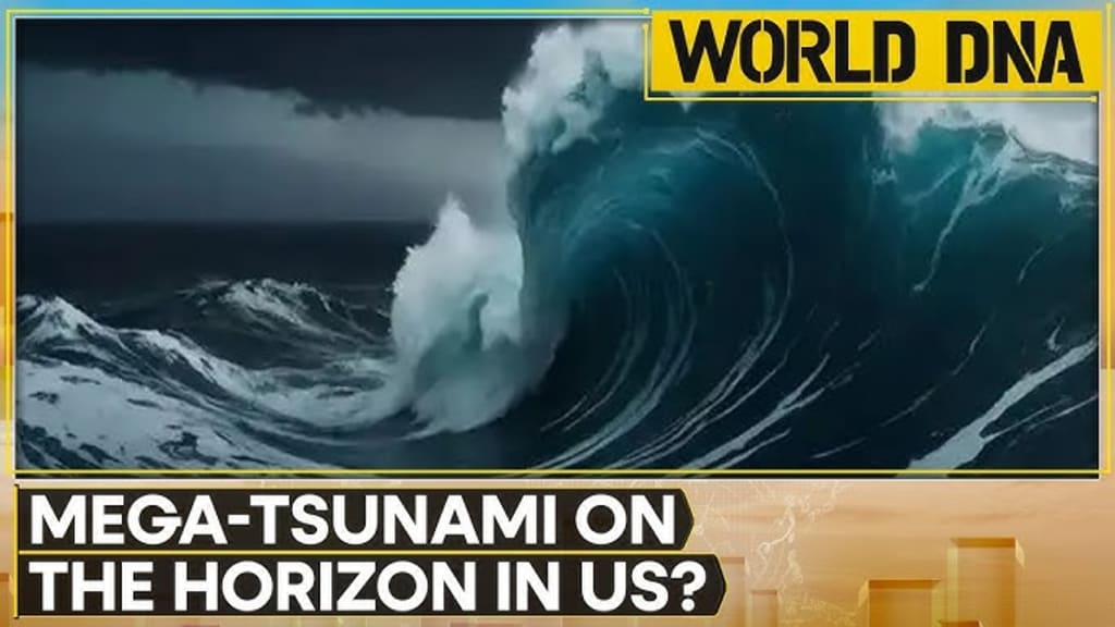
Mega-Tsunami: Not Your Ordinary Wave
Unlike typical tsunamis, mega-tsunamis tower hundreds or thousands of feet, moving far inland and wreaking catastrophic damage.
A wave of up to 1,000 feet could effectively erase coastal cities within minutes
Historic Precedents and Global Patterns
Lituya Bay, Alaska — The Biggest Wave Ever Recorded
In 1958, a quake-induced landslide at Lituya Bay generated a 1,719-foot tsunami—the tallest ever measured
This natural event shows that mega-tsunamis can occur from geological shifts and massive landslides.
Hawaii’s Volcanic History
Geological evidence suggests a 1,000-foot tsunami struck Lanai about 105,000 years ago, triggered by a volcanic collapse
Hawaii remains vulnerable due to ongoing volcanic activity and unstable terrain
Regions at Risk: A Broader Geographic Threat
U.S. West Coast: High-Risk Zones
Coastal areas of Northern California, Oregon, and Southern Washington face the most immediate danger.
Major population centers—including Seattle and Portland—could be catastrophically impacted
Alaska & Hawaii: Multi-Threat Regions
Alaska: Increasing landslide potential due to melting glaciers adds tsunami risk
Hawaii: Volcanic collapses and seismic activity could precipitate another mega-tsunami
The Human Cost: Infrastructure, Lives, and Recovery
Vulnerabilities in Urban Centers
Many West Coast cities, including Seattle and Portland, were not built for such monumental earthquakes or waves. Their infrastructure is vulnerable, especially unreinforced buildings and aging lifelines
FEMA estimates have projected 13,000 fatalities, 27,000 injuries, and over 1 million displaced in a mega-earthquake scenario, potentially making it North America’s deadliest natural disaster
Inadequate Preparedness
Current tsunami maps and readiness plans fall short of accounting for mega-tsunami scenarios. Virginia Tech researchers criticize outdated risk assessments
Emergency infrastructure—like evacuation routes, vertical shelters, and warning systems—remains limited.
From Scientific Study to Action: What Must Be Done?
National and Local Preparedness Upgrades
Revise Risk Maps: Incorporate worst-case mega-tsunami projections into hazard planning.
Strengthen Infrastructure: Enforce seismic retrofitting and build coastal barriers.
Create Vertical Evacuation Structures: Build safe, elevated refuge points inland.
Community Drills & Education: Ensure residents understand tsunami behavior, evacuations, and tsunami signage.
Early Warning Enhancements: Deploy advanced sensors, drones, and real-time communication networks.
Showcase Indigenous Resilience: Pacific Northwest tribes have relocated or elevated community centers—a model worth amplifying
Global Lessons: Learning from Other Disasters
The 2004 Indian Ocean tsunami struck with little warning, killing over 230,000. The tragedy highlighted the importance of warning systems and disaster communication
The Hunga Tonga–Hunga Haʻapai eruption in 2022 demonstrated how far-reaching volcanic tsunamis can be, causing damage across the Pacific, including the U.S. West Coast
A Call to Action: Never Too Late to Prepare
The possibility of a mega-tsunami may sound like science fiction, but the science is clear—and so is the message: preparation matters.
Urban planners, emergency services, and coastal communities must treat this threat as real—not remote.
Time is the most critical resource once such events strike. Being proactive today can save lives tomorrow.
The CSZ hasn't ruptured since 1700. History tells us it likely will again. Are we ready?
Summary Table: Mega-Tsunami at a Glance
Topic Key Details
Fault Zone Cascadia Subduction Zone (600 miles, U.S. Pacific Coast)
Earthquake Probability ~15% chance of M 8.0+ quake in 50 years
Land Subsidence Up to 6.5 feet sudden drop in coastal areas
Mega-Tsunami Height Potentially up to 1,000 feet
High-Risk Regions Northern California, Oregon, Washington, Alaska, Hawaii
Historical Precedents Lituya Bay (1,719 ft) and Lanai volcanic wave (1,000 ft)
Urban Vulnerabilities Unreinforced buildings, bridges, limited evacuation infrastructure
Preparedness Gaps Outdated risk maps, inadequate warning systems, lack of vertical shelters
Recommendations Update planning, build resilient infrastructure, community education
Global Lessons 2004 tsunami highlighted warning systems; 2022 Tonga event showed reach
As of August 16, 2025, the Times of India article (and supporting studies) underscore that mega-tsunami risk is not hypothetical but a credible threat backed by cutting-edge scientific analysis
Ongoing vigilance, informed policy, and resilient infrastructure are our best insurance against one of nature's most devastating phenomena.
About the Creator
Omasanjuwa Ogharandukun
I'm a passionate writer & blogger crafting inspiring stories from everyday life. Through vivid words and thoughtful insights, I spark conversations and ignite change—one post at a time.
Keep reading
More stories from Omasanjuwa Ogharandukun and writers in Journal and other communities.
“Liberation Day”? Inside Trump’s National Guard Deployment to D.C. And What The Numbers Really Say
Opening the Chapter: A Capital on Edge? It was Monday, August 11, 2025—a day that changed the rhythm of Washington, D.C. President Trump strode before the cameras at the White House and declared a “public safety emergency”, promising to “rescue” the nation’s capital from crime, homelessness, and disorder. Surrounded by federal officials, he announced the deployment of 800 National Guard troops and the takeover of the city’s police force under Attorney General Pam Bondi.
By Omasanjuwa Ogharandukun5 months ago in Journal
How to Build AI Agents in 2026: Stop Coding Like It's 2024
Remember when we all thought pasting a prompt into ChatGPT was "prompt engineering"? Cute. It's 2026 now, and if your "AI" can't plan a vacation, book the flights, and argue with the airline about a refund, it's just a chatbot. Learning how to build AI agents isn't just a resume booster anymore; it's the only way to survive the "white-collar shockwave" experts warned us about.
By Sherry Walker7 days ago in Journal
Smart phones, Humans and Aliens.
WARNING. I will be tapping into one of your favorite creative tensions: The absurdity of humans worshipping their glowing rectangles as if they were tiny oracles. There’s something deliciously poetic about that contradiction, and it lends itself beautifully to an instructive proviso.
By Novel Allen5 days ago in Poets


Comments
There are no comments for this story
Be the first to respond and start the conversation.