
How GPS Systems Work: Navigating the World with Satellites
GPS

Global Positioning System (GPS) technology has become an integral part of daily life, helping people navigate cities, track assets, and even guide emergency responses. Whether you're using it to find the fastest route to your destination, track your fitness progress, or locate a remote place, GPS systems rely on a sophisticated network of satellites, ground stations, and receivers to determine precise locations. But how exactly does GPS work, and what makes it so accurate?
1. The Basics of GPS: Satellite Navigation
At its core, GPS is a satellite-based navigation system that allows users to determine their position anywhere on Earth. The system is made up of three key components:
- Space Segment: This consists of a constellation of at least 24 satellites orbiting the Earth. These satellites are constantly transmitting signals containing their position and the precise time the signal was sent.
- Control Segment: Ground stations located around the world monitor the satellites, ensuring they are operating correctly. They track the satellites' orbits, adjust their positions if necessary, and update the data that the satellites broadcast.
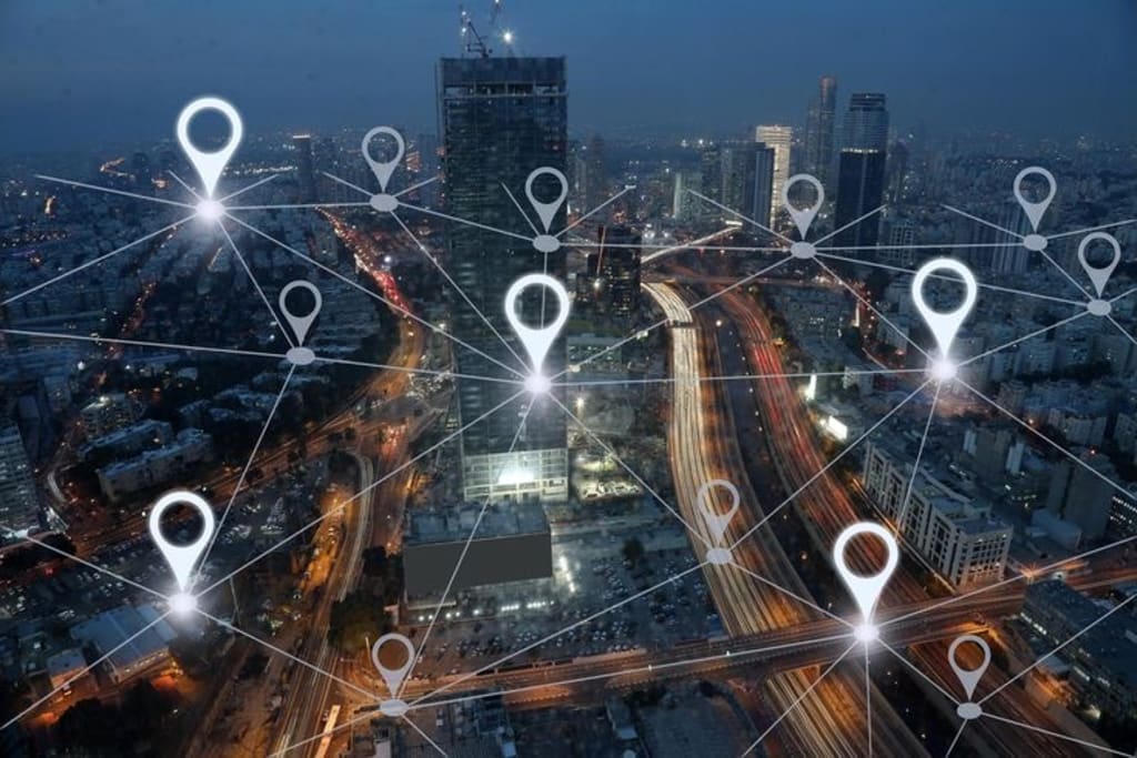
- User Segment: This includes GPS receivers, which can be found in devices like smartphones, cars, aircraft, ships, and handheld navigation tools. These receivers capture signals from multiple satellites and use the data to calculate the user's position.
2. How GPS Determines Your Location
The GPS process begins when your device receives signals from at least four satellites. Here’s how the system calculates your position step by step:
- Step 1: Signal Transmission
Each GPS satellite transmits a signal that includes its location and the exact time the signal was sent. The satellites are equipped with highly accurate atomic clocks, so they can send precise time stamps to GPS receivers.
- Step 2: Signal Reception
Your GPS receiver picks up the signals from at least four different satellites. Because the signals travel at the speed of light, the receiver calculates how long each signal took to reach it. The longer the signal takes, the farther away the satellite is.
- Step 3: Triangulation
Using the time it took for the signals to travel from each satellite, the GPS receiver can determine how far away each satellite is. With distances to multiple satellites known, the receiver can perform a process called **triangulation**. This process uses the distances to the satellites to create spheres of possible locations, with the intersection of these spheres pinpointing the user’s exact location.
- Step 4: Time Correction and Altitude
To improve accuracy, the GPS system also factors in the effects of **atmospheric conditions**, such as the ionosphere and troposphere, which can delay signals. Additionally, the system takes into account the precise altitude of the user’s position, which is often needed for more advanced applications, such as aviation or surveying.
3. The Role of Atomic Clocks
One of the most critical components of GPS accuracy is the **atomic clocks** onboard the satellites. These clocks are incredibly precise, far more accurate than the ones most of us use daily. A satellite’s atomic clock is synchronized with the system’s master clock, ensuring that the time stamps sent with each signal are reliable.
Even tiny errors in time can result in large inaccuracies when calculating distance. For instance, a 1-microsecond delay (which is one-millionth of a second) can lead to a position error of about 300 meters. By using highly accurate atomic clocks, GPS can maintain an accuracy of within a few meters for most consumer devices and even better for specialized applications.
4. Why Do You Need at Least Four Satellites?
You might wonder why your GPS receiver needs signals from at least four satellites. Here's why:
- Three Satellites for Location: In theory, three satellites can determine your position in two dimensions—latitude and longitude—by triangulating the intersection of three spheres. This is similar to determining your position on a flat map.
- Fourth Satellite for Altitude and Time Correction: The fourth satellite is necessary to calculate your altitude (height above sea level), and also to correct for potential errors in the receiver's clock. Without a fourth satellite, the system could give you a "floating" position because it wouldn't know the exact height or correct timing discrepancies.
5. GPS Accuracy
The accuracy of GPS can vary depending on several factors:
- Number of Satellites: The more satellites your receiver can communicate with, the more accurate your location will be. Ideally, receivers connect to at least four satellites, but they can still work with three.
- Atmospheric Conditions: Weather, especially the ionosphere, can affect GPS signals. For example, thunderstorms or solar flares can disrupt signal accuracy.
- Obstructions*: Buildings, trees, or mountains can block signals or cause multipath errors, where the signal bounces off objects before reaching the receiver, leading to inaccuracies.
- Multiple Errors: GPS signals can reflect off buildings or other large surfaces, causing the signal to arrive at the receiver multiple times, resulting in small errors.
In optimal conditions, GPS can offer accuracy within 5-10 meters. More advanced systems, such as those used in aviation or military applications, can provide accuracy within centimeters.
6. Differential GPS (DGPS)
For even higher accuracy, Differential GPS (DGPS) can be used. DGPS works by comparing the GPS signal received at a stationary reference location to the predicted signal based on its known position. The difference between these values is used to adjust the GPS measurements in real-time, significantly improving accuracy. This is particularly useful in applications like surveying, farming, and autonomous vehicles.
7. GPS Applications
The applications of GPS technology are vast and continue to expand:
- Navigation: GPS is most commonly used for navigation in cars, airplanes, ships, and on mobile devices, providing directions and real-time traffic information.
- Mapping and Surveying: GPS helps create accurate maps and is used in land surveying to measure precise distances and locations.
- Military: GPS was originally developed by the U.S. Department of Defense and remains crucial for military operations, providing real-time position tracking for soldiers, vehicles, and equipment.
- Agriculture: GPS enables precision farming, helping farmers to monitor field conditions, track machinery, and optimize planting and harvesting.
- Tracking and Safety: GPS is used in personal devices for tracking pets, children, and valuable assets. It's also used in emergency response to locate people in distress.
8. Global GPS Systems
Although the U.S. GPS system is the most well-known, other countries have developed their own satellite navigation systems:
- GLONASS: Russia’s version of GPS, similar in function but with a different satellite constellation.
- Galileo: The European Union’s GPS system, offering high accuracy and a focus on civilian use.
- BeiDou: China’s satellite navigation system, which is expanding its reach worldwide.
These systems work in parallel and are often used in combination with GPS to improve accuracy, reliability, and coverage.
Conclusion
GPS is a remarkable technology that has revolutionized how we navigate the world. By utilizing a network of satellites, atomic clocks, and sophisticated calculations, GPS systems provide precise location data to a wide range of devices, from smartphones to airplanes. Whether you're driving across town or hiking in the wilderness, GPS ensures you're never far from the right direction, offering a level of navigation precision that would have been unimaginable just a few decades ago. As the technology continues to evolve, GPS will play an even greater role in shaping how we connect to the world around us.
About the Creator
Keep reading
More stories from Matilda Otu and writers in Humans and other communities.
Why We Sleep?:Unlocking the Secrets of Rest
Sleep is a natural, yet mysterious, part of our lives. Every day, millions of people around the world spend hours sleeping, yet we still don't fully understand why we need it. While the necessity of sleep is clear from both science and experience, the exact reasons why it’s so essential for our health remain a subject of ongoing research. However, several key theories highlight its importance for both the body and the brain. From memory consolidation to physical restoration, sleep is not just a passive state but a complex biological process with profound implications for our well-being.
By Matilda Otuabout a year ago in Humans
Growing Up in Split: The Scent of Rain and Angels Without Wings
Whenever I close my eyes and think of my childhood, I don't see clear pictures. I smell things first. I smell the wet, white limestone of the Riva. I smell the salt that the southern wind, the Jugo, carries through the narrow stone alleys of the palace. And most of all, I smell that heavy, dusty scent of rain hitting the hot pavement of Split after a long, dry summer.
By Magma Stara day ago in Humans


Comments
There are no comments for this story
Be the first to respond and start the conversation.