
How Live Location Tracking Can Help You Stay Informed During Natural Disasters or Severe Weather Events?
Safety Matters

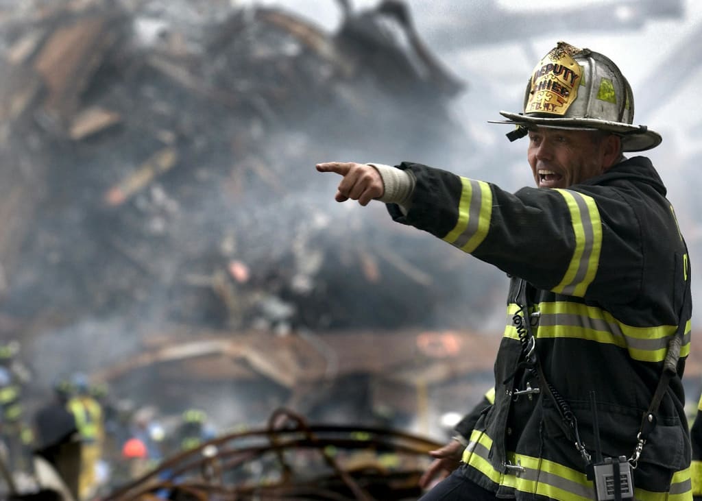
Landslides, tornadoes, earthquakes, and hurricanes—these catastrophic events wreak havoc on land, property, and lives. According to Tulane University, natural disasters cost the United States an estimated $165 billion in damages in 2022 alone, with Hurricane Ian accounting for a staggering $113 billion. The long-term repercussions of these disasters are even more alarming. Since 1980, the U.S. has experienced 341 severe weather events, resulting in over 15,800 fatalities and $2.4 trillion in damages, as reported by the National Centers for Environmental Information. These statistics underscore the urgent need for proactive disaster preparedness to safeguard lives and minimize destruction.
The Role of Live Location Tracking in Disaster Preparedness
As the frequency and intensity of natural disasters increase, technological advancements such as live location tracking have emerged as essential tools for ensuring safety. These tools provide real-time updates on evacuation routes, emergency response measures, and weather conditions. By enabling individuals and families to stay connected during crises, location tracking apps empower them to make informed decisions and react swiftly to changing situations.
Beyond personal safety, live location tracking enhances crisis communication, which is often disrupted during disasters. Whether it is sharing one’s whereabouts with family or receiving updates from rescue teams, these tools help coordinate responses efficiently, reducing panic and confusion.
Benefits of Location Tracking During Natural Disasters
Quickly Locate Missing Loved Ones
During emergencies, family members may get separated, creating anxiety and uncertainty. Location tracking allows individuals to monitor the real-time whereabouts of their loved ones, ensuring they remain connected even when traditional communication lines fail. Precise coordinates can also be shared with rescue teams for prompt intervention.
Ensuring the Safety of Elderly and Vulnerable Individuals
Elderly individuals and those with mobility challenges are particularly vulnerable during natural disasters. Geofencing technology enables caregivers to set virtual boundaries around their residences, sending alerts if the individual moves beyond these areas. This ensures timely action to prevent them from becoming stranded or endangered.
Enhanced Crisis Communication for Families and Emergency Teams
Natural disasters often lead to widespread network outages, disrupting conventional means of communication. GPS-enabled tracking apps act as reliable emergency management tools, allowing users to share locations and receive critical updates. Such technology proved invaluable during Hurricane Katrina, facilitating coordinated rescue efforts and ensuring timely assistance.
Assisting Emergency Responders in Critical Situations
Rescue teams rely on accurate information to deploy aid efficiently. GPS tracking streamlines emergency response by guiding rescuers directly to individuals in distress, significantly reducing response times. Mobile alert systems can pinpoint affected areas, ensuring that help reaches those who need it most.
Supporting Public Safety and Large-Scale Disaster Management
Beyond individual benefits, location tracking strengthens public safety by enabling authorities to monitor widespread geographic areas. Emergency response teams can assess infrastructure damage, locate survivors, and allocate resources effectively. This was crucial in events like the 2005 Pakistan-India earthquake, highlighting GPS technology’s importance in disaster management.
Preventing Isolation in Remote or High-Risk Areas
For outdoor enthusiasts and those living in disaster-prone regions, GPS tracking is an invaluable safety measure. Whether hiking, camping, or working in remote areas, real-time location monitoring ensures individuals can be located quickly in case of emergencies, enhancing their safety and preparedness.
How GPS Tracking Enhances Emergency Response
Real-Time Monitoring and Disaster Notifications
GPS-enabled tools offer real-time updates on road closures, evacuation routes, and impending weather threats. Location-based notifications help individuals make informed decisions, allowing them to navigate crises more safely and effectively.
Reducing Emergency Response Times
In life-threatening situations, every second counts. GPS tracking allows rescuers and family members to locate individuals swiftly, ensuring a faster response. Whether a parent searching for a missing child or an injured hiker summoning help, quick and precise location sharing can be lifesaving.
Optimizing Evacuation and Travel Routes
Evacuations can be chaotic, with congested roads and shifting hazards. GPS tools map out the safest, quickest routes, preventing unnecessary delays and guiding individuals toward designated safe zones.
Customized Alerts for Specific Crisis Scenarios
Mobile alert systems allow users to set tailored notifications based on their location and needs. Residents in hurricane-prone areas, for instance, can enable evacuation alerts, while hikers can send emergency signals when needed. This level of customization enhances overall preparedness and responsiveness.
Why Geolocation Technology is Essential in Disaster Management
Minimizing Information Gaps
Inaccurate or delayed information can hinder decision-making during emergencies. Geolocation technology bridges these gaps, delivering precise data to both individuals and authorities, ensuring well-coordinated disaster responses.
Facilitating Post-Disaster Recovery Efforts
Beyond immediate survival, GPS tracking assists in recovery efforts by identifying heavily damaged areas, coordinating relief distribution, and streamlining rebuilding initiatives. This was evident in disaster-stricken regions where precise mapping improved aid distribution.
Strengthening Community-Wide Safety Measures
Regions susceptible to recurring disasters can integrate GPS technology into public safety programs. Such initiatives keep residents informed about potential risks and ensure they are better prepared for future emergencies.
Enhancing Global Collaboration During Crises
In large-scale disasters, international aid efforts require seamless coordination. GPS-based crisis communication tools allow governments and relief organizations to strategize responses efficiently, allocate resources effectively, and provide timely assistance to affected areas.
Improving Personal Security for Travelers
Frequent travelers and expatriates benefit from location tracking by receiving real-time emergency alerts and local weather updates. Being aware of potential hazards in unfamiliar areas allows them to adjust their plans accordingly and prioritize safety.
Why Choose Circles for Natural Disaster Preparedness?
Circles is a cutting-edge platform designed to enhance natural disaster preparedness by integrating geolocation technology with real-time alerts and seamless communication. It offers several key features, including:
Live Tracking: Monitor the exact location of family members, ensuring everyone stays connected during chaotic situations.
Group Geofencing: Establish designated safe zones and receive alerts when individuals enter or leave these areas.
Emergency Notifications: Get real-time updates on weather conditions, road closures, and evacuation orders, helping you make informed decisions.
These features streamline crisis communication, ensuring individuals and emergency responders can act swiftly and efficiently. By leveraging Circles, you can significantly enhance your disaster preparedness strategy and improve safety outcomes for yourself and your loved ones.
Conclusion
As the world faces increasingly severe and frequent natural disasters, preparedness is more critical than ever. Advanced technologies like Circles offer a modern solution to staying connected and informed, empowering individuals and communities to respond effectively during crises. By leveraging GPS tracking and emergency alerts, we can improve disaster resilience, minimize risks, and safeguard lives.
Natural disasters challenge our adaptability, but with the right tools, we can navigate these challenges with greater confidence. Investing in location tracking technology ensures that individuals, families, and communities remain prepared, protected, and proactive in the face of unpredictable events.
About the Creator
Circles: Location Tracker
Link: trackwithcircles.com
Peace of Mind is Just a Download Away . Circles ensures everyone is always within reach with real-time tracking. Stay connected no matter where life takes you to keep your loved ones safe and close.
Keep reading
More stories from Circles: Location Tracker and writers in Families and other communities.
Protecting What Matters most
The chilling statistic from the Global Missing Children's Network - 460,000 children reported missing annually in the US, serves as a stark reminder of the vulnerabilities families face. This harsh reality underscores the critical need for proactive measures to protect our children and loved ones.
By Circles: Location Tracker11 months ago in Families
Wise~Guys
— Look Behind what's in Front of You ~ Make Good Choices — Hey, So how you Doin'..! Made~Men — Mobster Movies romanticise a distinctive, elegant appearance, impeccable attire style, along with the 'Families' expressive lingo. Making their 'Bones' gave them Panache — with vintage fedoras, tailored pin-striped suits, mirror-polished wing-tip shoes adorned with tassels; with their 'Gun Moll' gorgeous dates on their arms.
By Jay Kantor23 days ago in Families


Comments
There are no comments for this story
Be the first to respond and start the conversation.