
Point Cloud Modeling for Virginia Infrastructure Development
Enhancing Virginia's Infrastructure with Precision

Virginia is known for its rich history and focus on progress. It is leading the way in using new technologies to improve city development. One important innovation is point cloud modeling. This technology is changing how public infrastructure projects are planned, designed, and built.
This blog looks at how point cloud modeling is transforming public infrastructure in Virginia. It highlights its benefits, uses, and what it could do in the future.
The Evolution of Public Infrastructure Development in Virginia
Public infrastructure development in Virginia has changed a lot over time. It has moved from simple methods in the past to advanced digital solutions today. This change shows a strong effort for better efficiency, accuracy, and sustainability.
In the past, traditional surveying methods and manual drafting were key to infrastructure projects. They had many problems, which often caused mistakes, delays, and increased costs.
The introduction of computer-aided design (CAD) was a big improvement. It allowed for digital design and data work. Now, the use of point cloud modeling has brought a major change to the process.
Historical Challenges in Infrastructure Planning and Execution

Traditional surveying methods were helpful in the past, but they had some big problems when it came to planning and carrying out infrastructure projects. These methods took a lot of time, which caused delays in projects and affected schedules and budgets.
Also, relying on manual measurements meant there was a higher chance of human mistakes, which could lead to errors in design and building.
Facility management, which is very important for public infrastructure, also faced issues with these old methods. Keeping accurate records of existing buildings and infrastructure took a lot of work. This made it hard to keep updated records for smooth operations and maintenance.
Because of these problems, it became clear that the industry needed better and faster solutions for construction projects. A technological upgrade was necessary to tackle these challenges. This would create a more efficient and reliable way to develop infrastructure.
You would like to explore these article -
The Rise of Digital Solutions in Urban Development

The growth of digital solutions is changing urban development. It offers new ways to handle problems that traditional methods can't solve. Key technologies in this change are Building Information Modeling (BIM) and point cloud data. These tools are changing how we design, build, and manage public infrastructure.
Point cloud data comes from advanced laser scanning technologies like LiDAR. It provides detailed and accurate 3D images of real assets. This information helps in many ways: creating exact as-built documentation, finding clashes during the design process, and improving facility management with digital twins.
When Virginia's urban planners and infrastructure developers use these digital solutions, they get a strong set of tools. These tools help them be more efficient, accurate, and sustainable throughout a project's life cycle.
Understanding Point Cloud Modeling Technology

Point cloud modeling is a new technology that is changing many industries. It creates detailed 3D digital images of real objects or places. This process uses laser scanning or photogrammetry to collect millions of data points, each with its own position in a three-dimensional space.
All these data points are called a "point cloud." Together, they make a digital copy of the scanned object or area, showing its shape, size, and surface features very accurately.
Software then takes this point cloud data and turns it into different outputs, like 3D models, 2D drawings, and other helpful visuals. This technology is especially useful in fields like construction, architecture, engineering, and manufacturing. It helps improve design processes, increases accuracy, and makes it easier for stakeholders to work together.
Definition and Basics of Point Cloud Modeling
Point cloud modeling is an advanced technology that makes precise 3D images of real environments. It collects data points using laser scanning. This process captures the shape, size, and position of objects very accurately. After collecting the data points, they can be processed to create a 3D model or point cloud.
Laser scanning plays a key role in point cloud modeling. It uses a device that sends out laser beams to measure distances to surfaces. By timing how long the laser beams take to travel back to the scanner, it finds the exact position of each point. The more data points it collects, the clearer and more real the point cloud appears.
Point cloud modeling has many uses. It is helpful for checking infrastructure, planning construction, surveying buildings, preserving history, and more. As technology moves forward, we can expect point cloud modeling to be used even more in different fields that want new ways of capturing and using spatial data.
How Point Cloud Modeling is Revolutionizing Infrastructure Projects

Point cloud modeling changes how we do infrastructure projects. It helps us capture the reality of our surroundings. This allows for clash detection and speeds up project timelines. By digitally recording existing buildings and places, everyone involved gets a clear view of project limits. This makes it easier to make smart choices. The digital copy of the real world helps reduce risks and improve project results.
Having the ability to find clash detection early in the design stage is key for building projects. Point cloud modeling lets us place various design models, like architectural, structural, and MEP, over the point cloud of the current site. This way, we can spot possible issues between different design parts before construction starts. It helps avoid expensive rework and delays.
Using point cloud modeling in projects gives us better and cheaper results. This tech makes design work smoother, enhances teamwork among stakeholders, and lowers the chances of mistakes during building. Because of this, projects finish on time and within budget, bringing the best return on investment for public infrastructure development.
Benefits of Point Cloud Modeling for Virginia's Infrastructure

Point cloud modeling has many great benefits for public infrastructure projects in Virginia. It helps make these projects more efficient, cost-effective, and sustainable. This technology gives a very accurate view of current conditions. This leads to better planning, design, and construction.
It improves teamwork among project stakeholders. It also enhances how assets are managed. Point cloud modeling is changing how Virginia works on public infrastructure. This ensures these projects last longer and are strong enough to meet the needs of the community.
Enhanced Accuracy in Planning and Design
Point cloud modeling greatly improves accuracy in planning and design. It provides clear and detailed 3D models of existing buildings. This accuracy helps make smart decisions in the early project phases. It ensures the design fits well with what is already there. With point cloud modeling, planners and designers can feel like they are in the project area. They can fully understand where challenges and existing features are.
The level of detail from point cloud modeling can show even small errors that traditional surveying methods might miss. This detail is very important for projects that involve updating or expanding current structures. It helps the new design blend well with the existing building.
Also, point cloud data works well with BIM models. You can easily put point clouds into BIM software. This process creates intelligent 3D models that include important spatial data and geometry. This teamwork leads to a better design process. Stakeholders can collaborate on one shared model. This reduces mistakes and makes the whole project run more smoothly.
Streamlined Project Management and Collaboration
Project management and teamwork in building infrastructure are very important for project success. Point cloud modeling helps with this by creating a central place for accurate and current project information. This makes it easy for everyone to get updates in real-time. So, all involved parties know how the project is going and can find the information they need to make decisions.
Point cloud modeling also helps share data with people outside of the immediate project team. This includes contractors, subcontractors, and regulatory agencies. Sharing point cloud data this way improves understanding and makes things more transparent. It also reduces confusion, avoids costly mistakes, and keeps the project moving forward.
Overall, point cloud modeling changes how we manage projects and collaborate in infrastructure development. It reshapes how information is shared, how you make decisions, and how stakeholders work together. By providing a clear and easy-to-use view of the project, it encourages smooth communication. This reduces risks and boosts efficiency throughout the project's lifecycle.
Cost Reduction and Time Efficiency in Construction Processes
Point cloud modeling helps cut costs and save time in construction. It allows for accurate as-built documentation. This helps contractors avoid expensive rework that happens from wrong or missing information. This accuracy also helps in estimating materials. The data from point cloud quantity takeoffs is reliable, which reduces waste and ensures materials are available when needed.
Point cloud modeling also saves time. It lets team members inspect the site faster. They can explore the construction area digitally and find issues without needing to be there in person. This means fewer site visits, saving time and resources.
Moreover, building components can be prefabricated off-site using accurate point cloud data. This speeds up assembly at the site and causes less disruption in the area. By improving these processes, point cloud modeling makes the construction phase more efficient and cost-effective. This helps to complete projects on time and within budget.
Case Studies: Successful Integration in Virginia’s Infrastructure Projects
Virginia has made great improvements in its public infrastructure by using point cloud modeling. Many projects in the state have used this technology. It has shown that it can make work more efficient, accurate, and cheaper. This technology helps change roadway corridors and strengthen coastal protection. Point cloud modeling leads to new ideas and better quality in infrastructure projects.
These real-life examples show how point cloud modeling is changing Virginia's infrastructure. By using this new technology, the state makes sure its public infrastructure projects look good and last a long time. This gives lasting benefits to the people who live there.
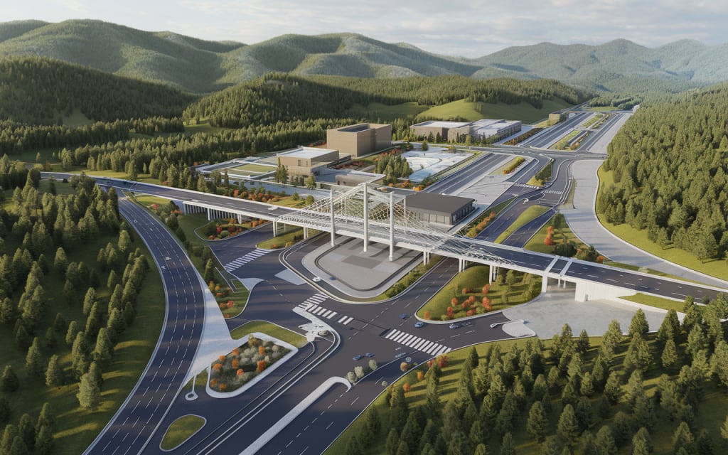
Transforming the Richmond Highway Corridor

The Richmond Highway Corridor is an important road in Virginia. It recently went through a major change. This change used point cloud modeling to fix problems with the infrastructure. The project's goal was to make traffic flow better, keep pedestrians safer, and improve nearby communities. The team used point cloud data to create precise as-built documentation.
Engineers looked at point cloud scans to check the current road layout. They found where there could be issues with underground utilities and came up with new ideas to widen roads and improve intersections. The accuracy of point cloud modeling was key. It helped reduce disruptions to existing structures and allowed the project to stay on budget and finish on time.
Using point cloud modeling in the Richmond Highway Corridor project shows how useful it is for complex infrastructure upgrades. The good results from this project encourage the use of this technology in future transportation projects throughout Virginia.
The Norfolk Coastal Protection Initiative

The city of Norfolk is at risk from rising sea levels and coastal erosion. To address this, they started a Coastal Protection Initiative. This program uses new technologies, like point cloud modeling, to protect important structures.
Laser scanners were used to get accurate data about the coastline. This includes details about height, shapes, and the strength of seawalls, floodgates, and other key assets.
The information gathered from point cloud data shows where erosion is likely to happen. This helps engineers create good protection plans like adding sand to beaches, creating living shorelines, and strengthening seawalls. By using this reliable data, they aim to reduce the damage from future storms and the effects of rising sea levels.
The Norfolk Coastal Protection Initiative shows how point cloud modeling helps create stronger infrastructure. It protects communities from the growing dangers of climate change. Using advanced technology for informed choices ensures the safety and support of important coastal resources in the long run.
Modernizing Arlington’s Public Transport System
Arlington County started a project to improve its public transportation system. They want to make things more efficient, accessible, and enjoyable for passengers. A big part of this effort is using point cloud modeling and BIM services. This helps create a digital twin of the current transportation setup, which includes bus routes, metro stations, and walkways.
This digital version is filled with real-time data. It lets planners try out different ideas, improve routes, and find areas that need changes. For example, point cloud data helped find the best spots for new bus stops by looking at things like how many people walk by, visibility, and access for people with disabilities.
By using new technology in public transport, Arlington shows how making decisions based on data can lead to a better, more accessible, and user-friendly transportation system. This work improves life for both residents and visitors.
Overcoming Implementation Challenges
Point cloud modeling is great for building public infrastructure, but there are some problems to solve. We need to adapt to new technology, keep data safe, and have skilled workers to make the most of this technology.
In Virginia, if stakeholders work together and share knowledge, they can solve these challenges. This teamwork can help create public infrastructure that is better, stronger, and more sustainable. This will help communities thrive for many years.
Navigating Technological Adaptation and Training
Technological adaptation can be tough for public infrastructure development. To successfully use point cloud modeling, a clear plan is needed. This plan should include training programs and working with experienced service providers. These steps help staff gain the skills and knowledge they need. Public agencies can team up with universities or technical schools to create specialized training programs for point cloud modeling in their projects.
Working with a knowledgeable service provider is very important when starting to use point cloud modeling. These providers have the skills for data collection, processing, and analysis. They can help agencies understand how to add this technology into their current workflows.
A good provider will look at the agency’s needs, suggest the right software and hardware, and give ongoing support. This ensures a smooth switch to using point cloud modeling effectively.
It's also vital to keep learning opportunities open for staff as technology changes. By supporting a culture of adapting to technology and giving continual training, public agencies can make the most of point cloud modeling. This help improves their development processes.
Ensuring Data Security and Privacy
Data security and privacy are very important when using point cloud modeling in public infrastructure projects. Point cloud data can include private details about physical assets and environments. This means strong security steps are needed to keep unauthorized people from accessing it or misusing it.
Public agencies should create detailed data management plans. These plans must cover how data is stored, shared, and accessed. Using encryption when storing and sharing data provides extra security.
This way, if there is a breach, the information will still be safe from unauthorized users. It's also essential to have strict access rules. Only allowing authorized staff to access data helps to keep it secure and private.
Public agencies need to make data security and privacy a top priority. This builds trust and ensures the responsible use of point cloud technology. By using the right steps and protections, public agencies can take advantage of point cloud modeling while keeping data safe.
Future Trends in Point Cloud Modeling for Urban Development
Point cloud modeling is set to become more advanced in urban development. Future trends will look at a closer connection with new technologies to improve its functions. A major trend is the link between point cloud modeling and AI, along with machine learning.
By adopting these trends, urban planners, architects, and engineers can solve complex development challenges better. They can do this with more accuracy, speed, and efficiency. This will help create smarter, greener, and more user-friendly cities.
Integration with AI and Machine Learning

The use of point cloud modeling with artificial intelligence (AI) and machine learning (ML) is set to change how we analyze data and make decisions in city development. By using machine learning, we can look at large point cloud datasets to find patterns, spot unusual things, and gain valuable insights that we might miss just by looking.
One major use of AI and ML in point cloud modeling is predicting what might happen in the future. By looking at past data and seeing trends, these tools can help us understand future scenarios. This might include things like finding out when infrastructure might break down, how cities are growing, or how the environment is shifting.
Bringing together AI and ML with point cloud modeling is a big step toward better urban development. It helps people make decisions based on data, which can improve how we use resources, plan our cities, and build more strong and sustainable communities for the future.
Predictive Analytics for Maintenance and Sustainability

Predictive analytics with point cloud modeling can greatly help improve maintenance schedules and make public infrastructure more sustainable. By looking at point cloud data over time, machine learning algorithms can spot small changes in infrastructure. These changes may signal potential problems before they turn into expensive repairs.
This proactive way of maintaining infrastructure leads to quicker fixes. It can extend the life of infrastructure assets, lower downtime, and help manage maintenance budgets better. Being able to predict and fix issues means public infrastructure stays safe, reliable, and working well.
Also, insights from point cloud modeling help in managing infrastructure more sustainably. By finding places to cut down on energy use, reuse or recycle materials, and improve construction processes, cities can lessen their environmental effects. This way, they can aim for a more circular economy in developing infrastructure.
Conclusion
In conclusion, point cloud modeling has changed how public infrastructure is developed in Virginia. This technology improves accuracy in planning. It also helps with project management and saves time and money during construction. Successful examples include the Richmond Highway Corridor and Norfolk Coastal Protection Initiative. These projects show how effective this technology can be. It is important to address challenges like using new technology and keeping data safe for it to keep succeeding. Looking ahead, we may see it combined with AI and predictive analytics to promote sustainability. Point cloud modeling is transforming urban development and creating new standards for infrastructure projects in Virginia.
Frequently Asked Questions
What is the accuracy level of point cloud modeling?
The accuracy of point cloud modeling is influenced by factors like the laser scanner and site conditions. Usually, it is accurate to within a few millimeters. Industry standards and best practices help achieve high accuracy for spatial data collected through point cloud modeling. There are strict verification processes and quality control steps in place to keep this accuracy.
Can point cloud modeling be used for historical building preservation?
Point cloud modeling is great for saving historical buildings. It helps us document complex shapes accurately and supports restoration work. Using laser scanning, we can make detailed 3D models of historical buildings. These models capture every small detail. Good documentation helps with structural analysis. This enables structural BIM services to protect and keep these architectural gems safe.
How does point cloud technology impact environmental assessment processes?
Point cloud technology, especially LiDAR, changes how we study the environment. It offers clear 3D images of land, plants, and water, which helps with understanding impacts and planning ways to reduce them. By using LiDAR technology, environmental workers can have virtual site visits. They can deeply see and feel what the area looks like through this great visualization.
What are the initial costs associated with adopting point cloud modeling for public projects?
The starting costs for using point cloud modeling in public projects can change. This depends on the size of the project and the technology chosen. However, this investment can bring a big return. It improves accuracy, cuts down on rework, and helps projects get done faster.
About the Creator
Matt Sharon
A professional content writer. Having years of experience in Technology, health, finance, and construction and real estate field. Writing is my passion and I love to play with words Confidently.
Keep reading
More stories from Matt Sharon and writers in Education and other communities.
Digital Twin vs Augmented Reality: Exploring the Debate
Key Highlights Digital twins and augmented reality are transforming industries by bridging the gap between the digital and physical worlds. Digital twins are dynamic representations of physical assets, constantly updated with real-time data. AR enhances digital twin visualization by overlaying data onto the real world, providing immersive experiences. These technologies offer numerous benefits, including improved operational efficiency, better decision-making, and enhanced customer experiences. From manufacturing to healthcare, digital twins and AR are revolutionizing various sectors across the globe.
By Matt Sharonabout a year ago in Education
Clear Paths to Discover Your Purpose in Life
Finding direction in life is a common human search. Many people want their work and daily actions to feel meaningful. When you discover your purpose in life, you gain a sense of direction and inner peace. Purpose does not appear in a single moment for most people. It often grows through reflection, action, and learning. Small steps can lead to deep insight.
By Philip Raymond Baquieabout 11 hours ago in Education


Comments
There are no comments for this story
Be the first to respond and start the conversation.