
An Introduction to Remote Sensing
Exploring the World from a Distance
Outline of the Article
I. Introduction
• Explanation of remote sensing
• Importance of remote sensing in our world
II. What is Remote Sensing?
• Definition of remote sensing
• Classification of remote sensing
• Examples of remote sensing technologies
III. The Advantages of Remote Sensing
• Ability to gather data from a distance
• Enhanced accuracy and efficiency
• Ability to monitor changes over time
IV. Applications of Remote Sensing in Our World
• Agriculture
• Environmental monitoring
• Disaster management
• Urban planning
• Military and national security
V. The Future of Remote Sensing: Ongoing Developments and Research
• Advances in technology
• Increased data accessibility and sharing
• Integration with other technologies
VI. Conclusion
a. Recap of the importance of remote sensing
b. Final thoughts on the future of remote sensing
Introduction:
Once upon a time, in the early days of our planet, humans had limited knowledge about the world around them. They relied on their five senses to understand and explore the world, but as time passed, our curiosity and thirst for knowledge grew, leading us to invent new tools and techniques to explore the world from a distance.
Exploring the world from a distance has become easier than ever, thanks to the advancements in remote sensing technology. Remote sensing is a process of gathering information about objects or areas of interest without physically coming into contact with them.
Have you ever wondered how scientists are able to study the Earth's surface and gather information about various natural and man-made features from a distance?
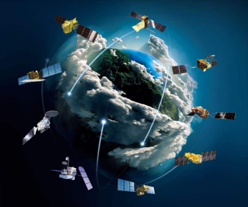
The answer is remote sensing. Remote sensing is a technology that allows us to explore the world from a distance using specially designed instruments and platforms such as satellites, aircrafts, and unmanned aerial vehicles (UAVs).
This technology has revolutionized the way we study and understand the world around us, providing valuable insights into areas that were once inaccessible. From monitoring environmental changes and natural disasters to helping us plan cities and grow crops, remote sensing plays a critical role in many aspects of our lives.
In this article, we will take a closer look at the basics of remote sensing and its significance in today's world.
What is Remote Sensing?
Remote sensing is the process of acquiring information about objects or areas from a distance without direct contact. The process is typically done using sensors and instruments, such as cameras, scanners, or radar systems that are mounted on platforms such as satellites, airplanes, or drones.
These sensors are designed to detect and measure different forms of energy that are emitted or reflected from the Earth's surface, including visible light, infrared, and microwave radiation.
Remote sensing can be classified into several categories based on various criteria, such as the type of sensors used, the source of energy, the spatial and spectral resolution of the data, and the application. Here are some of the common classification types of remote sensing:
1. Based on the type of sensors used:
i. Active remote sensing:
- Uses sensors that emit energy, such as RADAR, LIDAR, and SONAR, and measures the reflected energy to derive information about the target.
ii. Passive remote sensing:
- Uses sensors that only detect energy emitted from the target, such as cameras, spectrometers, and radiometers.
2. Based on the source of energy:
i. Optical remote sensing:
- Uses the visible and near-infrared regions of the electromagnetic spectrum to collect data, such as from cameras or spectrometers.
ii. Microwave remote sensing:
- Uses longer wavelengths of the electromagnetic spectrum, such as RADAR, to penetrate through clouds and vegetation cover and collect data.
3. Based on the spatial and spectral resolution of the data:
i. High-resolution remote sensing:
- Captures detailed information about small areas, such as from airborne sensors or satellite sensors with small pixel sizes.
ii. Low-resolution remote sensing:
- Captures less detailed information about large areas, such as from satellite sensors with larger pixel sizes.
4. Based on the application:
i. Land remote sensing:
- Focuses on monitoring and mapping land features, such as land cover, vegetation, topography, and soil moisture.
ii. Atmospheric remote sensing:
- Focuses on monitoring and mapping the atmosphere's characteristics, such as temperature, pressure, humidity, and air quality.
iii. Oceanic remote sensing:
- Focuses on monitoring and mapping ocean features, such as sea surface temperature, salinity, currents, and marine life.
Remote sensing can be done from either airborne platforms or space-borne platforms. Airborne remote sensing involves the use of sensors mounted on aircraft, UAVs, or balloons, while space-borne remote sensing involves the use of sensors on satellites.
Examples of remote sensing technologies include Radar, LiDAR, and satellite imagery. These technologies allow us to gather a wealth of information about the Earth's surface, including topography, land cover, and the distribution of natural resources.
The Advantages of Remote Sensing
One of the biggest advantages of remote sensing is its ability to gather data from a distance. This allows us to study and monitor large areas of the Earth's surface without having to physically visit every location. This not only saves time and resources, but it also provides a more comprehensive understanding of the Earth's surface and atmosphere.
Another advantage of remote sensing is its enhanced accuracy and efficiency. Remote sensing technologies allow us to collect detailed data with a high degree of accuracy, which is essential for many applications, including urban planning, disaster management, and resource management.
Additionally, remote sensing technologies can provide real-time data, allowing us to respond to natural disasters and other emergencies more quickly and effectively.
Applications of Remote Sensing in Our World
Remote sensing plays a critical role in many aspects of our lives;
1. Agriculture
- Remote sensing technologies are used to monitor crop growth and predict yields, which helps farmers make informed decisions about planting and harvesting crops.
2. Environmental monitoring
- Remote sensing is used to track changes in land cover and vegetation, monitor the health of forests and wetlands, and assess the impact of human activities on the environment.
3. Disaster management
- Remote sensing technology has become an essential tool in disaster management. It is used for damage assessment, search and rescue, early warning systems, environmental monitoring, and response planning.
- Remote sensing is used to monitor and respond to natural disasters, such as hurricanes, earthquakes, and floods. With its ability to provide real-time data, remote sensing helps emergency responders make informed decisions and respond more effectively to natural disasters.
4. Urban planning
- Remote sensing is used to map and analyze the urban environment, including the distribution of buildings, roads, and other infrastructure. This information is critical for understanding and planning the growth of cities and ensuring that new developments are sustainable and resilient.
5. Field of military and national security
- Remote sensing plays a crucial role in military and national security, providing valuable information to aid in response efforts and prevent potential threats.
- Remote sensing is used for intelligence gathering, reconnaissance, surveillance, border security, navigation, and disaster response.
- This technology enables governments to gather and analyze information in a safe and effective manner, enhancing situational awareness, response to threats, and decision-making to ensure the safety and security of their citizens.
Additionally, remote sensing is used to assess air and water quality. It provides information on air pollution, water pollution, and other environmental hazards.
The Future of Remote Sensing: Ongoing Developments and Research
Remote sensing is a rapidly evolving field, with ongoing developments and research that promise to expand its capabilities and improve its applications.
Here are some of the key trends and innovations in remote sensing that are shaping its future:
1. High-Resolution Imaging:
- Advances in sensor technology are enabling remote sensing systems to capture higher-resolution images, allowing for more detailed and precise analysis of Earth's surface.
2. Artificial Intelligence and Machine Learning:
- The application of AI and machine learning algorithms to remote sensing data is helping to automate the processing of large datasets and improve the accuracy of the analysis.
3. Hyper-spectral Imaging:
- Hyper-spectral sensors are capable of capturing detailed images of Earth's surface in hundreds of narrow and contiguous spectral bands.
- This technology allows for the identification of specific materials and substances, making it a valuable tool in geological and environmental studies.
4. CubeSats:
- Small, low-cost CubeSats are being developed for remote sensing applications, enabling more frequent and widespread data collection.
5. LiDAR:
- Light Detection and Ranging (LiDAR) technology is being used to generate 3D models of Earth's surface, providing highly accurate elevation data that is useful in a variety of applications, including mapping, urban planning, and environmental studies.
6. Integration with other technologies:
- Remote sensing is being integrated with other technologies such as drones, artificial intelligence, and machine learning, opening up new possibilities for applications in various fields.
Overall, remote sensing technology is rapidly evolving, and ongoing research and development are driving its potential applications and impact.
With advances in high-resolution imaging, AI, and machine learning, hyperspectral imaging, CubeSats, LiDAR, and integration with other technologies, remote sensing is poised to become an even more powerful tool in a variety of applications, from disaster management to environmental monitoring, urban planning, and beyond.
Conclusion
- Remote sensing has revolutionized the way we study and monitor our planet, allowing us to explore the world from a distance.
- Remote sensing is a powerful tool for environmental scientists. It allows them to collect information about the Earth's surface and atmosphere, without physically being there.
- It has various applications, including monitoring land use and land cover changes, detecting and mapping natural disasters, and assessing air and water quality.
- From agriculture and environmental monitoring to disaster management and urban planning, remote sensing plays a critical role in many aspects of our lives.
- Remote sensing data can be analyzed using various techniques, including visual interpretation, digital image processing, and machine learning.
- The goal of remote sensing is to provide a better understanding of the planet and its systems, and to support decision-making in fields such as agriculture, forestry, urban planning, and environmental management.
About the Creator
Keep reading
More stories from writers in Education and other communities.
Everyday Cooking Skills That Turn Home Kitchens Into Creative Spaces
Cooking at home is more than a routine task. It is a practical life skill that supports better health, saves money, and encourages creativity. While recipes are helpful, true kitchen confidence comes from understanding essential cooking skills that work across countless dishes. When home cooks grasp these fundamentals, they can adapt recipes, solve problems, and cook with freedom rather than fear.
By Erika Mackinnon3 days ago in Education


Comments
There are no comments for this story
Be the first to respond and start the conversation.